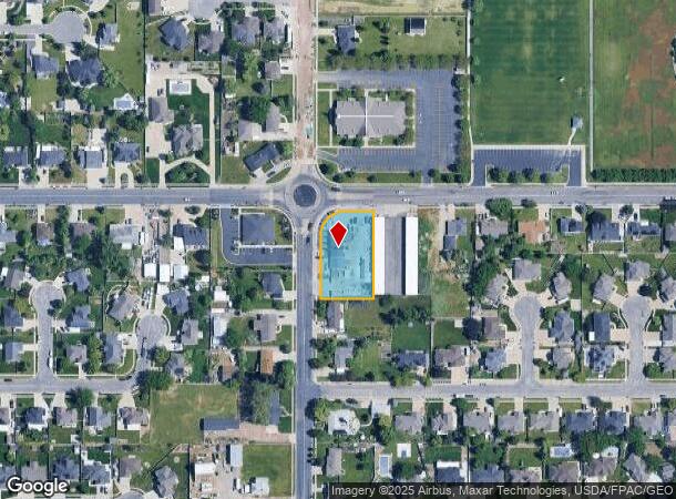
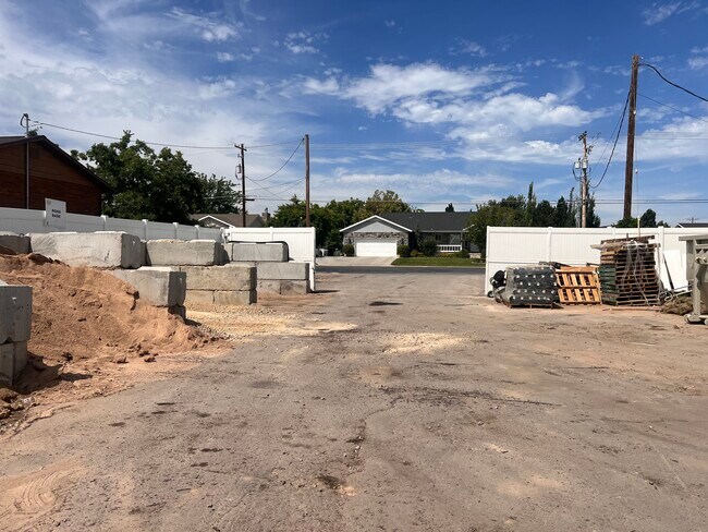
Property Record
2751 S 1000 W, Syracuse, UT 84075
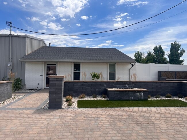

This Property Is For Sale
Current Lease Availabilities
NEARBY LISTINGS FOR SALE OR LEASE
Property Detail
2751 S 1000 W
12-108-0297
Mt View Estates Phase 6
Distributionwarehouseregional
BEG N 89^57'35" E 33 FT & S 0^14'02" W 33 FT & S 00^14'03" W 64.69 FT FR NW COR SEC 23-T4N-R2W, SLM; SD PT BEING THE MOST S'LY PT OF PPTY CONV IN SW DEED RECORDED 05/08/2009 AS E# 2449061 BK 4772 PG 6
X
Davis
49011C0210E
Utah
2025
0.75 AC
2025
Davis North
125413
Salt Lake City
3,707 SF
Ogden-Clearfield, UT
DEMOGRAPHICS near 2751 S 1000 W
1 Mile
3 Mile
5 Mile
2024 Total Population
14,402
71,638
161,926
2029 Population
15,288
76,442
172,505
Pop Growth 2024-2029
+ 6.15%
+ 6.71%
+ 6.53%
Average Age
33
33
33
2024 Total Households
3,824
20,763
49,030
HH Growth 2024-2029
+ 6.30%
+ 6.94%
+ 6.61%
Median Household Inc
$122,705
$95,037
$86,678
Avg Household Size
3.80
3.40
3.30
2024 Avg HH Vehicles
3.00
2.00
2.00
Median Home Value
$439,538
$401,098
$392,565
Median Year Built
2004
2001
1997
Nearby Places
- Restaurants
- Banks
- Shops
- Fitness
- Groceries
PUBLIC TRANSPORTATION
COMMUTER RAIL
Clearfield (FrontRunner North - Utah Transit Authority (UTA))
DRIVE
WALK
Distance
Clearfield (FrontRunner North - Utah Transit Authority (UTA))
8 min
3.9 mi
Layton (FrontRunner North - Utah Transit Authority (UTA))
DRIVE
WALK
Distance
Layton (FrontRunner North - Utah Transit Authority (UTA))
12 min
5.4 mi
AIRPORT
Salt Lake City International
DRIVE
WALK
Distance
Salt Lake City International
42 min
31.9 mi
Nearby Properties
Address
Land Use
TOTAL SIZE
Lot Size
Zoning
Address
Land Use
TOTAL SIZE
Lot Size
Zoning
399,630 SF
31.55 AC
I
Address
Land Use
TOTAL SIZE
Lot Size
Zoning
664,440 SF
37.07 AC
Address
Land Use
TOTAL SIZE
Lot Size
Zoning
217,412 SF
13.23 AC
RS
Address
Land Use
TOTAL SIZE
Lot Size
Zoning
151,064 SF
48.81 AC
Address
Land Use
TOTAL SIZE
Lot Size
Zoning
233,780 SF
14.77 AC
C-H
Address
Land Use
TOTAL SIZE
Lot Size
Zoning
86,213 SF
12.27 AC
Address
Land Use
TOTAL SIZE
Lot Size
Zoning
123,824 SF
41.89 AC
M1
Address
Land Use
TOTAL SIZE
Lot Size
Zoning
121,332 SF
44.40 AC
Address
Land Use
TOTAL SIZE
Lot Size
Zoning
123,445 SF
27.94 AC
M1
Address
Land Use
TOTAL SIZE
Lot Size
Zoning
27,763 SF
11.41 AC
Address
Land Use
TOTAL SIZE
Lot Size
Zoning
4,281 SF
16.55 AC
RM1
Address
Land Use
TOTAL SIZE
Lot Size
Zoning
75,946 SF
5.67 AC
CH
Address
Land Use
TOTAL SIZE
Lot Size
Zoning
638,065 SF
33.77 AC
M1
Address
Land Use
TOTAL SIZE
Lot Size
Zoning
91,750 SF
6.76 AC
C2
Address
Land Use
TOTAL SIZE
Lot Size
Zoning
63,828 SF
5.30 AC
PF
Address
Land Use
TOTAL SIZE
Lot Size
Zoning
1,540 SF
11.52 AC
Address
Land Use
TOTAL SIZE
Lot Size
Zoning
453,129 SF
24.72 AC
M1
Address
Land Use
TOTAL SIZE
Lot Size
Zoning
26,058 SF
5.86 AC
Address
Land Use
TOTAL SIZE
Lot Size
Zoning
5,481 SF
15.54 AC
Address
Land Use
TOTAL SIZE
Lot Size
Zoning
2,373 SF
6.63 AC
RM2PRUD
Address
Land Use
TOTAL SIZE
Lot Size
Zoning
6,591 SF
12.12 AC
R3
Address
Land Use
TOTAL SIZE
Lot Size
Zoning
9,792 SF
12.31 AC
R3
Address
Land Use
TOTAL SIZE
Lot Size
Zoning
503,599 SF
47.71 AC
M1
Address
Land Use
TOTAL SIZE
Lot Size
Zoning
72,750 SF
12.82 AC
BRP
The World's #1 Commercial Real Estate Marketplace
Connect with us
© 2025 CoStar Group
The information above has been obtained from sources believed reliable. While we do not doubt its accuracy we have not verified it and make no guarantee, warranty or representation about it. It is your responsibility to independently confirm its accuracy and completeness. Any projections, opinions, assumptions, or estimates used are for example only and do not represent the current or future performance of the property. The value of this transaction to you depends on tax and other factors which should be evaluated by your tax, financial, and legal advisors. You and your advisors should conduct a careful, independent investigation of the property to determine to your satisfaction the suitability of the property for your needs.