No Photo
Property Record
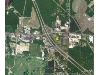
2755 Holton Whitehall Rd, Whitehall, MI 49461

NEARBY LISTINGS FOR SALE OR LEASE
-
-
View all Whitehall listings for sale on LoopNet.com
Property Detail
2755 Holton Whitehall Rd
03-026-100-0022-00
WHITEHALL TOWNSHIP SEC 26 T12N R17W THAT PT SEC 26 DESC AS FOL: COM N 1/4 COR SEC 26 TH S 00D 15M 46S W 2639.62 FT TO POB AND
Commercialnec
Muskegon
X
Michigan
26121C0050D
30.35 AC
2024
Northern Muskegon County
2025
West Michigan
004000
Muskegon, MI
126,901 SF
DEMOGRAPHICS near 2755 Holton Whitehall Rd
1 Mile
3 Mile
5 Mile
2024 Total Population
808
8,213
15,076
2029 Population
817
8,317
15,283
Pop Growth 2024-2029
+ 1.11%
+ 1.27%
+ 1.37%
Average Age
43
43
42
2024 Total Households
344
3,373
5,970
HH Growth 2024-2029
+ 1.16%
+ 1.25%
+ 1.41%
Median Household Inc
$46,810
$59,157
$62,565
Avg Household Size
2.30
2.40
2.50
2024 Avg HH Vehicles
2.00
2.00
2.00
Median Home Value
$163,247
$181,134
$181,004
Median Year Built
1975
1973
1976
Nearby Places
Map Layers
Map Styles
 Street
 Aerial
- Restaurants
- Banks
- Shops
- Fitness
- Groceries
SALE & LEASE HISTORY
LISTING DATE
SALE/LEASE

Sep 24, 2016
For Sale
Nearby Properties
Address
Land Use
TOTAL SIZE
Lot Size
Zoning
Address
Land Use
TOTAL SIZE
Lot Size
Zoning
620,456 SF
127.38 AC
M-2 GEN
Address
Land Use
TOTAL SIZE
Lot Size
Zoning
104,000 SF
Address
Land Use
TOTAL SIZE
Lot Size
Zoning
117,661 SF
14.70 AC
M-1 LIM
Address
Land Use
TOTAL SIZE
Lot Size
Zoning
70,092 SF
14.17 AC
C-COM
Address
Land Use
TOTAL SIZE
Lot Size
Zoning
114,008 SF
R - 1
Address
Land Use
TOTAL SIZE
Lot Size
Zoning
183,166 SF
12.83 AC
M-2 GEN
Address
Land Use
TOTAL SIZE
Lot Size
Zoning
44,844 SF
7.83 AC
NC
Address
Land Use
TOTAL SIZE
Lot Size
Zoning
52,111 SF
R - 1
Address
Land Use
TOTAL SIZE
Lot Size
Zoning
14,418 SF
2.50 AC
MI LIMI
Address
Land Use
TOTAL SIZE
Lot Size
Zoning
32,945 SF
14.70 AC
Address
Land Use
TOTAL SIZE
Lot Size
Zoning
75,575 SF
5 AC
M-1 LIM
Address
Land Use
TOTAL SIZE
Lot Size
Zoning
41,187 SF
1.50 AC
B COM
Address
Land Use
TOTAL SIZE
Lot Size
Zoning
37,041 SF
12.18 AC
R-1 RES
Address
Land Use
TOTAL SIZE
Lot Size
Zoning
27,205 SF
3.68 AC
B COM
Address
Land Use
TOTAL SIZE
Lot Size
Zoning
32,717 SF
R - 1
Address
Land Use
TOTAL SIZE
Lot Size
Zoning
23,280 SF
Address
Land Use
TOTAL SIZE
Lot Size
Zoning
35,320 SF
10.88 AC
R-3 RES
Address
Land Use
TOTAL SIZE
Lot Size
Zoning
41,390 SF
9.54 AC
MI LIMI
Address
Land Use
TOTAL SIZE
Lot Size
Zoning
37,368 SF
2.80 AC
B COM
Address
Land Use
TOTAL SIZE
Lot Size
Zoning
78,066 SF
15.24 AC
B COM
Address
Land Use
TOTAL SIZE
Lot Size
Zoning
38,180 SF
3.12 AC
LR-LAKE
Address
Land Use
TOTAL SIZE
Lot Size
Zoning
34,825 SF
6.77 AC
M-1 LIM
Address
Land Use
TOTAL SIZE
Lot Size
Zoning
29,262 SF
2.74 AC
C-1 COM
Address
Land Use
TOTAL SIZE
Lot Size
Zoning
2,359 SF
2.32 AC
LR-LAKE
Address
Land Use
TOTAL SIZE
Lot Size
Zoning
15,846 SF
1.54 AC
B-1 GEN
Address
Land Use
TOTAL SIZE
Lot Size
Zoning
30,300 SF
R - 1
Address
Land Use
TOTAL SIZE
Lot Size
Zoning
41,969 SF
3.26 AC
R-3 RES
Address
Land Use
TOTAL SIZE
Lot Size
Zoning
39,696 SF
3.09 AC
R-3 RES
Address
Land Use
TOTAL SIZE
Lot Size
Zoning
14,418 SF
2.79 AC
R - 1
The World's #1 Commercial Real Estate Marketplace
Connect with us
© 2026 CoStar Group
The information above has been obtained from sources believed reliable. While we do not doubt its accuracy we have not verified it and make no guarantee, warranty or representation about it. It is your responsibility to independently confirm its accuracy and completeness. Any projections, opinions, assumptions, or estimates used are for example only and do not represent the current or future performance of the property. The value of this transaction to you depends on tax and other factors which should be evaluated by your tax, financial, and legal advisors. You and your advisors should conduct a careful, independent investigation of the property to determine to your satisfaction the suitability of the property for your needs.