Property Record
27607 E Main St, West Point, MS 39773

Property Detail
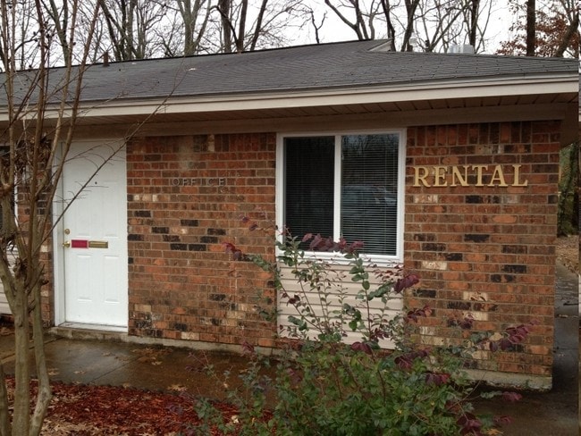
27607 E Main St
083A312A-0140000
S 12 T 17 R 06 PT SW 1/4 SW 1/4 DB 273/676
Apartment
CLAY
AE The base floodplain where base flood elevations are provided. AE Zones are now used on new format FIRMs instead of A1-A30 Zones.
Mississippi
2024
5.80 AC
2025
Vicksburg/Central Area
950400
Other Market Areas
5,777 SF
NEARBY LISTINGS FOR SALE OR LEASE
-
-
View all West Point listings for sale on LoopNet.com
DEMOGRAPHICS near 27607 E Main St
1 mile
3 mile
5 mile
2025 Total Population
2,917
9,260
11,516
2030 Population
2,849
9,048
11,257
Pop Growth 2025-2030
(2.33%)
(2.29%)
(2.25%)
Average Age
41
41
41
2025 Total Households
1,225
3,864
4,796
HH Growth 2025-2030
(2.37%)
(2.30%)
(2.25%)
Median Household Inc
$36,421
$37,664
$39,671
Avg Household Size
2.30
2.30
2.30
2025 Avg HH Vehicles
2.00
2.00
2.00
Median Home Value
$129,138
$139,096
$146,215
Median Year Built
1966
1971
1974
Nearby Places
Map Layers
Map Styles
 Street
 Aerial
Transit
 Traffic
 Biking
Places
Listings with unknown addresses are not visible on the map
- Restaurants
- Banks
- Shops
- Fitness
- Groceries
PUBLIC TRANSPORTATION
AIRPORT
Golden Triangle Regional
Drive
Walk
Distance
Golden Triangle Regional
30 min
17.4 mi
Freight Ports
Port of Mobile
Drive
Walk
Distance
Port of Mobile
268 min
228.9 mi
Nearby Properties
Address
Land Use
TOTAL SIZE
Lot Size
Zoning
Address
Land Use
TOTAL SIZE
Lot Size
Zoning
171,635 SF
37.01 AC
Address
Land Use
TOTAL SIZE
Lot Size
Zoning
151,568 SF
19.28 AC
Address
Land Use
TOTAL SIZE
Lot Size
Zoning
316,175 SF
150 AC
Address
Land Use
TOTAL SIZE
Lot Size
Zoning
17,252 SF
172 AC
Address
Land Use
TOTAL SIZE
Lot Size
Zoning
35,556 SF
2.04 AC
Address
Land Use
TOTAL SIZE
Lot Size
Zoning
10,489 SF
10 AC
Address
Land Use
TOTAL SIZE
Lot Size
Zoning
57,536 SF
11.44 AC
Address
Land Use
TOTAL SIZE
Lot Size
Zoning
37,224 SF
2.98 AC
Address
Land Use
TOTAL SIZE
Lot Size
Zoning
26,311 SF
2.06 AC
Address
Land Use
TOTAL SIZE
Lot Size
Zoning
10,070 SF
5.54 AC
Address
Land Use
TOTAL SIZE
Lot Size
Zoning
9,100 SF
2 AC
Address
Land Use
TOTAL SIZE
Lot Size
Zoning
15,355 SF
Address
Land Use
TOTAL SIZE
Lot Size
Zoning
89,600 SF
17.80 AC
Address
Land Use
TOTAL SIZE
Lot Size
Zoning
11,550 SF
Address
Land Use
TOTAL SIZE
Lot Size
Zoning
34,160 SF
19.20 AC
Address
Land Use
TOTAL SIZE
Lot Size
Zoning
5,627 SF
5.57 AC
Address
Land Use
TOTAL SIZE
Lot Size
Zoning
16,547 SF
28.13 AC
Address
Land Use
TOTAL SIZE
Lot Size
Zoning
47,102 SF
5.70 AC
Address
Land Use
TOTAL SIZE
Lot Size
Zoning
37,800 SF
13 AC
Address
Land Use
TOTAL SIZE
Lot Size
Zoning
10,706 SF
8 AC
Address
Land Use
TOTAL SIZE
Lot Size
Zoning
7,120 SF
3.24 AC
Address
Land Use
TOTAL SIZE
Lot Size
Zoning
9,614 SF
2.60 AC
Address
Land Use
TOTAL SIZE
Lot Size
Zoning
12,433 SF
1.66 AC
Address
Land Use
TOTAL SIZE
Lot Size
Zoning
21,498 SF
Address
Land Use
TOTAL SIZE
Lot Size
Zoning
4,860 SF
46 AC
Address
Land Use
TOTAL SIZE
Lot Size
Zoning
4,221 SF
1.78 AC
The World's #1 Commercial Real Estate Marketplace
Connect with us
© 2026 CoStar Group
The information above has been obtained from sources believed reliable. While we do not doubt its accuracy we have not verified it and make no guarantee, warranty or representation about it. It is your responsibility to independently confirm its accuracy and completeness. Any projections, opinions, assumptions, or estimates used are for example only and do not represent the current or future performance of the property. The value of this transaction to you depends on tax and other factors which should be evaluated by your tax, financial, and legal advisors. You and your advisors should conduct a careful, independent investigation of the property to determine to your satisfaction the suitability of the property for your needs.