Property Record
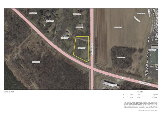
27610 N Darrell Rd, Mchenry, IL 60051

Property Detail
27610 N Darrell Rd
Chicago-Naperville-Elgin, IL-IN
PT SE NE; BEG PNT X ELN NE1/4 WI CLN RT 176 329.9 N OF SE C OR,N390,W190, SWLYTO PNT ON CLN SD RD 262.2 NWLY OF POB,S ELY ALG SD RD 262.2TO POB(EX PT TKN FORSCHOOL PER BK30DEEDS
09-28-200-007
LAKE
Commercialacreage
Illinois
B and X Area of moderate flood hazard, usually the area between the limits of the 100-year and 500-year floods.
0.78 AC
2024
Far Northwest
2025
Chicago
870702
NEARBY LISTINGS FOR SALE OR LEASE
DEMOGRAPHICS near 27610 N Darrell Rd
1 mile
3 mile
5 mile
2025 Total Population
2,725
27,861
73,366
2030 Population
2,753
28,118
74,161
Pop Growth 2025-2030
+ 1.03%
+ 0.92%
+ 1.08%
Average Age
41
42
42
2025 Total Households
1,042
10,828
27,249
HH Growth 2025-2030
+ 0.96%
+ 0.93%
+ 1.10%
Median Household Inc
$102,516
$100,265
$115,687
Avg Household Size
2.60
2.50
2.70
2025 Avg HH Vehicles
2.00
2.00
2.00
Median Home Value
$309,091
$284,609
$337,341
Median Year Built
1991
1982
1986
Nearby Places
Map Layers
Map Styles
 Street
 Aerial
Layers
 Traffic
 Biking
Places
Listings with unknown addresses are not visible on the map
- Restaurants
- Banks
- Shops
- Fitness
- Groceries
PUBLIC TRANSPORTATION
COMMUTER RAIL
Cary Station (Union Pacific Northwest Line - Northeast Illinois Regional Commuter Railroad (Metra))
Drive
Walk
Distance
Cary Station (Union Pacific Northwest Line - Northeast Illinois Regional Commuter Railroad (Metra))
16 min
6.6 mi
Fox River Grove Station (Union Pacific Northwest Line - Northeast Illinois Regional Commuter Railroad (Metra))
Drive
Walk
Distance
Fox River Grove Station (Union Pacific Northwest Line - Northeast Illinois Regional Commuter Railroad (Metra))
16 min
9.2 mi
AIRPORT
Chicago O'Hare International
Drive
Walk
Distance
Chicago O'Hare International
45 min
32.4 mi
Freight Ports
Port Milwaukee
Drive
Walk
Distance
Port Milwaukee
83 min
65.3 mi
SALE & LEASE HISTORY
LISTING DATE
SALE/LEASE

Apr 01, 2020
For Sale
Nearby Properties
Address
Land Use
TOTAL SIZE
Lot Size
Zoning
Address
Land Use
TOTAL SIZE
Lot Size
Zoning
220,060 SF
11.75 AC
Address
Land Use
TOTAL SIZE
Lot Size
Zoning
68,132 SF
1.96 AC
Address
Land Use
TOTAL SIZE
Lot Size
Zoning
212,880 SF
20.06 AC
Address
Land Use
TOTAL SIZE
Lot Size
Zoning
114,186 SF
17.14 AC
Address
Land Use
TOTAL SIZE
Lot Size
Zoning
258,252 SF
1.97 AC
Address
Land Use
TOTAL SIZE
Lot Size
Zoning
118,869 SF
5.88 AC
Address
Land Use
TOTAL SIZE
Lot Size
Zoning
521,479 SF
6.20 AC
Address
Land Use
TOTAL SIZE
Lot Size
Zoning
1,525,750 SF
7.55 AC
Address
Land Use
TOTAL SIZE
Lot Size
Zoning
54,572 SF
4.97 AC
Address
Land Use
TOTAL SIZE
Lot Size
Zoning
100,000 SF
5.13 AC
Address
Land Use
TOTAL SIZE
Lot Size
Zoning
60,202 SF
5 AC
Address
Land Use
TOTAL SIZE
Lot Size
Zoning
77,881 SF
4.60 AC
Address
Land Use
TOTAL SIZE
Lot Size
Zoning
142,560 SF
8.02 AC
Address
Land Use
TOTAL SIZE
Lot Size
Zoning
34,600 SF
2.91 AC
Address
Land Use
TOTAL SIZE
Lot Size
Zoning
18,873 SF
159.95 AC
Address
Land Use
TOTAL SIZE
Lot Size
Zoning
10.55 AC
Address
Land Use
TOTAL SIZE
Lot Size
Zoning
123,948 SF
4 AC
Address
Land Use
TOTAL SIZE
Lot Size
Zoning
56,042 SF
1.15 AC
Address
Land Use
TOTAL SIZE
Lot Size
Zoning
4,256 SF
6.62 AC
Address
Land Use
TOTAL SIZE
Lot Size
Zoning
99,256 SF
2 AC
Address
Land Use
TOTAL SIZE
Lot Size
Zoning
56,566 SF
1.86 AC
Address
Land Use
TOTAL SIZE
Lot Size
Zoning
44,952 SF
3.26 AC
Address
Land Use
TOTAL SIZE
Lot Size
Zoning
163,800 SF
5 AC
Address
Land Use
TOTAL SIZE
Lot Size
Zoning
71,007 SF
7.02 AC
Address
Land Use
TOTAL SIZE
Lot Size
Zoning
76,740 SF
12.03 AC
Address
Land Use
TOTAL SIZE
Lot Size
Zoning
87,600 SF
17.05 AC
Address
Land Use
TOTAL SIZE
Lot Size
Zoning
13,833 SF
1.54 AC
Address
Land Use
TOTAL SIZE
Lot Size
Zoning
40,108 SF
3.46 AC
Address
Land Use
TOTAL SIZE
Lot Size
Zoning
20,580 SF
1.92 AC
Address
Land Use
TOTAL SIZE
Lot Size
Zoning
58,200 SF
2.85 AC
The World's #1 Commercial Real Estate Marketplace
Connect with us
© 2026 CoStar Group
The information above has been obtained from sources believed reliable. While we do not doubt its accuracy we have not verified it and make no guarantee, warranty or representation about it. It is your responsibility to independently confirm its accuracy and completeness. Any projections, opinions, assumptions, or estimates used are for example only and do not represent the current or future performance of the property. The value of this transaction to you depends on tax and other factors which should be evaluated by your tax, financial, and legal advisors. You and your advisors should conduct a careful, independent investigation of the property to determine to your satisfaction the suitability of the property for your needs.