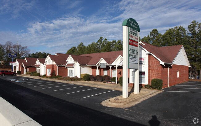
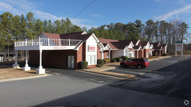
Property Record
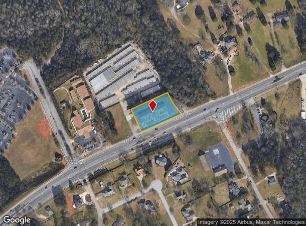
2763 Highway 138 E, Jonesboro, GA 30236

NEARBY LISTINGS FOR SALE OR LEASE
Property Detail
2763 Highway 138 E
12-0043A-00A-007
Clayton
Officebuilding
Georgia
X
43
13063C0091F
1.04 AC
2025
Riverdale/Jonesboro
2025
Atlanta
040615
Atlanta-Sandy Springs-Roswell, GA
8,224 SF
DEMOGRAPHICS near 2763 Highway 138 E
1 Mile
3 Mile
5 Mile
2024 Total Population
5,814
57,122
152,684
2029 Population
5,875
57,837
155,290
Pop Growth 2024-2029
+ 1.05%
+ 1.25%
+ 1.71%
Average Age
43
38
37
2024 Total Households
2,009
21,039
54,641
HH Growth 2024-2029
+ 1.14%
+ 1.20%
+ 1.81%
Median Household Inc
$75,317
$64,214
$56,971
Avg Household Size
2.80
2.70
2.70
2024 Avg HH Vehicles
2.00
2.00
2.00
Median Home Value
$242,749
$201,147
$184,784
Median Year Built
1991
1992
1990
Nearby Places
Map Layers
Map Styles
 Street
 Aerial
- Restaurants
- Banks
- Shops
- Fitness
- Groceries
PUBLIC TRANSPORTATION
AIRPORT
Hartsfield - Jackson Atlanta International
DRIVE
WALK
Distance
Hartsfield - Jackson Atlanta International
22 min
14.6 mi
Nearby Properties
Address
Land Use
TOTAL SIZE
Lot Size
Zoning
Address
Land Use
TOTAL SIZE
Lot Size
Zoning
368 SF
42.85 AC
RM
Address
Land Use
TOTAL SIZE
Lot Size
Zoning
35,082 SF
31.82 AC
C3
Address
Land Use
TOTAL SIZE
Lot Size
Zoning
217,289 SF
52.12 AC
OI
Address
Land Use
TOTAL SIZE
Lot Size
Zoning
194,682 SF
27.80 AC
OI
Address
Land Use
TOTAL SIZE
Lot Size
Zoning
25.16 AC
RM
Address
Land Use
TOTAL SIZE
Lot Size
Zoning
17,862 SF
30 AC
PD
Address
Land Use
TOTAL SIZE
Lot Size
Zoning
330 SF
33.30 AC
RM
Address
Land Use
TOTAL SIZE
Lot Size
Zoning
11.31 AC
RM
Address
Land Use
TOTAL SIZE
Lot Size
Zoning
1,140 SF
187.84 AC
MX
Address
Land Use
TOTAL SIZE
Lot Size
Zoning
200 SF
23.02 AC
RM
Address
Land Use
TOTAL SIZE
Lot Size
Zoning
2,426 SF
19.79 AC
RM
Address
Land Use
TOTAL SIZE
Lot Size
Zoning
284 SF
29 AC
RM
Address
Land Use
TOTAL SIZE
Lot Size
Zoning
707,780 SF
85.14 AC
MXI
Address
Land Use
TOTAL SIZE
Lot Size
Zoning
123,842 SF
31.53 AC
RS110
Address
Land Use
TOTAL SIZE
Lot Size
Zoning
351,207 SF
20 AC
HI
Address
Land Use
TOTAL SIZE
Lot Size
Zoning
216 SF
31.17 AC
RM
Address
Land Use
TOTAL SIZE
Lot Size
Zoning
20.65 AC
RM
Address
Land Use
TOTAL SIZE
Lot Size
Zoning
200 SF
22 AC
RM
Address
Land Use
TOTAL SIZE
Lot Size
Zoning
87,449 SF
14 AC
MC
Address
Land Use
TOTAL SIZE
Lot Size
Zoning
200 SF
20.23 AC
RM
Address
Land Use
TOTAL SIZE
Lot Size
Zoning
200 SF
25 AC
RM
Address
Land Use
TOTAL SIZE
Lot Size
Zoning
30.90 AC
RS110
Address
Land Use
TOTAL SIZE
Lot Size
Zoning
182 SF
19.46 AC
RM
Address
Land Use
TOTAL SIZE
Lot Size
Zoning
120 SF
26.48 AC
RM
Address
Land Use
TOTAL SIZE
Lot Size
Zoning
96,315 SF
3.53 AC
RS110
Address
Land Use
TOTAL SIZE
Lot Size
Zoning
512,321 SF
19.83 AC
C
Address
Land Use
TOTAL SIZE
Lot Size
Zoning
200 SF
18.36 AC
RM
Address
Land Use
TOTAL SIZE
Lot Size
Zoning
200 SF
19 AC
RM
Address
Land Use
TOTAL SIZE
Lot Size
Zoning
56,939 SF
10.04 AC
C
Address
Land Use
TOTAL SIZE
Lot Size
Zoning
84,230 SF
11.56 AC
MCD
The World's #1 Commercial Real Estate Marketplace
Connect with us
© 2025 CoStar Group
The information above has been obtained from sources believed reliable. While we do not doubt its accuracy we have not verified it and make no guarantee, warranty or representation about it. It is your responsibility to independently confirm its accuracy and completeness. Any projections, opinions, assumptions, or estimates used are for example only and do not represent the current or future performance of the property. The value of this transaction to you depends on tax and other factors which should be evaluated by your tax, financial, and legal advisors. You and your advisors should conduct a careful, independent investigation of the property to determine to your satisfaction the suitability of the property for your needs.