Property Record
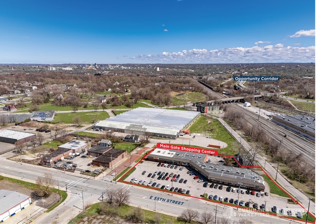
2765 E 55Th St, Cleveland, OH 44104


NEARBY LISTINGS FOR SALE OR LEASE
-
-
-
-
-
-
-
-
-
-
-
-
-
-
-
-
-
-
No Photo
-
View all Cleveland listings for sale on LoopNet.com
Property Detail
2765 E 55Th St
Cleveland-Elyria, OH
Pt
124-20-001
328 PT VAC ALLEY 12420002 & 12420050
Stripcommercialcenter
Cuyahoga
X
Ohio
39035C0182E
328
2024
2.07 AC
2024
East
198400
Cleveland
24,432 SF
DEMOGRAPHICS near 2765 E 55Th St
1 Mile
3 Mile
5 Mile
2024 Total Population
12,524
109,148
300,435
2029 Population
12,336
107,669
295,378
Pop Growth 2024-2029
(1.50%)
(1.36%)
(1.68%)
Average Age
30
38
38
2024 Total Households
4,542
51,959
136,104
HH Growth 2024-2029
(1.63%)
(1.13%)
(1.62%)
Median Household Inc
$16,751
$31,409
$35,955
Avg Household Size
2.50
1.90
2.10
2024 Avg HH Vehicles
1.00
1.00
1.00
Median Home Value
$72,649
$80,258
$92,578
Median Year Built
1972
1948
1947
Nearby Places
Map Layers
Map Styles
 Street
 Aerial
- Restaurants
- Banks
- Shops
- Fitness
- Groceries
PUBLIC TRANSPORTATION
TRANSIT/SUBWAY
East 55 (Blue Line - Greater Cleveland Regional Transit Authority Rapid Transit (The Rapid), Green Line - Greater Cleveland Regional Transit Authority Rapid Transit (The Rapid), Red Line - Greater Cleveland Regional Transit Authority Rapid Transit (The Rapid))
DRIVE
WALK
Distance
East 55 (Blue Line - Greater Cleveland Regional Transit Authority Rapid Transit (The Rapid), Green Line - Greater Cleveland Regional Transit Authority Rapid Transit (The Rapid), Red Line - Greater Cleveland Regional Transit Authority Rapid Transit (The Rapid))
1 min
5 min
0.2 mi
COMMUTER RAIL
Cleveland Lakefront Station (Blue Line - Greater Cleveland Regional Transit Authority Rapid Transit (The Rapid), Green Line - Greater Cleveland Regional Transit Authority Rapid Transit (The Rapid))
DRIVE
WALK
Distance
Cleveland Lakefront Station (Blue Line - Greater Cleveland Regional Transit Authority Rapid Transit (The Rapid), Green Line - Greater Cleveland Regional Transit Authority Rapid Transit (The Rapid))
12 min
4.3 mi
DRIVE
WALK
Distance
15 min
7.8 mi
AIRPORT
Cleveland-Hopkins International
DRIVE
WALK
Distance
Cleveland-Hopkins International
24 min
14.2 mi
SALE & LEASE HISTORY
LISTING DATE
SALE/LEASE

Sep 25, 2016
For Lease
Sep 18, 2017
For Lease
Sep 18, 2017
For Sale
Mar 11, 2025
For Sale
Jan 31, 2017
For Lease
Dec 14, 2017
For Lease
Aug 10, 2023
For Sale
Apr 05, 2024
For Sale
Nearby Properties
Address
Land Use
TOTAL SIZE
Lot Size
Zoning
Address
Land Use
TOTAL SIZE
Lot Size
Zoning
3,172,147 SF
20.33 AC
GR
Address
Land Use
TOTAL SIZE
Lot Size
Zoning
1,211,519 SF
13.57 AC
GR
Address
Land Use
TOTAL SIZE
Lot Size
Zoning
3,491,901 SF
34.32 AC
Address
Land Use
TOTAL SIZE
Lot Size
Zoning
2,064,168 SF
17.90 AC
GR
Address
Land Use
TOTAL SIZE
Lot Size
Zoning
1,104,152 SF
13.96 AC
GR
Address
Land Use
TOTAL SIZE
Lot Size
Zoning
753,970 SF
9.31 AC
GR
Address
Land Use
TOTAL SIZE
Lot Size
Zoning
942,168 SF
8.34 AC
IR
Address
Land Use
TOTAL SIZE
Lot Size
Zoning
53.85 AC
2F
Address
Land Use
TOTAL SIZE
Lot Size
Zoning
1,211,519 SF
13.63 AC
GR
Address
Land Use
TOTAL SIZE
Lot Size
Zoning
484,355 SF
11.60 AC
GR
Address
Land Use
TOTAL SIZE
Lot Size
Zoning
1,570,958 SF
1.33 AC
GR
Address
Land Use
TOTAL SIZE
Lot Size
Zoning
16.78 AC
SI
Address
Land Use
TOTAL SIZE
Lot Size
Zoning
370,230 SF
4.08 AC
GR
Address
Land Use
TOTAL SIZE
Lot Size
Zoning
710,780 SF
4.33 AC
GR
Address
Land Use
TOTAL SIZE
Lot Size
Zoning
1,151,581 SF
10.13 AC
L1F
Address
Land Use
TOTAL SIZE
Lot Size
Zoning
500,042 SF
1.34 AC
1F
Address
Land Use
TOTAL SIZE
Lot Size
Zoning
765,607 SF
12.15 AC
GR
Address
Land Use
TOTAL SIZE
Lot Size
Zoning
788,580 SF
4.85 AC
GR
Address
Land Use
TOTAL SIZE
Lot Size
Zoning
592,922 SF
11.72 AC
GR
Address
Land Use
TOTAL SIZE
Lot Size
Zoning
1,227,793 SF
6.80 AC
GR
Address
Land Use
TOTAL SIZE
Lot Size
Zoning
434,475 SF
0.53 AC
Address
Land Use
TOTAL SIZE
Lot Size
Zoning
595,671 SF
14.98 AC
MF3+
Address
Land Use
TOTAL SIZE
Lot Size
Zoning
128,967 SF
3.54 AC
Address
Land Use
TOTAL SIZE
Lot Size
Zoning
1,191,268 SF
3.94 AC
SI
Address
Land Use
TOTAL SIZE
Lot Size
Zoning
6.98 AC
SI
Address
Land Use
TOTAL SIZE
Lot Size
Zoning
913,527 SF
5.17 AC
GR
Address
Land Use
TOTAL SIZE
Lot Size
Zoning
148,486 SF
489.21 AC
GI
Address
Land Use
TOTAL SIZE
Lot Size
Zoning
942,168 SF
9.93 AC
IR
Address
Land Use
TOTAL SIZE
Lot Size
Zoning
652,455 SF
2.04 AC
GR
Address
Land Use
TOTAL SIZE
Lot Size
Zoning
230,820 SF
41.47 AC
UI
The World's #1 Commercial Real Estate Marketplace
Connect with us
© 2026 CoStar Group
The information above has been obtained from sources believed reliable. While we do not doubt its accuracy we have not verified it and make no guarantee, warranty or representation about it. It is your responsibility to independently confirm its accuracy and completeness. Any projections, opinions, assumptions, or estimates used are for example only and do not represent the current or future performance of the property. The value of this transaction to you depends on tax and other factors which should be evaluated by your tax, financial, and legal advisors. You and your advisors should conduct a careful, independent investigation of the property to determine to your satisfaction the suitability of the property for your needs.