Property Record
210 E Nc Hwy E, Holly Ridge, NC 28445


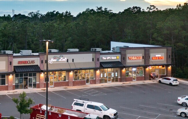
Current Lease Availabilities
Property Detail
210 E Nc Hwy E
Wilmington, NC
PARCEL 1 PB 60/84 SURF CITY TOPSAIL PTNRS RECOMB
4235-28-6560-0000
PENDER
Supermarket
North Carolina
2025
1
2025
7.41 AC
920105
East Pender County
46,080 SF
Wilmington
NEARBY LISTINGS FOR SALE OR LEASE
DEMOGRAPHICS near 210 E Nc Hwy E
1 mile
3 mile
5 mile
2025 Total Population
2,314
12,651
21,382
2030 Population
2,713
14,608
24,419
Pop Growth 2025-2030
+ 17.24%
+ 15.47%
+ 14.20%
Average Age
40
42
41
2025 Total Households
937
5,183
8,615
HH Growth 2025-2030
+ 17.61%
+ 15.99%
+ 14.80%
Median Household Inc
$57,236
$82,766
$89,961
Avg Household Size
2.40
2.40
2.40
2025 Avg HH Vehicles
2.00
2.00
2.00
Median Home Value
$270,105
$409,771
$424,315
Median Year Built
1997
1999
2001
Nearby Places
Map Layers
Map Styles
 Street
 Aerial
Layers
 Traffic
 Biking
Places
Listings with unknown addresses are not visible on the map
- Restaurants
- Banks
- Shops
- Fitness
- Groceries
PUBLIC TRANSPORTATION
AIRPORT
Wilmington International
Drive
Walk
Distance
Wilmington International
47 min
30.2 mi
Albert J Ellis
Drive
Walk
Distance
Albert J Ellis
57 min
35.6 mi
Freight Ports
Port of Wilmington
Drive
Walk
Distance
Port of Wilmington
54 min
32.1 mi
Nearby Properties
Address
Land Use
TOTAL SIZE
Lot Size
Zoning
Address
Land Use
TOTAL SIZE
Lot Size
Zoning
333,789 SF
1 AC
RP
Address
Land Use
TOTAL SIZE
Lot Size
Zoning
151,776 SF
32.21 AC
SEEMAP
Address
Land Use
TOTAL SIZE
Lot Size
Zoning
900 SF
4.74 AC
C1
Address
Land Use
TOTAL SIZE
Lot Size
Zoning
104,760 SF
20 AC
Address
Land Use
TOTAL SIZE
Lot Size
Zoning
6,909 SF
36.97 AC
R-20
Address
Land Use
TOTAL SIZE
Lot Size
Zoning
60,562 SF
9.34 AC
SEEMAP
Address
Land Use
TOTAL SIZE
Lot Size
Zoning
138,492 SF
32.99 AC
SEEMAP
Address
Land Use
TOTAL SIZE
Lot Size
Zoning
42,232 SF
6.23 AC
SEEMAP
Address
Land Use
TOTAL SIZE
Lot Size
Zoning
22,068 SF
3.13 AC
B2
Address
Land Use
TOTAL SIZE
Lot Size
Zoning
35,205 SF
5.86 AC
SEEMAP
Address
Land Use
TOTAL SIZE
Lot Size
Zoning
23,444 SF
5.17 AC
SEEMAP
Address
Land Use
TOTAL SIZE
Lot Size
Zoning
5,000 SF
24.13 AC
LI
Address
Land Use
TOTAL SIZE
Lot Size
Zoning
1,213.25 AC
R-15
Address
Land Use
TOTAL SIZE
Lot Size
Zoning
8,331 SF
2.17 AC
SEEMAP
Address
Land Use
TOTAL SIZE
Lot Size
Zoning
11,534 SF
1 AC
SEEMAP
Address
Land Use
TOTAL SIZE
Lot Size
Zoning
11,500 SF
1.59 AC
C1
Address
Land Use
TOTAL SIZE
Lot Size
Zoning
13,606 SF
1.52 AC
SEEMAP
Address
Land Use
TOTAL SIZE
Lot Size
Zoning
7,828 SF
2.89 AC
SEEMAP
Address
Land Use
TOTAL SIZE
Lot Size
Zoning
15,360 SF
0.95 AC
C2
Address
Land Use
TOTAL SIZE
Lot Size
Zoning
9,664 SF
3.10 AC
C1
Address
Land Use
TOTAL SIZE
Lot Size
Zoning
22,584 SF
3.35 AC
SEEMAP
Address
Land Use
TOTAL SIZE
Lot Size
Zoning
16,000 SF
0.68 AC
Address
Land Use
TOTAL SIZE
Lot Size
Zoning
4.02 AC
R5
Address
Land Use
TOTAL SIZE
Lot Size
Zoning
9,021 SF
2.65 AC
SEEMAP
Address
Land Use
TOTAL SIZE
Lot Size
Zoning
6,500 SF
34.41 AC
SEEMAP
Address
Land Use
TOTAL SIZE
Lot Size
Zoning
3,088 SF
31.91 AC
R-10A
Address
Land Use
TOTAL SIZE
Lot Size
Zoning
49,760 SF
7.42 AC
LI
Address
Land Use
TOTAL SIZE
Lot Size
Zoning
6,520 SF
8.82 AC
LI
Address
Land Use
TOTAL SIZE
Lot Size
Zoning
16,072 SF
3.18 AC
PD
The World's #1 Commercial Real Estate Marketplace
Connect with us
© 2026 CoStar Group
The information above has been obtained from sources believed reliable. While we do not doubt its accuracy we have not verified it and make no guarantee, warranty or representation about it. It is your responsibility to independently confirm its accuracy and completeness. Any projections, opinions, assumptions, or estimates used are for example only and do not represent the current or future performance of the property. The value of this transaction to you depends on tax and other factors which should be evaluated by your tax, financial, and legal advisors. You and your advisors should conduct a careful, independent investigation of the property to determine to your satisfaction the suitability of the property for your needs.