Property Record
2765 Road A Dr, Elgin, IL 60124


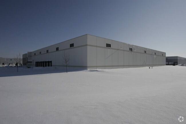

Property Detail
2765 Road A Dr
Chicago-Naperville-Elgin, IL-IN
NORTHWEST BUSINESS PARK RESUB NO 1 - LOT 101 & NORTHWEST BUSINESS PARK - LOTS 37 THRU 43 & W 45 FT LOT 36 AS DESC IN DOC 2018K047629
03-19-376-004
KANE
Industrialgeneral
Illinois
B and X Area of moderate flood hazard, usually the area between the limits of the 100-year and 500-year floods.
40
2024
0.59 AC
2024
North Kane/I-90
850711
Chicago
NEARBY LISTINGS FOR SALE OR LEASE
DEMOGRAPHICS near 2765 Road A Dr
1 mile
3 mile
5 mile
2025 Total Population
3,100
30,424
114,231
2030 Population
3,187
30,963
116,223
Pop Growth 2025-2030
+ 2.81%
+ 1.77%
+ 1.74%
Average Age
38
40
40
2025 Total Households
1,029
10,452
39,830
HH Growth 2025-2030
+ 2.72%
+ 1.80%
+ 1.72%
Median Household Inc
$120,338
$118,228
$109,682
Avg Household Size
3.00
2.90
2.80
2025 Avg HH Vehicles
2.00
2.00
2.00
Median Home Value
$366,778
$349,440
$331,769
Median Year Built
1995
1997
1991
Nearby Places
Map Layers
Map Styles
 Street
 Aerial
Layers
 Traffic
 Biking
Places
Listings with unknown addresses are not visible on the map
- Restaurants
- Banks
- Shops
- Fitness
- Groceries
PUBLIC TRANSPORTATION
COMMUTER RAIL
Big Timber Road Station (Milwaukee District West Line - Northeast Illinois Regional Commuter Railroad (Metra))
Drive
Walk
Distance
Big Timber Road Station (Milwaukee District West Line - Northeast Illinois Regional Commuter Railroad (Metra))
10 min
3.9 mi
Elgin Station (Milwaukee District West Line - Northeast Illinois Regional Commuter Railroad (Metra))
Drive
Walk
Distance
Elgin Station (Milwaukee District West Line - Northeast Illinois Regional Commuter Railroad (Metra))
14 min
6.9 mi
AIRPORT
Chicago O'Hare International
Drive
Walk
Distance
Chicago O'Hare International
39 min
30.3 mi
Chicago Midway International
Drive
Walk
Distance
Chicago Midway International
64 min
46.7 mi
Nearby Properties
Address
Land Use
TOTAL SIZE
Lot Size
Zoning
Address
Land Use
TOTAL SIZE
Lot Size
Zoning
Address
Land Use
TOTAL SIZE
Lot Size
Zoning
61.92 AC
Address
Land Use
TOTAL SIZE
Lot Size
Zoning
37.65 AC
Address
Land Use
TOTAL SIZE
Lot Size
Zoning
10.88 AC
Address
Land Use
TOTAL SIZE
Lot Size
Zoning
547,668 SF
30.17 AC
Address
Land Use
TOTAL SIZE
Lot Size
Zoning
18.73 AC
Address
Land Use
TOTAL SIZE
Lot Size
Zoning
411,943 SF
17 AC
Address
Land Use
TOTAL SIZE
Lot Size
Zoning
20.02 AC
Address
Land Use
TOTAL SIZE
Lot Size
Zoning
20.33 AC
Address
Land Use
TOTAL SIZE
Lot Size
Zoning
22.04 AC
Address
Land Use
TOTAL SIZE
Lot Size
Zoning
14.36 AC
Address
Land Use
TOTAL SIZE
Lot Size
Zoning
20.93 AC
Address
Land Use
TOTAL SIZE
Lot Size
Zoning
307,150 SF
29.72 AC
Address
Land Use
TOTAL SIZE
Lot Size
Zoning
Address
Land Use
TOTAL SIZE
Lot Size
Zoning
18.55 AC
Address
Land Use
TOTAL SIZE
Lot Size
Zoning
522,133 SF
16 AC
Address
Land Use
TOTAL SIZE
Lot Size
Zoning
7.92 AC
Address
Land Use
TOTAL SIZE
Lot Size
Zoning
14.01 AC
Address
Land Use
TOTAL SIZE
Lot Size
Zoning
342,700 SF
19 AC
Address
Land Use
TOTAL SIZE
Lot Size
Zoning
99,800 SF
0.53 AC
Address
Land Use
TOTAL SIZE
Lot Size
Zoning
10.87 AC
Address
Land Use
TOTAL SIZE
Lot Size
Zoning
9.17 AC
Address
Land Use
TOTAL SIZE
Lot Size
Zoning
250,000 SF
13.22 AC
Address
Land Use
TOTAL SIZE
Lot Size
Zoning
250,530 SF
12 AC
Address
Land Use
TOTAL SIZE
Lot Size
Zoning
251,200 SF
13.99 AC
Address
Land Use
TOTAL SIZE
Lot Size
Zoning
11.16 AC
Address
Land Use
TOTAL SIZE
Lot Size
Zoning
13.53 AC
Address
Land Use
TOTAL SIZE
Lot Size
Zoning
19.06 AC
Address
Land Use
TOTAL SIZE
Lot Size
Zoning
Address
Land Use
TOTAL SIZE
Lot Size
Zoning
7,254 SF
1.98 AC
The World's #1 Commercial Real Estate Marketplace
Connect with us
© 2026 CoStar Group
The information above has been obtained from sources believed reliable. While we do not doubt its accuracy we have not verified it and make no guarantee, warranty or representation about it. It is your responsibility to independently confirm its accuracy and completeness. Any projections, opinions, assumptions, or estimates used are for example only and do not represent the current or future performance of the property. The value of this transaction to you depends on tax and other factors which should be evaluated by your tax, financial, and legal advisors. You and your advisors should conduct a careful, independent investigation of the property to determine to your satisfaction the suitability of the property for your needs.