Property Record
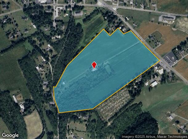
2766 Route 100, Orefield, PA 18069

This Property Is For Sale
NEARBY LISTINGS FOR SALE OR LEASE
Property Detail
2766 Route 100
Allentown-Bethlehem-Easton, PA-NJ
Act 319P
545702330003-1
Lehigh
Sfr
Pennsylvania
X
43.35 AC
42011C0210G
Lehigh Valley
1,432 SF
Philadelphia
DEMOGRAPHICS near 2766 Route 100
1 Mile
3 Mile
5 Mile
2024 Total Population
954
7,786
35,505
2029 Population
959
7,889
35,907
Pop Growth 2024-2029
+ 0.52%
+ 1.32%
+ 1.13%
Average Age
43
43
41
2024 Total Households
350
2,899
13,225
HH Growth 2024-2029
+ 0.57%
+ 1.35%
+ 1.16%
Median Household Inc
$129,891
$129,864
$106,250
Avg Household Size
2.70
2.70
2.60
2024 Avg HH Vehicles
3.00
3.00
2.00
Median Home Value
$401,053
$422,695
$359,914
Median Year Built
1981
1989
1991
Nearby Places
- Restaurants
- Banks
- Shops
- Fitness
- Groceries
PUBLIC TRANSPORTATION
AIRPORT
Lehigh Valley International
DRIVE
WALK
Distance
Lehigh Valley International
25 min
15.3 mi
Freight Ports
Port of Philadelphia
DRIVE
WALK
Distance
Port of Philadelphia
84 min
63.6 mi
Nearby Properties
Address
Land Use
TOTAL SIZE
Lot Size
Zoning
Address
Land Use
TOTAL SIZE
Lot Size
Zoning
1,042,665 SF
86 AC
LI
Address
Land Use
TOTAL SIZE
Lot Size
Zoning
1,192,380 SF
83.59 AC
LI
Address
Land Use
TOTAL SIZE
Lot Size
Zoning
980,000 SF
71.57 AC
GI
Address
Land Use
TOTAL SIZE
Lot Size
Zoning
822,162 SF
50.12 AC
LI
Address
Land Use
TOTAL SIZE
Lot Size
Zoning
794,880 SF
45.63 AC
LI
Address
Land Use
TOTAL SIZE
Lot Size
Zoning
4,948 SF
51.05 AC
R3
Address
Land Use
TOTAL SIZE
Lot Size
Zoning
808,418 SF
65.50 AC
LI
Address
Land Use
TOTAL SIZE
Lot Size
Zoning
607,320 SF
53.44 AC
LI
Address
Land Use
TOTAL SIZE
Lot Size
Zoning
244,481 SF
30.24 AC
LI
Address
Land Use
TOTAL SIZE
Lot Size
Zoning
293,406 SF
48.34 AC
LI
Address
Land Use
TOTAL SIZE
Lot Size
Zoning
384,575 SF
28.49 AC
LI
Address
Land Use
TOTAL SIZE
Lot Size
Zoning
425,093 SF
52.57 AC
GC
Address
Land Use
TOTAL SIZE
Lot Size
Zoning
112,200 SF
25.05 AC
LI
Address
Land Use
TOTAL SIZE
Lot Size
Zoning
336,000 SF
20.34 AC
GC
Address
Land Use
TOTAL SIZE
Lot Size
Zoning
266,850 SF
41.93 AC
LI
Address
Land Use
TOTAL SIZE
Lot Size
Zoning
240,747 SF
30.64 AC
LI
Address
Land Use
TOTAL SIZE
Lot Size
Zoning
289,300 SF
18.66 AC
LI
Address
Land Use
TOTAL SIZE
Lot Size
Zoning
111,833 SF
12.97 AC
LI
Address
Land Use
TOTAL SIZE
Lot Size
Zoning
299,399 SF
17.32 AC
LI
Address
Land Use
TOTAL SIZE
Lot Size
Zoning
81.45 AC
LIL
Address
Land Use
TOTAL SIZE
Lot Size
Zoning
139,236 SF
13.42 AC
LI
Address
Land Use
TOTAL SIZE
Lot Size
Zoning
100,521 SF
13.43 AC
LI
Address
Land Use
TOTAL SIZE
Lot Size
Zoning
26,834 SF
5.10 AC
HC
Address
Land Use
TOTAL SIZE
Lot Size
Zoning
124,408 SF
10.89 AC
LI
Address
Land Use
TOTAL SIZE
Lot Size
Zoning
141,392 SF
9.37 AC
LI
Address
Land Use
TOTAL SIZE
Lot Size
Zoning
178,856 SF
13.71 AC
LI
Address
Land Use
TOTAL SIZE
Lot Size
Zoning
108,793 SF
13.02 AC
LI
Address
Land Use
TOTAL SIZE
Lot Size
Zoning
153,188 SF
9.20 AC
LI
Address
Land Use
TOTAL SIZE
Lot Size
Zoning
187,342 SF
11.87 AC
LI
Address
Land Use
TOTAL SIZE
Lot Size
Zoning
80,527 SF
10.71 AC
NC
The World's #1 Commercial Real Estate Marketplace
Connect with us
© 2025 CoStar Group
The information above has been obtained from sources believed reliable. While we do not doubt its accuracy we have not verified it and make no guarantee, warranty or representation about it. It is your responsibility to independently confirm its accuracy and completeness. Any projections, opinions, assumptions, or estimates used are for example only and do not represent the current or future performance of the property. The value of this transaction to you depends on tax and other factors which should be evaluated by your tax, financial, and legal advisors. You and your advisors should conduct a careful, independent investigation of the property to determine to your satisfaction the suitability of the property for your needs.