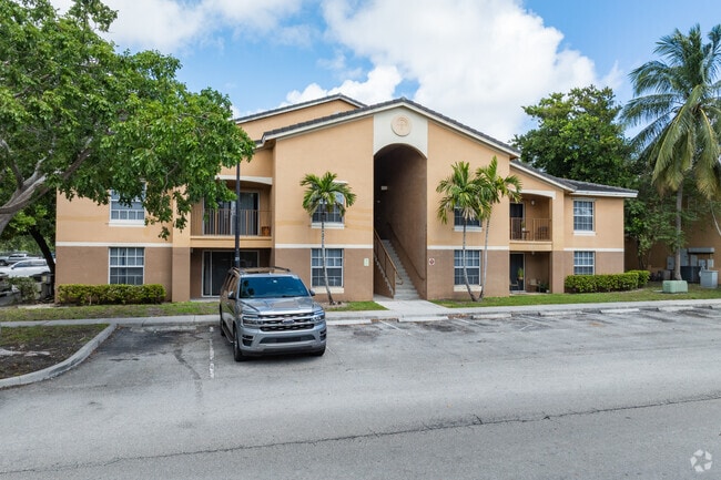
Property Record
2767 10Th Ave N, Palm Springs, FL 33461


NEARBY LISTINGS FOR SALE OR LEASE
Property Detail
2767 10Th Ave N
70-43-44-20-01-012-0020
Model Land Co Sub
Multifamilydwelling
MODEL LAND CO SUB W 1/2 OF TR 12~ TR 13 (LESS N 55 FT LWDD CNL R/W)~ SLY 4.52 FT OF TR 14~ NLY 143.48 FT OF TR 17 & TR 18 & W 1/2 OF TR 19
AE
Palm Beach
12099C0589F
Florida
2024
14.56 AC
2025
Outer Greenacres
004500
South Florida
289,225 SF
West Palm Beach-Boca Raton-Delray Beach, FL
DEMOGRAPHICS near 2767 10Th Ave N
1 Mile
3 Mile
5 Mile
2024 Total Population
18,538
149,810
326,425
2029 Population
18,980
154,467
337,460
Pop Growth 2024-2029
+ 2.38%
+ 3.11%
+ 3.38%
Average Age
39
38
40
2024 Total Households
6,715
52,659
118,407
HH Growth 2024-2029
+ 2.10%
+ 2.88%
+ 3.40%
Median Household Inc
$49,937
$55,645
$58,931
Avg Household Size
2.70
2.70
2.60
2024 Avg HH Vehicles
2.00
2.00
2.00
Median Home Value
$241,245
$257,687
$272,535
Median Year Built
1975
1975
1980
Nearby Places
Map Layers
Map Styles
 Street
 Aerial
- Restaurants
- Banks
- Shops
- Fitness
- Groceries
PUBLIC TRANSPORTATION
COMMUTER RAIL
Lake Worth (Mangonia Park - Miami Airport - Tri-Rail, Tri-County Commuter - Tri-Rail)
DRIVE
WALK
Distance
Lake Worth (Mangonia Park - Miami Airport - Tri-Rail, Tri-County Commuter - Tri-Rail)
4 min
1.8 mi
Boynton Beach (Mangonia Park - Miami Airport - Tri-Rail, Tri-County Commuter - Tri-Rail)
DRIVE
WALK
Distance
Boynton Beach (Mangonia Park - Miami Airport - Tri-Rail, Tri-County Commuter - Tri-Rail)
12 min
6.9 mi
AIRPORT
Palm Beach International
DRIVE
WALK
Distance
Palm Beach International
12 min
5.3 mi
Freight Ports
Port of Palm Beach
DRIVE
WALK
Distance
Port of Palm Beach
23 min
12.9 mi
Nearby Properties
Address
Land Use
TOTAL SIZE
Lot Size
Zoning
Address
Land Use
TOTAL SIZE
Lot Size
Zoning
981,713 SF
77.89 AC
PO
Address
Land Use
TOTAL SIZE
Lot Size
Zoning
1,346,412 SF
23.09 AC
HD PUD
Address
Land Use
TOTAL SIZE
Lot Size
Zoning
902,798 SF
112.99 AC
PO
Address
Land Use
TOTAL SIZE
Lot Size
Zoning
81,194 SF
675.47 AC
PO
Address
Land Use
TOTAL SIZE
Lot Size
Zoning
404,222 SF
36.71 AC
RH
Address
Land Use
TOTAL SIZE
Lot Size
Zoning
211,774 SF
304.50 AC
PO
Address
Land Use
TOTAL SIZE
Lot Size
Zoning
261,460 SF
17.63 AC
RM
Address
Land Use
TOTAL SIZE
Lot Size
Zoning
387,788 SF
48.75 AC
GU
Address
Land Use
TOTAL SIZE
Lot Size
Zoning
344,562 SF
19.84 AC
G
Address
Land Use
TOTAL SIZE
Lot Size
Zoning
302,487 SF
24.42 AC
CS
Address
Land Use
TOTAL SIZE
Lot Size
Zoning
224,978 SF
5.48 AC
MU-DIXIE
Address
Land Use
TOTAL SIZE
Lot Size
Zoning
338,035 SF
26.98 AC
PO
Address
Land Use
TOTAL SIZE
Lot Size
Zoning
296,033 SF
2.04 AC
TOD-E
Address
Land Use
TOTAL SIZE
Lot Size
Zoning
178,602 SF
7.61 AC
MU-W
Address
Land Use
TOTAL SIZE
Lot Size
Zoning
15,441 SF
20.59 AC
R-B
Address
Land Use
TOTAL SIZE
Lot Size
Zoning
251,292 SF
18.59 AC
I-POC
Address
Land Use
TOTAL SIZE
Lot Size
Zoning
208,473 SF
14.57 AC
CG
Address
Land Use
TOTAL SIZE
Lot Size
Zoning
188,100 SF
48.66 AC
GU
Address
Land Use
TOTAL SIZE
Lot Size
Zoning
238,988 SF
8.55 AC
RM
Address
Land Use
TOTAL SIZE
Lot Size
Zoning
344,466 SF
24.37 AC
P
Address
Land Use
TOTAL SIZE
Lot Size
Zoning
201,733 SF
11.32 AC
RM
Address
Land Use
TOTAL SIZE
Lot Size
Zoning
191,404 SF
30.48 AC
GU
Address
Land Use
TOTAL SIZE
Lot Size
Zoning
210,643 SF
28.85 AC
G
Address
Land Use
TOTAL SIZE
Lot Size
Zoning
200,366 SF
12.59 AC
MU-W
Address
Land Use
TOTAL SIZE
Lot Size
Zoning
228,757 SF
17.65 AC
CG
Address
Land Use
TOTAL SIZE
Lot Size
Zoning
132,792 SF
10.51 AC
MUPD
Address
Land Use
TOTAL SIZE
Lot Size
Zoning
58,081 SF
67.01 AC
MI
Address
Land Use
TOTAL SIZE
Lot Size
Zoning
203,046 SF
16.06 AC
G
Address
Land Use
TOTAL SIZE
Lot Size
Zoning
220,885 SF
20.48 AC
GC
Address
Land Use
TOTAL SIZE
Lot Size
Zoning
103,956 SF
7.06 AC
RM
The World's #1 Commercial Real Estate Marketplace
Connect with us
© 2025 CoStar Group
The information above has been obtained from sources believed reliable. While we do not doubt its accuracy we have not verified it and make no guarantee, warranty or representation about it. It is your responsibility to independently confirm its accuracy and completeness. Any projections, opinions, assumptions, or estimates used are for example only and do not represent the current or future performance of the property. The value of this transaction to you depends on tax and other factors which should be evaluated by your tax, financial, and legal advisors. You and your advisors should conduct a careful, independent investigation of the property to determine to your satisfaction the suitability of the property for your needs.