Property Record
277 Fairfield Rd, Fairfield, NJ 07004

Save to a Folder
{{folder.Name}}
{{folder.ListingIds.length}} Properties
{{folder.ListingIds.length}} Property
Create a New Folder
Current Lease Availabilities
Property Detail
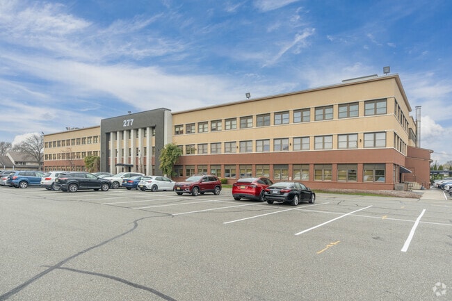
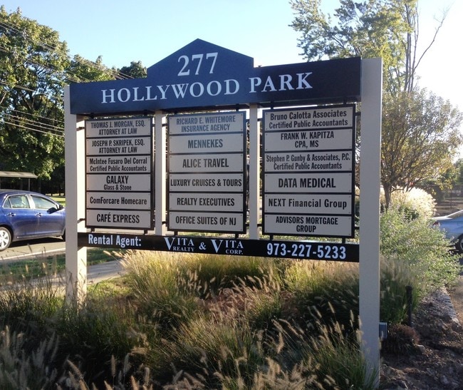
277 Fairfield Rd
07-03802-0000-00003
9.95 AC
Industrialgeneral
Essex
HD
New Jersey
AE The base floodplain where base flood elevations are provided. AE Zones are now used on new format FIRMs instead of A1-A30 Zones.
3
2025
9.95 AC
2026
Suburban Essex/Rt 280
021601
Northern New Jersey
8,628 SF
Newark, NJ
NEARBY LISTINGS FOR SALE OR LEASE
DEMOGRAPHICS near 277 Fairfield Rd
1 mile
3 mile
5 mile
2025 Total Population
4,495
52,778
192,276
2030 Population
4,778
55,532
200,648
Pop Growth 2025-2030
+ 6.30%
+ 5.22%
+ 4.35%
Average Age
43
43
43
2025 Total Households
1,536
19,738
70,089
HH Growth 2025-2030
+ 6.45%
+ 5.24%
+ 4.46%
Median Household Inc
$137,215
$132,969
$137,638
Avg Household Size
2.90
2.60
2.60
2025 Avg HH Vehicles
2.00
2.00
2.00
Median Home Value
$711,393
$628,588
$647,209
Median Year Built
1967
1966
1964
Nearby Places
Map Layers
Map Styles
 Street
 Aerial
Layers
 Traffic
 Biking
Places
Listings with unknown addresses are not visible on the map
- Restaurants
- Banks
- Shops
- Fitness
- Groceries
PUBLIC TRANSPORTATION
COMMUTER RAIL
Wayne/Route 23 Transit Center (Montclair-Boonton Line - NJ Transit Commuter Rail (NJ Transit))
Drive
Walk
Distance
Wayne/Route 23 Transit Center (Montclair-Boonton Line - NJ Transit Commuter Rail (NJ Transit))
6 min
3.7 mi
Mountain View (Montclair-Boonton Line - NJ Transit Commuter Rail (NJ Transit))
Drive
Walk
Distance
Mountain View (Montclair-Boonton Line - NJ Transit Commuter Rail (NJ Transit))
7 min
4.5 mi
AIRPORT
Newark Liberty International
Drive
Walk
Distance
Newark Liberty International
27 min
23.6 mi
LaGuardia
Drive
Walk
Distance
LaGuardia
44 min
31.8 mi
Freight Ports
Port Newark Container Terminal
Drive
Walk
Distance
Port Newark Container Terminal
33 min
22.9 mi
Nearby Properties
Address
Land Use
TOTAL SIZE
Lot Size
Zoning
Address
Land Use
TOTAL SIZE
Lot Size
Zoning
667,698 SF
38.15 AC
Address
Land Use
TOTAL SIZE
Lot Size
Zoning
74.58 AC
S
Address
Land Use
TOTAL SIZE
Lot Size
Zoning
48.85 AC
R-3B
Address
Land Use
TOTAL SIZE
Lot Size
Zoning
98.27 AC
AH1
Address
Land Use
TOTAL SIZE
Lot Size
Zoning
49.48 AC
Address
Land Use
TOTAL SIZE
Lot Size
Zoning
2.87 AC
Address
Land Use
TOTAL SIZE
Lot Size
Zoning
4.60 AC
Address
Land Use
TOTAL SIZE
Lot Size
Zoning
8,600 SF
27.27 AC
L3
Address
Land Use
TOTAL SIZE
Lot Size
Zoning
84.70 AC
Address
Land Use
TOTAL SIZE
Lot Size
Zoning
17.90 AC
B-2
Address
Land Use
TOTAL SIZE
Lot Size
Zoning
960 SF
22.84 AC
GWS
Address
Land Use
TOTAL SIZE
Lot Size
Zoning
116,505 SF
10.77 AC
Address
Land Use
TOTAL SIZE
Lot Size
Zoning
67.49 AC
Address
Land Use
TOTAL SIZE
Lot Size
Zoning
103.46 AC
R-40
Address
Land Use
TOTAL SIZE
Lot Size
Zoning
93,207 SF
23.44 AC
Address
Land Use
TOTAL SIZE
Lot Size
Zoning
27.50 AC
M-2
Address
Land Use
TOTAL SIZE
Lot Size
Zoning
207,519 SF
32.39 AC
Address
Land Use
TOTAL SIZE
Lot Size
Zoning
243,660 SF
20.53 AC
Address
Land Use
TOTAL SIZE
Lot Size
Zoning
251,974 SF
27.96 AC
Address
Land Use
TOTAL SIZE
Lot Size
Zoning
38.40 AC
Address
Land Use
TOTAL SIZE
Lot Size
Zoning
7,507 SF
18.82 AC
L-1
Address
Land Use
TOTAL SIZE
Lot Size
Zoning
259,325 SF
13.62 AC
I1A
Address
Land Use
TOTAL SIZE
Lot Size
Zoning
10.69 AC
M-2
Address
Land Use
TOTAL SIZE
Lot Size
Zoning
136,500 SF
12.65 AC
HD
Address
Land Use
TOTAL SIZE
Lot Size
Zoning
192,206 SF
7.73 AC
R-20
Address
Land Use
TOTAL SIZE
Lot Size
Zoning
92,287 SF
7.80 AC
B-3
Address
Land Use
TOTAL SIZE
Lot Size
Zoning
8,910 SF
20.68 AC
L-1
Address
Land Use
TOTAL SIZE
Lot Size
Zoning
10.51 AC
B-3
Address
Land Use
TOTAL SIZE
Lot Size
Zoning
439,114 SF
19.21 AC
Address
Land Use
TOTAL SIZE
Lot Size
Zoning
598 SF
68.65 AC
HDL1
The World's #1 Commercial Real Estate Marketplace
Connect with us
© 2026 CoStar Group
The information above has been obtained from sources believed reliable. While we do not doubt its accuracy we have not verified it and make no guarantee, warranty or representation about it. It is your responsibility to independently confirm its accuracy and completeness. Any projections, opinions, assumptions, or estimates used are for example only and do not represent the current or future performance of the property. The value of this transaction to you depends on tax and other factors which should be evaluated by your tax, financial, and legal advisors. You and your advisors should conduct a careful, independent investigation of the property to determine to your satisfaction the suitability of the property for your needs.