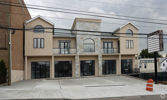
Property Record
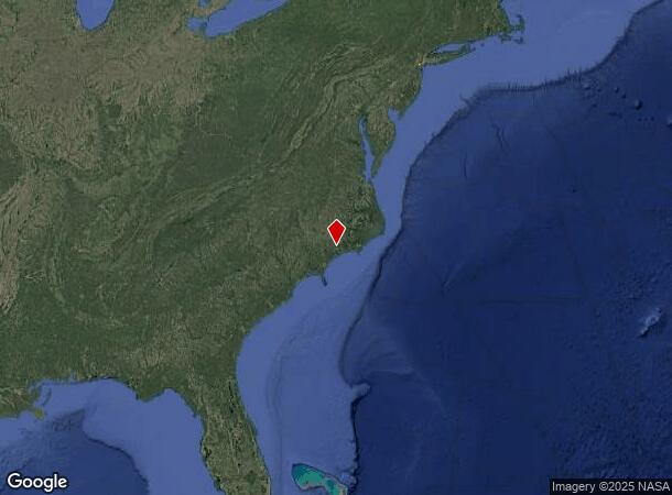
277 Merin Height Rd, Jacksonville, NC 28546
NEARBY LISTINGS FOR SALE OR LEASE
Property Detail
277 Merin Height Rd
00708-0004
Staten Island
Storebuilding
New York
X
4
3604970326F
0.17 AC
2024
Staten Island
2025
Long Island (New York)
018902
New York-Jersey City-White Plains, NY-NJ
7,500 SF
DEMOGRAPHICS near 277 Merin Height Rd
1 Mile
3 Mile
5 Mile
2024 Total Population
33,992
306,544
518,736
2029 Population
33,593
301,164
507,236
Pop Growth 2024-2029
(1.17%)
(1.76%)
(2.22%)
Average Age
42
40
41
2024 Total Households
11,818
105,241
186,141
HH Growth 2024-2029
(1.21%)
(1.80%)
(2.42%)
Median Household Inc
$100,032
$82,438
$80,497
Avg Household Size
2.80
2.80
2.70
2024 Avg HH Vehicles
2.00
1.00
1.00
Median Home Value
$689,648
$628,194
$616,672
Median Year Built
1960
1966
1965
Nearby Places
Map Layers
Map Styles
 Street
 Aerial
- Restaurants
- Banks
- Shops
- Fitness
- Groceries
PUBLIC TRANSPORTATION
AIRPORT
Albert J Ellis
DRIVE
WALK
Distance
Albert J Ellis
39 min
19.6 mi
Coastal Carolina Regional
DRIVE
WALK
Distance
Coastal Carolina Regional
60 min
42.0 mi
Freight Ports
Port of Morehead City
DRIVE
WALK
Distance
Port of Morehead City
79 min
48.0 mi
SALE & LEASE HISTORY
LISTING DATE
SALE/LEASE

Sep 25, 2016
For Lease
Nearby Properties
Address
Land Use
TOTAL SIZE
Lot Size
Zoning
Address
Land Use
TOTAL SIZE
Lot Size
Zoning
185,000 SF
57.05 AC
OI
Address
Land Use
TOTAL SIZE
Lot Size
Zoning
5,929 SF
19.45 AC
RMF-HD
Address
Land Use
TOTAL SIZE
Lot Size
Zoning
27,193 SF
20.13 AC
RMF-HD
Address
Land Use
TOTAL SIZE
Lot Size
Zoning
87,143 SF
71.12 AC
OI
Address
Land Use
TOTAL SIZE
Lot Size
Zoning
1,500 SF
16.75 AC
RMF-HD
Address
Land Use
TOTAL SIZE
Lot Size
Zoning
6,110 SF
17.20 AC
RMF-HD
Address
Land Use
TOTAL SIZE
Lot Size
Zoning
27,480 SF
16.90 AC
RMF-HD
Address
Land Use
TOTAL SIZE
Lot Size
Zoning
50,600 SF
17 AC
CC
Address
Land Use
TOTAL SIZE
Lot Size
Zoning
27,696 SF
10.15 AC
RMF-HD
Address
Land Use
TOTAL SIZE
Lot Size
Zoning
26,244 SF
13.12 AC
RMF-HD
Address
Land Use
TOTAL SIZE
Lot Size
Zoning
18,150 SF
15.65 AC
RMF-HD
Address
Land Use
TOTAL SIZE
Lot Size
Zoning
2,951 SF
16.39 AC
RMF-HD
Address
Land Use
TOTAL SIZE
Lot Size
Zoning
24,882 SF
7.30 AC
RMF-HD
Address
Land Use
TOTAL SIZE
Lot Size
Zoning
89,260 SF
30 AC
OI
Address
Land Use
TOTAL SIZE
Lot Size
Zoning
64,288 SF
35.78 AC
CC
Address
Land Use
TOTAL SIZE
Lot Size
Zoning
2,289 SF
7.22 AC
RMF-HD
Address
Land Use
TOTAL SIZE
Lot Size
Zoning
85,609 SF
11.20 AC
CC
Address
Land Use
TOTAL SIZE
Lot Size
Zoning
50,112 SF
4.07 AC
CC
Address
Land Use
TOTAL SIZE
Lot Size
Zoning
15,746 SF
27.64 AC
RSF-7
Address
Land Use
TOTAL SIZE
Lot Size
Zoning
17,568 SF
14.39 AC
CC
Address
Land Use
TOTAL SIZE
Lot Size
Zoning
65,571 SF
10 AC
CC
Address
Land Use
TOTAL SIZE
Lot Size
Zoning
2,276 SF
8.43 AC
RMF-HD
Address
Land Use
TOTAL SIZE
Lot Size
Zoning
94,764 SF
11.50 AC
CC
Address
Land Use
TOTAL SIZE
Lot Size
Zoning
103,789 SF
9.31 AC
CC
Address
Land Use
TOTAL SIZE
Lot Size
Zoning
25,625 SF
10.46 AC
CC
Address
Land Use
TOTAL SIZE
Lot Size
Zoning
57,167 SF
6.71 AC
CC
Address
Land Use
TOTAL SIZE
Lot Size
Zoning
2,226 SF
8.43 AC
RMF-HD
Address
Land Use
TOTAL SIZE
Lot Size
Zoning
50,198 SF
10.11 AC
CC
Address
Land Use
TOTAL SIZE
Lot Size
Zoning
21,420 SF
20.05 AC
CC
Address
Land Use
TOTAL SIZE
Lot Size
Zoning
7,674 SF
107.02 AC
OI
The World's #1 Commercial Real Estate Marketplace
Connect with us
© 2026 CoStar Group
The information above has been obtained from sources believed reliable. While we do not doubt its accuracy we have not verified it and make no guarantee, warranty or representation about it. It is your responsibility to independently confirm its accuracy and completeness. Any projections, opinions, assumptions, or estimates used are for example only and do not represent the current or future performance of the property. The value of this transaction to you depends on tax and other factors which should be evaluated by your tax, financial, and legal advisors. You and your advisors should conduct a careful, independent investigation of the property to determine to your satisfaction the suitability of the property for your needs.