Property Record
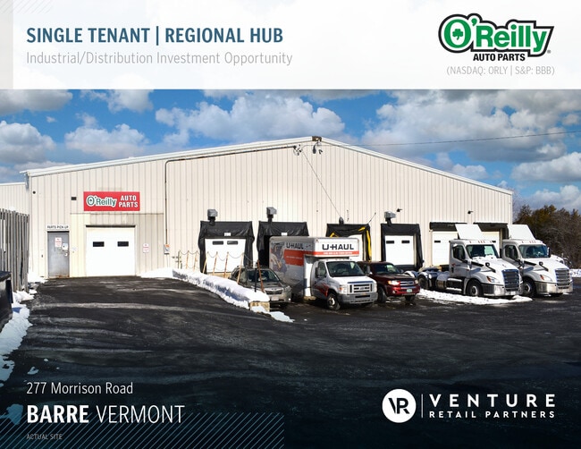
277 Morrison Rd, Barre, VT 05641
NEARBY LISTINGS FOR SALE OR LEASE
-
-
View all Barre listings for sale on LoopNet.com
Property Detail
277 Morrison Rd
039-012-10463
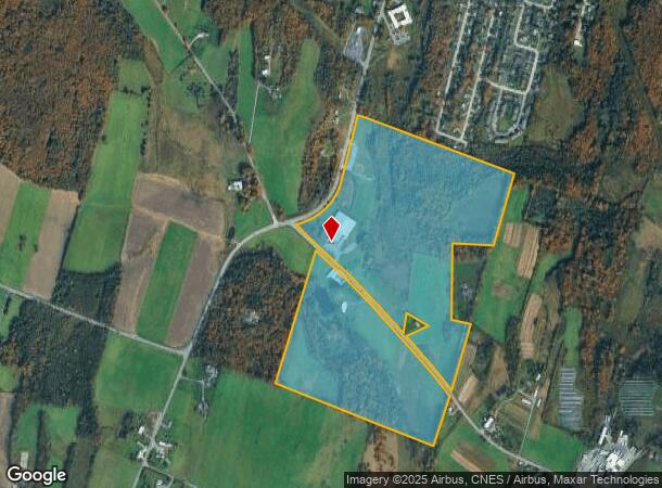
BLDG & 6.1 ACRES
Warehouse
Washington
X
Vermont
50023C0434E
6.10 AC
2024
Vermont North Area
2024
Other Market Areas
955400
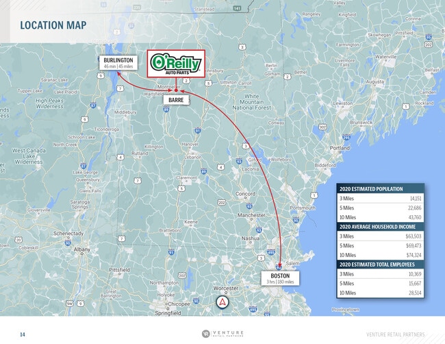
Barre, VT
55,233 SF
DEMOGRAPHICS near 277 Morrison Rd
1 Mile
3 Mile
5 Mile
2024 Total Population
1,818
14,805
22,289
2029 Population
1,836
14,868
22,410
Pop Growth 2024-2029
+ 0.99%
+ 0.43%
+ 0.54%
Average Age
43
43
43
2024 Total Households
787
6,561
9,749
HH Growth 2024-2029
+ 1.02%
+ 0.41%
+ 0.53%
Median Household Inc
$58,199
$63,306
$68,800
Avg Household Size
2.20
2.10
2.20
2024 Avg HH Vehicles
1.00
2.00
2.00
Median Home Value
$142,274
$192,170
$209,463
Median Year Built
1969
1964
1969
Nearby Places
Map Layers
Map Styles
 Street
 Aerial
- Restaurants
- Banks
- Shops
- Fitness
- Groceries
PUBLIC TRANSPORTATION
COMMUTER RAIL
Montpelier-Berlin Amtrak Station (Vermonter - Amtrak)
DRIVE
WALK
Distance
Montpelier-Berlin Amtrak Station (Vermonter - Amtrak)
18 min
8.9 mi
Freight Ports
Montreal
DRIVE
WALK
Distance
Montreal
180 min
140.5 mi
SALE & LEASE HISTORY
LISTING DATE
SALE/LEASE

Jul 22, 2021
For Sale
Feb 16, 2021
For Sale
Nearby Properties
Address
Land Use
TOTAL SIZE
Lot Size
Zoning
Address
Land Use
TOTAL SIZE
Lot Size
Zoning
7,500 SF
21.47 AC
A
Address
Land Use
TOTAL SIZE
Lot Size
Zoning
0.58 AC
AE
Address
Land Use
TOTAL SIZE
Lot Size
Zoning
3,084 SF
20 AC
HDR
Address
Land Use
TOTAL SIZE
Lot Size
Zoning
Address
Land Use
TOTAL SIZE
Lot Size
Zoning
Address
Land Use
TOTAL SIZE
Lot Size
Zoning
55.21 AC
Address
Land Use
TOTAL SIZE
Lot Size
Zoning
242.35 AC
Address
Land Use
TOTAL SIZE
Lot Size
Zoning
11.40 AC
CIV
Address
Land Use
TOTAL SIZE
Lot Size
Zoning
Address
Land Use
TOTAL SIZE
Lot Size
Zoning
1.94 AC
Address
Land Use
TOTAL SIZE
Lot Size
Zoning
36.11 AC
Address
Land Use
TOTAL SIZE
Lot Size
Zoning
17.40 AC
Address
Land Use
TOTAL SIZE
Lot Size
Zoning
54,324 SF
2.76 AC
MU-1
Address
Land Use
TOTAL SIZE
Lot Size
Zoning
27,913 SF
10.45 AC
CIV
Address
Land Use
TOTAL SIZE
Lot Size
Zoning
43,014 SF
1.01 AC
UC-1
Address
Land Use
TOTAL SIZE
Lot Size
Zoning
3.40 AC
UC-2
Address
Land Use
TOTAL SIZE
Lot Size
Zoning
130,680 SF
0.76 AC
UC-1
Address
Land Use
TOTAL SIZE
Lot Size
Zoning
21,600 SF
7.70 AC
I
Address
Land Use
TOTAL SIZE
Lot Size
Zoning
103,980 SF
0.95 AC
AE
Address
Land Use
TOTAL SIZE
Lot Size
Zoning
38,091 SF
4.57 AC
Address
Land Use
TOTAL SIZE
Lot Size
Zoning
62,930 SF
0.62 AC
UC-2
Address
Land Use
TOTAL SIZE
Lot Size
Zoning
20.30 AC
Address
Land Use
TOTAL SIZE
Lot Size
Zoning
30,338 SF
6.10 AC
HC
Address
Land Use
TOTAL SIZE
Lot Size
Zoning
28,780 SF
4.08 AC
AE
Address
Land Use
TOTAL SIZE
Lot Size
Zoning
6.72 AC
Address
Land Use
TOTAL SIZE
Lot Size
Zoning
39,183 SF
1.50 AC
UC-2
Address
Land Use
TOTAL SIZE
Lot Size
Zoning
26,093 SF
6.90 AC
R-4
Address
Land Use
TOTAL SIZE
Lot Size
Zoning
10.85 AC
Address
Land Use
TOTAL SIZE
Lot Size
Zoning
126,256 SF
31.48 AC
Address
Land Use
TOTAL SIZE
Lot Size
Zoning
11.55 AC
AE
The World's #1 Commercial Real Estate Marketplace
Connect with us
© 2026 CoStar Group
The information above has been obtained from sources believed reliable. While we do not doubt its accuracy we have not verified it and make no guarantee, warranty or representation about it. It is your responsibility to independently confirm its accuracy and completeness. Any projections, opinions, assumptions, or estimates used are for example only and do not represent the current or future performance of the property. The value of this transaction to you depends on tax and other factors which should be evaluated by your tax, financial, and legal advisors. You and your advisors should conduct a careful, independent investigation of the property to determine to your satisfaction the suitability of the property for your needs.