Property Record
2770 Glebe Rd, Lemon Grove, CA 91945


NEARBY LISTINGS FOR SALE OR LEASE
Property Detail
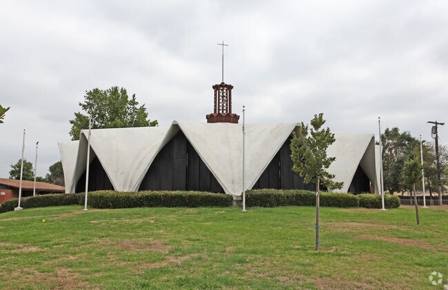
2770 Glebe Rd
San Diego-Carlsbad, CA
Glebe Sub
479-291-11
LOT 1 (EX ST&SLY 7 FT) TR 004142
Religious
San Diego
X
California
06073C1910G
1
2024
3.46 AC
2025
East County
014300
San Diego
15,975 SF
DEMOGRAPHICS near 2770 Glebe Rd
1 Mile
3 Mile
5 Mile
2024 Total Population
22,460
214,165
529,005
2029 Population
22,185
211,877
523,855
Pop Growth 2024-2029
(1.22%)
(1.07%)
(0.97%)
Average Age
39
38
38
2024 Total Households
7,387
70,060
175,962
HH Growth 2024-2029
(1.41%)
(1.20%)
(1.11%)
Median Household Inc
$74,376
$71,733
$74,715
Avg Household Size
2.90
2.90
2.90
2024 Avg HH Vehicles
2.00
2.00
2.00
Median Home Value
$617,299
$631,013
$670,340
Median Year Built
1964
1968
1969
Nearby Places
Map Layers
Map Styles
 Street
 Aerial
- Restaurants
- Banks
- Shops
- Fitness
- Groceries
PUBLIC TRANSPORTATION
TRANSIT/SUBWAY
Lemon Grove Depot (Orange Line - San Diego Metropolitan Transit System Trolley (San Diego Trolley))
DRIVE
WALK
Distance
Lemon Grove Depot (Orange Line - San Diego Metropolitan Transit System Trolley (San Diego Trolley))
3 min
18 min
1.0 mi
COMMUTER RAIL
San Diego (Santa Fe Depot) (Coaster - San Diego North County Transit District (Coaster/Sprinter/Breeze))
DRIVE
WALK
Distance
San Diego (Santa Fe Depot) (Coaster - San Diego North County Transit District (Coaster/Sprinter/Breeze))
14 min
9.4 mi
AIRPORT
San Diego International
DRIVE
WALK
Distance
San Diego International
17 min
11.8 mi
Freight Ports
Port of San Diego
DRIVE
WALK
Distance
Port of San Diego
15 min
9.2 mi
Nearby Properties
Address
Land Use
TOTAL SIZE
Lot Size
Zoning
Address
Land Use
TOTAL SIZE
Lot Size
Zoning
8.23 AC
CUPD-CU-2-
Address
Land Use
TOTAL SIZE
Lot Size
Zoning
4.77 AC
C
Address
Land Use
TOTAL SIZE
Lot Size
Zoning
5.02 AC
RM-4-10
Address
Land Use
TOTAL SIZE
Lot Size
Zoning
8.65 AC
R3
Address
Land Use
TOTAL SIZE
Lot Size
Zoning
135,165 SF
12.24 AC
CC-5-3
Address
Land Use
TOTAL SIZE
Lot Size
Zoning
92,500 SF
7.05 AC
R3
Address
Land Use
TOTAL SIZE
Lot Size
Zoning
1.54 AC
RM-3-9
Address
Land Use
TOTAL SIZE
Lot Size
Zoning
4.10 AC
RB
Address
Land Use
TOTAL SIZE
Lot Size
Zoning
11.28 AC
C
Address
Land Use
TOTAL SIZE
Lot Size
Zoning
5.47 AC
R3
Address
Land Use
TOTAL SIZE
Lot Size
Zoning
6.14 AC
R3
Address
Land Use
TOTAL SIZE
Lot Size
Zoning
84,900 SF
3.54 AC
R3
Address
Land Use
TOTAL SIZE
Lot Size
Zoning
89,332 SF
1.14 AC
C
Address
Land Use
TOTAL SIZE
Lot Size
Zoning
4.73 AC
RM-4-10
Address
Land Use
TOTAL SIZE
Lot Size
Zoning
17.63 AC
RM-1-3
Address
Land Use
TOTAL SIZE
Lot Size
Zoning
63,964 SF
5.25 AC
R3
Address
Land Use
TOTAL SIZE
Lot Size
Zoning
83,324 SF
5.17 AC
RU
Address
Land Use
TOTAL SIZE
Lot Size
Zoning
11.28 AC
RM-2-5
Address
Land Use
TOTAL SIZE
Lot Size
Zoning
97,270 SF
3.40 AC
RM-3-7
Address
Land Use
TOTAL SIZE
Lot Size
Zoning
96,664 SF
1.63 AC
CIVIC CENT
Address
Land Use
TOTAL SIZE
Lot Size
Zoning
88,902 SF
3.86 AC
RM-3-9
Address
Land Use
TOTAL SIZE
Lot Size
Zoning
7.09 AC
RV
Address
Land Use
TOTAL SIZE
Lot Size
Zoning
10.45 AC
RM-2-5
Address
Land Use
TOTAL SIZE
Lot Size
Zoning
95,506 SF
4.65 AC
RU
Address
Land Use
TOTAL SIZE
Lot Size
Zoning
1.25 AC
C
Address
Land Use
TOTAL SIZE
Lot Size
Zoning
94,486 SF
0.17 AC
CN-1-2
Address
Land Use
TOTAL SIZE
Lot Size
Zoning
89,600 SF
1.52 AC
CUPD-CT-2-
Address
Land Use
TOTAL SIZE
Lot Size
Zoning
10.89 AC
CM
Address
Land Use
TOTAL SIZE
Lot Size
Zoning
68,164 SF
3.59 AC
R3
Address
Land Use
TOTAL SIZE
Lot Size
Zoning
0.32 AC
CUPD-CU-2-
The World's #1 Commercial Real Estate Marketplace
Connect with us
© 2025 CoStar Group
The information above has been obtained from sources believed reliable. While we do not doubt its accuracy we have not verified it and make no guarantee, warranty or representation about it. It is your responsibility to independently confirm its accuracy and completeness. Any projections, opinions, assumptions, or estimates used are for example only and do not represent the current or future performance of the property. The value of this transaction to you depends on tax and other factors which should be evaluated by your tax, financial, and legal advisors. You and your advisors should conduct a careful, independent investigation of the property to determine to your satisfaction the suitability of the property for your needs.