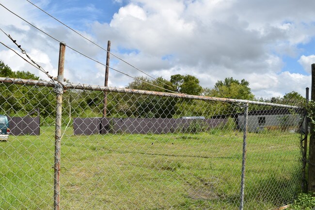
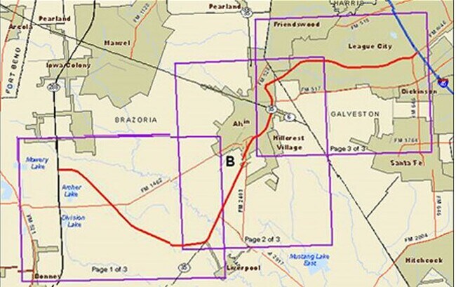
Property Record
2770 N Gordon St, Alvin, TX 77511
NEARBY LISTINGS FOR SALE OR LEASE
Property Detail
2770 N Gordon St
0491-0042-000
Hooper & Wade
Commercialnec
A0491 HOOPER & WADE BLOCK 1 TRACT 2B1 ACRES .7601 (ALVIN)
X
Brazoria
48039C0155K
Texas
2024
0.76 AC
2025
NASA/Clear Lake
661100
Houston
2,400 SF
Houston-The Woodlands-Sugar Land, TX
DEMOGRAPHICS near 2770 N Gordon St
1 Mile
3 Mile
5 Mile
2024 Total Population
3,121
27,528
62,249
2029 Population
3,494
30,559
68,201
Pop Growth 2024-2029
+ 11.95%
+ 11.01%
+ 9.56%
Average Age
35
37
38
2024 Total Households
1,044
9,795
21,462
HH Growth 2024-2029
+ 12.07%
+ 11.17%
+ 9.85%
Median Household Inc
$75,092
$70,070
$76,318
Avg Household Size
3.00
2.70
2.80
2024 Avg HH Vehicles
2.00
2.00
2.00
Median Home Value
$221,227
$212,771
$247,925
Median Year Built
2002
1986
1990
Nearby Places
Map Layers
Map Styles
 Street
 Aerial
- Restaurants
- Banks
- Shops
- Fitness
- Groceries
PUBLIC TRANSPORTATION
AIRPORT
William P Hobby
DRIVE
WALK
Distance
William P Hobby
28 min
14.9 mi
Freight Ports
Port of Houston
DRIVE
WALK
Distance
Port of Houston
39 min
23.1 mi
SALE & LEASE HISTORY
LISTING DATE
SALE/LEASE

Nov 12, 2019
For Sale
Nearby Properties
Address
Land Use
TOTAL SIZE
Lot Size
Zoning
Address
Land Use
TOTAL SIZE
Lot Size
Zoning
65,935 SF
81.27 AC
Address
Land Use
TOTAL SIZE
Lot Size
Zoning
39.21 AC
0113
Address
Land Use
TOTAL SIZE
Lot Size
Zoning
13.56 AC
Address
Land Use
TOTAL SIZE
Lot Size
Zoning
197,506 SF
20.52 AC
Address
Land Use
TOTAL SIZE
Lot Size
Zoning
209,431 SF
17.44 AC
Address
Land Use
TOTAL SIZE
Lot Size
Zoning
116,628 SF
5.90 AC
0011
Address
Land Use
TOTAL SIZE
Lot Size
Zoning
74,780 SF
5.51 AC
0034
Address
Land Use
TOTAL SIZE
Lot Size
Zoning
68,435 SF
5.62 AC
0041
Address
Land Use
TOTAL SIZE
Lot Size
Zoning
110,165 SF
12.32 AC
Address
Land Use
TOTAL SIZE
Lot Size
Zoning
83,344 SF
4.40 AC
0002
Address
Land Use
TOTAL SIZE
Lot Size
Zoning
111,370 SF
11.10 AC
Address
Land Use
TOTAL SIZE
Lot Size
Zoning
84,423 SF
7.87 AC
Address
Land Use
TOTAL SIZE
Lot Size
Zoning
90,044 SF
9.62 AC
Address
Land Use
TOTAL SIZE
Lot Size
Zoning
80,672 SF
4.58 AC
Address
Land Use
TOTAL SIZE
Lot Size
Zoning
276,750 SF
35.24 AC
Address
Land Use
TOTAL SIZE
Lot Size
Zoning
136,700 SF
9.91 AC
0095
Address
Land Use
TOTAL SIZE
Lot Size
Zoning
147,939 SF
38.36 AC
0026
Address
Land Use
TOTAL SIZE
Lot Size
Zoning
89,466 SF
8.61 AC
0109
Address
Land Use
TOTAL SIZE
Lot Size
Zoning
36,596 SF
14.75 AC
Address
Land Use
TOTAL SIZE
Lot Size
Zoning
77,933 SF
3.67 AC
0113
Address
Land Use
TOTAL SIZE
Lot Size
Zoning
109,608 SF
5.58 AC
0071
Address
Land Use
TOTAL SIZE
Lot Size
Zoning
32,340 SF
4.38 AC
0001
Address
Land Use
TOTAL SIZE
Lot Size
Zoning
74,406 SF
11.99 AC
Address
Land Use
TOTAL SIZE
Lot Size
Zoning
70,086 SF
3.16 AC
0115
Address
Land Use
TOTAL SIZE
Lot Size
Zoning
10,160 SF
1.57 AC
Address
Land Use
TOTAL SIZE
Lot Size
Zoning
108,807 SF
10.01 AC
0001
Address
Land Use
TOTAL SIZE
Lot Size
Zoning
44,501 SF
4.15 AC
Address
Land Use
TOTAL SIZE
Lot Size
Zoning
22,400 SF
2.25 AC
0067
Address
Land Use
TOTAL SIZE
Lot Size
Zoning
57.64 AC
0184
Address
Land Use
TOTAL SIZE
Lot Size
Zoning
74,002 SF
9.58 AC
The World's #1 Commercial Real Estate Marketplace
Connect with us
© 2025 CoStar Group
The information above has been obtained from sources believed reliable. While we do not doubt its accuracy we have not verified it and make no guarantee, warranty or representation about it. It is your responsibility to independently confirm its accuracy and completeness. Any projections, opinions, assumptions, or estimates used are for example only and do not represent the current or future performance of the property. The value of this transaction to you depends on tax and other factors which should be evaluated by your tax, financial, and legal advisors. You and your advisors should conduct a careful, independent investigation of the property to determine to your satisfaction the suitability of the property for your needs.