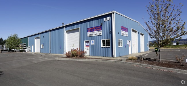
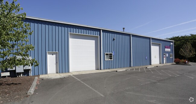
Property Record
2771 E 9Th St, Newberg, OR 97132


Property Detail
2771 E 9Th St
Portland-Vancouver-Hillsboro, OR-WA
PARCEL 3 PARTITION P2006-45
535288
YAMHILL
Industrialgeneral
Oregon
AI
3
B and X Area of moderate flood hazard, usually the area between the limits of the 100-year and 500-year floods.
0.68 AC
2025
Yamhill County
2025
Portland
030202
NEARBY LISTINGS FOR SALE OR LEASE
DEMOGRAPHICS near 2771 E 9Th St
1 mile
3 mile
5 mile
2025 Total Population
9,653
33,592
40,106
2030 Population
9,985
34,689
41,209
Pop Growth 2025-2030
+ 3.44%
+ 3.27%
+ 2.75%
Average Age
39
39
40
2025 Total Households
3,662
12,058
14,404
HH Growth 2025-2030
+ 3.69%
+ 3.56%
+ 3.03%
Median Household Inc
$93,884
$98,189
$102,156
Avg Household Size
2.60
2.60
2.60
2025 Avg HH Vehicles
2.00
2.00
2.00
Median Home Value
$516,411
$513,342
$566,821
Median Year Built
1997
1993
1991
Nearby Places
Map Layers
Map Styles
 Street
 Aerial
Layers
 Traffic
 Biking
Places
Listings with unknown addresses are not visible on the map
- Restaurants
- Banks
- Shops
- Fitness
- Groceries
PUBLIC TRANSPORTATION
AIRPORT
Portland International
Drive
Walk
Distance
Portland International
58 min
34.8 mi
Freight Ports
Port of Portland
Drive
Walk
Distance
Port of Portland
44 min
26.0 mi
SALE & LEASE HISTORY
LISTING DATE
SALE/LEASE

Jan 27, 2025
For Lease
Nearby Properties
Address
Land Use
TOTAL SIZE
Lot Size
Zoning
Address
Land Use
TOTAL SIZE
Lot Size
Zoning
Address
Land Use
TOTAL SIZE
Lot Size
Zoning
30.70 AC
SD/H
Address
Land Use
TOTAL SIZE
Lot Size
Zoning
4,630 SF
4.72 AC
R-2
Address
Land Use
TOTAL SIZE
Lot Size
Zoning
72 AC
R-1
Address
Land Use
TOTAL SIZE
Lot Size
Zoning
16.49 AC
I
Address
Land Use
TOTAL SIZE
Lot Size
Zoning
17.18 AC
C-2
Address
Land Use
TOTAL SIZE
Lot Size
Zoning
Address
Land Use
TOTAL SIZE
Lot Size
Zoning
3,020 SF
6.66 AC
I
Address
Land Use
TOTAL SIZE
Lot Size
Zoning
936 SF
7.67 AC
VLDR-1
Address
Land Use
TOTAL SIZE
Lot Size
Zoning
1,728 SF
6.39 AC
R-1
Address
Land Use
TOTAL SIZE
Lot Size
Zoning
16.84 AC
R-1
Address
Land Use
TOTAL SIZE
Lot Size
Zoning
4.96 AC
R-P/SP
Address
Land Use
TOTAL SIZE
Lot Size
Zoning
17.90 AC
M-1
Address
Land Use
TOTAL SIZE
Lot Size
Zoning
4.97 AC
R-P/SP
Address
Land Use
TOTAL SIZE
Lot Size
Zoning
3.65 AC
R-P/SP
Address
Land Use
TOTAL SIZE
Lot Size
Zoning
18.91 AC
M-1
Address
Land Use
TOTAL SIZE
Lot Size
Zoning
2,049 SF
3.21 AC
R-1
Address
Land Use
TOTAL SIZE
Lot Size
Zoning
9.96 AC
C-2
Address
Land Use
TOTAL SIZE
Lot Size
Zoning
14.21 AC
R-P/SP
Address
Land Use
TOTAL SIZE
Lot Size
Zoning
1.53 AC
R-P/SP
Address
Land Use
TOTAL SIZE
Lot Size
Zoning
2.99 AC
R-P/SP
Address
Land Use
TOTAL SIZE
Lot Size
Zoning
6.50 AC
M-1
Address
Land Use
TOTAL SIZE
Lot Size
Zoning
4.19 AC
C2
Address
Land Use
TOTAL SIZE
Lot Size
Zoning
Address
Land Use
TOTAL SIZE
Lot Size
Zoning
6.70 AC
I
Address
Land Use
TOTAL SIZE
Lot Size
Zoning
14.28 AC
R-2
Address
Land Use
TOTAL SIZE
Lot Size
Zoning
5.67 AC
M-2
Address
Land Use
TOTAL SIZE
Lot Size
Zoning
0.47 AC
I
Address
Land Use
TOTAL SIZE
Lot Size
Zoning
4,578 SF
38.05 AC
I
Address
Land Use
TOTAL SIZE
Lot Size
Zoning
12 AC
M-1
The World's #1 Commercial Real Estate Marketplace
Connect with us
© 2026 CoStar Group
The information above has been obtained from sources believed reliable. While we do not doubt its accuracy we have not verified it and make no guarantee, warranty or representation about it. It is your responsibility to independently confirm its accuracy and completeness. Any projections, opinions, assumptions, or estimates used are for example only and do not represent the current or future performance of the property. The value of this transaction to you depends on tax and other factors which should be evaluated by your tax, financial, and legal advisors. You and your advisors should conduct a careful, independent investigation of the property to determine to your satisfaction the suitability of the property for your needs.