Property Record
2772 W Us Highway 27, Clewiston, FL 33440

NEARBY LISTINGS FOR SALE OR LEASE
Property Detail
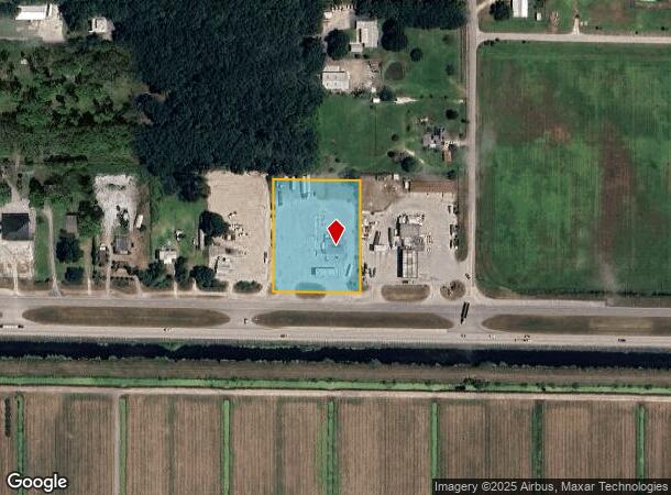
2772 W Us Highway 27
Clewiston, FL
Lankford S/D
1-34-43-07-020-0000-0110
LANKFORD S/D LOTS 12 TO 14 EXC RD RWY
Servicestation
Hendry
X
Florida
12051C0140E
11
2025
2.23 AC
2025
Florida Central South Area
000200
Other Market Areas
2,578 SF
DEMOGRAPHICS near 2772 W Us Highway 27
1 Mile
3 Mile
5 Mile
2024 Total Population
220
7,416
13,621
2029 Population
242
8,099
14,864
Pop Growth 2024-2029
+ 10.00%
+ 9.21%
+ 9.13%
Average Age
39
38
37
2024 Total Households
65
2,516
4,522
HH Growth 2024-2029
+ 9.23%
+ 9.82%
+ 9.75%
Median Household Inc
$28,571
$31,639
$40,841
Avg Household Size
2.90
2.80
2.90
2024 Avg HH Vehicles
2.00
2.00
2.00
Median Home Value
$155,555
$120,522
$122,640
Median Year Built
1969
1982
1985
Nearby Places
Map Layers
Map Styles
 Street
 Aerial
- Restaurants
- Banks
- Shops
- Fitness
- Groceries
SALE & LEASE HISTORY
LISTING DATE
SALE/LEASE

Jul 20, 2020
For Sale
Nearby Properties
Address
Land Use
TOTAL SIZE
Lot Size
Zoning
Address
Land Use
TOTAL SIZE
Lot Size
Zoning
105,692 SF
9.13 AC
CL-P
Address
Land Use
TOTAL SIZE
Lot Size
Zoning
823,813 SF
109.02 AC
A-2
Address
Land Use
TOTAL SIZE
Lot Size
Zoning
159,172 SF
2.58 AC
CL-P
Address
Land Use
TOTAL SIZE
Lot Size
Zoning
132,618 SF
3.92 AC
A-2
Address
Land Use
TOTAL SIZE
Lot Size
Zoning
40,010 SF
19.71 AC
CL-P
Address
Land Use
TOTAL SIZE
Lot Size
Zoning
116,156 SF
18.12 AC
RG4
Address
Land Use
TOTAL SIZE
Lot Size
Zoning
12,954 SF
163.12 AC
CL-P
Address
Land Use
TOTAL SIZE
Lot Size
Zoning
151,014 SF
23.02 AC
CL-C
Address
Land Use
TOTAL SIZE
Lot Size
Zoning
36,761 SF
19.62 AC
CL-C
Address
Land Use
TOTAL SIZE
Lot Size
Zoning
52,935 SF
1.31 AC
CL-C
Address
Land Use
TOTAL SIZE
Lot Size
Zoning
3,756 SF
28.49 AC
CL-P
Address
Land Use
TOTAL SIZE
Lot Size
Zoning
70,800 SF
3.33 AC
CL-R3
Address
Land Use
TOTAL SIZE
Lot Size
Zoning
23,486 SF
21.23 AC
CL-P
Address
Land Use
TOTAL SIZE
Lot Size
Zoning
144,708 SF
11.42 AC
CL-C
Address
Land Use
TOTAL SIZE
Lot Size
Zoning
32,356 SF
7.58 AC
CL-R3
Address
Land Use
TOTAL SIZE
Lot Size
Zoning
33,176 SF
1.19 AC
CL-C
Address
Land Use
TOTAL SIZE
Lot Size
Zoning
43,875 SF
1.17 AC
A-2
Address
Land Use
TOTAL SIZE
Lot Size
Zoning
18,093 SF
0.51 AC
CL-C
Address
Land Use
TOTAL SIZE
Lot Size
Zoning
137,500 SF
20.17 AC
A-2
Address
Land Use
TOTAL SIZE
Lot Size
Zoning
89,194 SF
9.32 AC
CL-C
Address
Land Use
TOTAL SIZE
Lot Size
Zoning
17,884 SF
8.92 AC
CL-I
Address
Land Use
TOTAL SIZE
Lot Size
Zoning
Address
Land Use
TOTAL SIZE
Lot Size
Zoning
14,803 SF
3 AC
CL-R1C
Address
Land Use
TOTAL SIZE
Lot Size
Zoning
30,626 SF
1.61 AC
CL-R2
Address
Land Use
TOTAL SIZE
Lot Size
Zoning
47,292 SF
Address
Land Use
TOTAL SIZE
Lot Size
Zoning
23,855 SF
1.28 AC
CL-P
Address
Land Use
TOTAL SIZE
Lot Size
Zoning
14,608 SF
4.13 AC
CL-P
Address
Land Use
TOTAL SIZE
Lot Size
Zoning
32,760 SF
1.50 AC
CL-I
Address
Land Use
TOTAL SIZE
Lot Size
Zoning
13,895 SF
4.21 AC
CL-C
Address
Land Use
TOTAL SIZE
Lot Size
Zoning
23,128 SF
1.40 AC
CL-C
The World's #1 Commercial Real Estate Marketplace
Connect with us
© 2026 CoStar Group
The information above has been obtained from sources believed reliable. While we do not doubt its accuracy we have not verified it and make no guarantee, warranty or representation about it. It is your responsibility to independently confirm its accuracy and completeness. Any projections, opinions, assumptions, or estimates used are for example only and do not represent the current or future performance of the property. The value of this transaction to you depends on tax and other factors which should be evaluated by your tax, financial, and legal advisors. You and your advisors should conduct a careful, independent investigation of the property to determine to your satisfaction the suitability of the property for your needs.