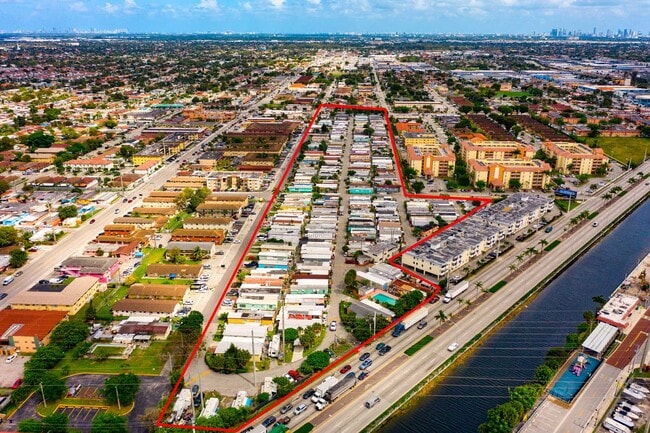
Property Record
2775 W Okeechobee Rd, Hialeah, FL 33010


Property Detail
2775 W Okeechobee Rd
04-3011-002-0890
11 53 40 13.518 AC M/L FLA FRUIT LAND CO SUB PB 2-17 TR 50 LESS N64.5FT OF W176FT OF E540FT & LESS N25FT OF E 364FT & E35FT FOR ST & LESS N30FT OF W 660FT & PORTS TRS 62 & 63 DESC BEG 30FT S & W OF NE COR OF TR 63 TH S519.47FT NWLY 476.13FT SWLY 125F
Parkinglot
Miami-Dade
4400
Florida
AH Areas with a 1% annual chance of shallow flooding, usually in the form of a pond, withan average depth ranging from 1 to 3 feet. These areas have a 26% chance of flooding over the life of a 30-year mortgage.
13.52 AC
2024
Hialeah
2025
South Florida
000710
Miami-Miami Beach-Kendall, FL
3,559 SF
NEARBY LISTINGS FOR SALE OR LEASE
DEMOGRAPHICS near 2775 W Okeechobee Rd
1 mile
3 mile
5 mile
2025 Total Population
22,788
197,088
426,120
2030 Population
24,207
209,687
454,974
Pop Growth 2025-2030
+ 6.23%
+ 6.39%
+ 6.77%
Average Age
45
44
42
2025 Total Households
7,718
67,508
142,672
HH Growth 2025-2030
+ 6.12%
+ 6.34%
+ 6.74%
Median Household Inc
$48,034
$54,644
$64,413
Avg Household Size
2.70
2.80
2.90
2025 Avg HH Vehicles
2.00
2.00
2.00
Median Home Value
$364,795
$421,362
$443,765
Median Year Built
1974
1973
1980
Nearby Places
Map Layers
Map Styles
 Street
 Aerial
Layers
 Traffic
 Biking
Places
Listings with unknown addresses are not visible on the map
- Restaurants
- Banks
- Shops
- Fitness
- Groceries
PUBLIC TRANSPORTATION
COMMUTER RAIL
Okeechobee (Metrorail Green Line - Miami-Dade Transit (Metrorail/Metromover))
Drive
Walk
Distance
Okeechobee (Metrorail Green Line - Miami-Dade Transit (Metrorail/Metromover))
4 min
20 min
1.1 mi
Palmetto (Metrorail Green Line - Miami-Dade Transit (Metrorail/Metromover))
Drive
Walk
Distance
Palmetto (Metrorail Green Line - Miami-Dade Transit (Metrorail/Metromover))
6 min
2.3 mi
AIRPORT
Miami International
Drive
Walk
Distance
Miami International
15 min
5.8 mi
Fort Lauderdale/Hollywood International
Drive
Walk
Distance
Fort Lauderdale/Hollywood International
38 min
25.5 mi
Freight Ports
Port of Miami
Drive
Walk
Distance
Port of Miami
25 min
12.2 mi
Nearby Properties
Address
Land Use
TOTAL SIZE
Lot Size
Zoning
Address
Land Use
TOTAL SIZE
Lot Size
Zoning
312,996 SF
157.16 AC
8900
Address
Land Use
TOTAL SIZE
Lot Size
Zoning
7.62 AC
7200
Address
Land Use
TOTAL SIZE
Lot Size
Zoning
666,015 SF
4 AC
6119
Address
Land Use
TOTAL SIZE
Lot Size
Zoning
582,921 SF
4.51 AC
6119
Address
Land Use
TOTAL SIZE
Lot Size
Zoning
929,765 SF
453.69 AC
6119
Address
Land Use
TOTAL SIZE
Lot Size
Zoning
418,532 SF
17.95 AC
7300
Address
Land Use
TOTAL SIZE
Lot Size
Zoning
1,700 SF
7.24 AC
7100
Address
Land Use
TOTAL SIZE
Lot Size
Zoning
301,593 SF
16 AC
7100
Address
Land Use
TOTAL SIZE
Lot Size
Zoning
538,715 SF
24.72 AC
7100
Address
Land Use
TOTAL SIZE
Lot Size
Zoning
352,663 SF
0.65 AC
6119
Address
Land Use
TOTAL SIZE
Lot Size
Zoning
451,817 SF
6400
Address
Land Use
TOTAL SIZE
Lot Size
Zoning
322,084 SF
6.60 AC
7100
Address
Land Use
TOTAL SIZE
Lot Size
Zoning
344,465 SF
5.03 AC
6400
Address
Land Use
TOTAL SIZE
Lot Size
Zoning
344,101 SF
0.74 AC
6119
Address
Land Use
TOTAL SIZE
Lot Size
Zoning
687,304 SF
3.03 AC
6119
Address
Land Use
TOTAL SIZE
Lot Size
Zoning
648,867 SF
33.08 AC
7100
Address
Land Use
TOTAL SIZE
Lot Size
Zoning
527,157 SF
4.15 AC
6119
Address
Land Use
TOTAL SIZE
Lot Size
Zoning
538,739 SF
5.05 AC
7100
Address
Land Use
TOTAL SIZE
Lot Size
Zoning
387,903 SF
4.49 AC
6119
Address
Land Use
TOTAL SIZE
Lot Size
Zoning
330,528 SF
4.46 AC
6119
Address
Land Use
TOTAL SIZE
Lot Size
Zoning
355,631 SF
2.02 AC
6119
Address
Land Use
TOTAL SIZE
Lot Size
Zoning
388,143 SF
1.60 AC
6119
Address
Land Use
TOTAL SIZE
Lot Size
Zoning
347,380 SF
18.37 AC
7600
Address
Land Use
TOTAL SIZE
Lot Size
Zoning
211,349 SF
6119
Address
Land Use
TOTAL SIZE
Lot Size
Zoning
233,552 SF
0.13 AC
6119
Address
Land Use
TOTAL SIZE
Lot Size
Zoning
328,942 SF
16.15 AC
7600
Address
Land Use
TOTAL SIZE
Lot Size
Zoning
225,137 SF
80.89 AC
7600
Address
Land Use
TOTAL SIZE
Lot Size
Zoning
419,656 SF
8.61 AC
6400
Address
Land Use
TOTAL SIZE
Lot Size
Zoning
530,479 SF
10.13 AC
6400
Address
Land Use
TOTAL SIZE
Lot Size
Zoning
296,660 SF
3.86 AC
7100
The World's #1 Commercial Real Estate Marketplace
Connect with us
© 2026 CoStar Group
The information above has been obtained from sources believed reliable. While we do not doubt its accuracy we have not verified it and make no guarantee, warranty or representation about it. It is your responsibility to independently confirm its accuracy and completeness. Any projections, opinions, assumptions, or estimates used are for example only and do not represent the current or future performance of the property. The value of this transaction to you depends on tax and other factors which should be evaluated by your tax, financial, and legal advisors. You and your advisors should conduct a careful, independent investigation of the property to determine to your satisfaction the suitability of the property for your needs.