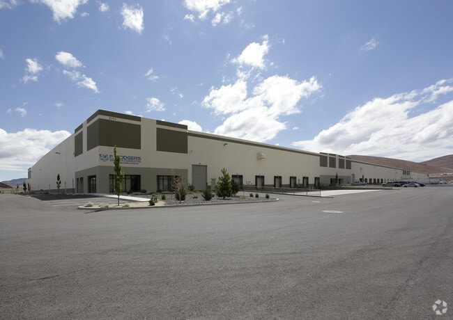
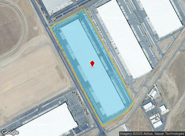
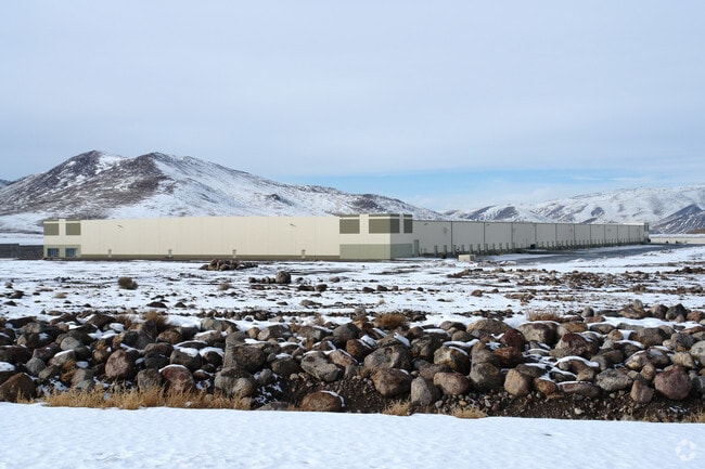
Property Record
2777 Usa Pkwy, Sparks, NV 89437
Current Lease Availabilities
NEARBY LISTINGS FOR SALE OR LEASE
Property Detail
2777 Usa Pkwy
Reno, NV
Survey Map 104986
005-071-39
PARCEL MAP ID : 2011-31 LOT : BLOCK : PTN S11,T19N R22E TOWN : INDUSTRIAL GID
Lightindustrial
Storey
X
Nevada
32031C3125G
2011
2024
39.65 AC
2025
Storey County
970200
Reno/Sparks
800,984 SF
DEMOGRAPHICS near 2777 Usa Pkwy
1 Mile
3 Mile
5 Mile
2024 Total Population
0
2
5
2029 Population
0
2
5
Pop Growth 2024-2029
0.00%
0.00%
0.00%
Average Age
0
0
0
2024 Total Households
0
1
2
HH Growth 2024-2029
0.00%
0.00%
0.00%
Median Household Inc
$0
$0
$0
Avg Household Size
.00
.00
1.50
2024 Avg HH Vehicles
.00
1.00
2.00
Median Home Value
$0
$250,000
$250,000
Median Year Built
0
0
1989
Nearby Places
- Restaurants
- Banks
- Shops
- Fitness
- Groceries
PUBLIC TRANSPORTATION
AIRPORT
Reno/Tahoe International
DRIVE
WALK
Distance
Reno/Tahoe International
50 min
27.0 mi
Freight Ports
Port of Stockton
DRIVE
WALK
Distance
Port of Stockton
234 min
201.3 mi
Nearby Properties
Address
Land Use
TOTAL SIZE
Lot Size
Zoning
Address
Land Use
TOTAL SIZE
Lot Size
Zoning
3,416,309 SF
1,056.61 AC
Address
Land Use
TOTAL SIZE
Lot Size
Zoning
941,445 SF
140 AC
I-2;INDUST
Address
Land Use
TOTAL SIZE
Lot Size
Zoning
484,852 SF
136.84 AC
Address
Land Use
TOTAL SIZE
Lot Size
Zoning
815,360 SF
41.43 AC
I2
Address
Land Use
TOTAL SIZE
Lot Size
Zoning
246,012 SF
33.66 AC
I-2;INDUST
Address
Land Use
TOTAL SIZE
Lot Size
Zoning
1,090,282 SF
46.32 AC
I2
Address
Land Use
TOTAL SIZE
Lot Size
Zoning
318,068 SF
19.97 AC
I2
Address
Land Use
TOTAL SIZE
Lot Size
Zoning
314,523 SF
8.83 AC
I2
Address
Land Use
TOTAL SIZE
Lot Size
Zoning
693,452 SF
36.04 AC
Address
Land Use
TOTAL SIZE
Lot Size
Zoning
670,492 SF
31.91 AC
I2
Address
Land Use
TOTAL SIZE
Lot Size
Zoning
663,600 SF
36.81 AC
I-2;INDUST
Address
Land Use
TOTAL SIZE
Lot Size
Zoning
871,866 SF
57.07 AC
I2
Address
Land Use
TOTAL SIZE
Lot Size
Zoning
597,521 SF
39.64 AC
I2
Address
Land Use
TOTAL SIZE
Lot Size
Zoning
672,000 SF
36.68 AC
I-2;INDUST
Address
Land Use
TOTAL SIZE
Lot Size
Zoning
610,400 SF
31.82 AC
I-2;INDUST
Address
Land Use
TOTAL SIZE
Lot Size
Zoning
630,240 SF
34.02 AC
I-2;INDUST
Address
Land Use
TOTAL SIZE
Lot Size
Zoning
547,249 SF
50 AC
I2
Address
Land Use
TOTAL SIZE
Lot Size
Zoning
706,794 SF
48.09 AC
I2
Address
Land Use
TOTAL SIZE
Lot Size
Zoning
160,509 SF
20.03 AC
Address
Land Use
TOTAL SIZE
Lot Size
Zoning
633,327 SF
34.06 AC
I-2;INDUST
Address
Land Use
TOTAL SIZE
Lot Size
Zoning
489,629 SF
24.97 AC
Address
Land Use
TOTAL SIZE
Lot Size
Zoning
434,480 SF
I2
Address
Land Use
TOTAL SIZE
Lot Size
Zoning
410,750 SF
35.52 AC
I-2;INDUST
Address
Land Use
TOTAL SIZE
Lot Size
Zoning
466,200 SF
23.88 AC
I2
Address
Land Use
TOTAL SIZE
Lot Size
Zoning
211,100 SF
24.25 AC
I-2;INDUST
The World's #1 Commercial Real Estate Marketplace
Connect with us
© 2025 CoStar Group
The information above has been obtained from sources believed reliable. While we do not doubt its accuracy we have not verified it and make no guarantee, warranty or representation about it. It is your responsibility to independently confirm its accuracy and completeness. Any projections, opinions, assumptions, or estimates used are for example only and do not represent the current or future performance of the property. The value of this transaction to you depends on tax and other factors which should be evaluated by your tax, financial, and legal advisors. You and your advisors should conduct a careful, independent investigation of the property to determine to your satisfaction the suitability of the property for your needs.