Property Record
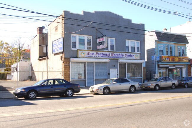
278 Lyons Ave, Newark, NJ 07112


Property Detail
278 Lyons Ave
Newark, NJ
40X86.10
14-03715-0000-00019
Essex
Religious
New Jersey
B and X Area of moderate flood hazard, usually the area between the limits of the 100-year and 500-year floods.
19
2024
0.08 AC
2025
Newark
004600
Northern New Jersey
NEARBY LISTINGS FOR SALE OR LEASE
DEMOGRAPHICS near 278 Lyons Ave
1 mile
3 mile
5 mile
2025 Total Population
51,179
356,711
829,926
2030 Population
52,387
368,410
859,382
Pop Growth 2025-2030
+ 2.36%
+ 3.28%
+ 3.55%
Average Age
37
38
38
2025 Total Households
17,966
126,334
297,646
HH Growth 2025-2030
+ 2.42%
+ 3.52%
+ 3.87%
Median Household Inc
$57,359
$62,406
$68,520
Avg Household Size
2.80
2.70
2.70
2025 Avg HH Vehicles
1.00
1.00
1.00
Median Home Value
$334,835
$401,839
$433,750
Median Year Built
1949
1957
1958
Nearby Places
Map Layers
Map Styles
 Street
 Aerial
Transit
 Traffic
 Biking
Places
Listings with unknown addresses are not visible on the map
- Restaurants
- Banks
- Shops
- Fitness
- Groceries
PUBLIC TRANSPORTATION
COMMUTER RAIL
Newark Airport (North Jersey Coast Line - NJ Transit Commuter Rail (NJ Transit), Northeast Corridor Line - NJ Transit Commuter Rail (NJ Transit))
Drive
Walk
Distance
Newark Airport (North Jersey Coast Line - NJ Transit Commuter Rail (NJ Transit), Northeast Corridor Line - NJ Transit Commuter Rail (NJ Transit))
9 min
3.0 mi
Newark International Airport (AirTrain Newark - Port Authority of New York and New Jersey Airtrain (Airtrain))
Drive
Walk
Distance
Newark International Airport (AirTrain Newark - Port Authority of New York and New Jersey Airtrain (Airtrain))
9 min
3.0 mi
AIRPORT
Newark Liberty International
Drive
Walk
Distance
Newark Liberty International
8 min
5.5 mi
LaGuardia
Drive
Walk
Distance
LaGuardia
42 min
24.7 mi
John F Kennedy International
Drive
Walk
Distance
John F Kennedy International
51 min
32.9 mi
Freight Ports
Maher Terminal
Drive
Walk
Distance
Maher Terminal
10 min
6.0 mi
SALE & LEASE HISTORY
LISTING DATE
SALE/LEASE

Jun 02, 2018
For Lease
Feb 22, 2019
For Lease
Dec 15, 2018
For Lease
Dec 01, 2016
For Sale
Nearby Properties
Address
Land Use
TOTAL SIZE
Lot Size
Zoning
Address
Land Use
TOTAL SIZE
Lot Size
Zoning
Address
Land Use
TOTAL SIZE
Lot Size
Zoning
Address
Land Use
TOTAL SIZE
Lot Size
Zoning
Address
Land Use
TOTAL SIZE
Lot Size
Zoning
789.45 AC
Address
Land Use
TOTAL SIZE
Lot Size
Zoning
57.23 AC
U
Address
Land Use
TOTAL SIZE
Lot Size
Zoning
Address
Land Use
TOTAL SIZE
Lot Size
Zoning
0.61 AC
Address
Land Use
TOTAL SIZE
Lot Size
Zoning
31.86 AC
Address
Land Use
TOTAL SIZE
Lot Size
Zoning
877 SF
7.25 AC
Address
Land Use
TOTAL SIZE
Lot Size
Zoning
1,136 SF
6.51 AC
Address
Land Use
TOTAL SIZE
Lot Size
Zoning
683 SF
9.59 AC
Address
Land Use
TOTAL SIZE
Lot Size
Zoning
Address
Land Use
TOTAL SIZE
Lot Size
Zoning
2.01 AC
Address
Land Use
TOTAL SIZE
Lot Size
Zoning
32.27 AC
CCRC
Address
Land Use
TOTAL SIZE
Lot Size
Zoning
Address
Land Use
TOTAL SIZE
Lot Size
Zoning
9.77 AC
Address
Land Use
TOTAL SIZE
Lot Size
Zoning
1.64 AC
Address
Land Use
TOTAL SIZE
Lot Size
Zoning
1.63 AC
Address
Land Use
TOTAL SIZE
Lot Size
Zoning
4.82 AC
Address
Land Use
TOTAL SIZE
Lot Size
Zoning
1,264 SF
3.20 AC
Address
Land Use
TOTAL SIZE
Lot Size
Zoning
1.89 AC
Address
Land Use
TOTAL SIZE
Lot Size
Zoning
0.06 AC
Address
Land Use
TOTAL SIZE
Lot Size
Zoning
0.09 AC
Address
Land Use
TOTAL SIZE
Lot Size
Zoning
1,073 SF
2.63 AC
Address
Land Use
TOTAL SIZE
Lot Size
Zoning
683 SF
0.79 AC
Address
Land Use
TOTAL SIZE
Lot Size
Zoning
1.29 AC
Address
Land Use
TOTAL SIZE
Lot Size
Zoning
16.14 AC
Address
Land Use
TOTAL SIZE
Lot Size
Zoning
1,264 SF
0.56 AC
Address
Land Use
TOTAL SIZE
Lot Size
Zoning
310.45 AC
Address
Land Use
TOTAL SIZE
Lot Size
Zoning
7.03 AC
The World's #1 Commercial Real Estate Marketplace
Connect with us
© 2026 CoStar Group
The information above has been obtained from sources believed reliable. While we do not doubt its accuracy we have not verified it and make no guarantee, warranty or representation about it. It is your responsibility to independently confirm its accuracy and completeness. Any projections, opinions, assumptions, or estimates used are for example only and do not represent the current or future performance of the property. The value of this transaction to you depends on tax and other factors which should be evaluated by your tax, financial, and legal advisors. You and your advisors should conduct a careful, independent investigation of the property to determine to your satisfaction the suitability of the property for your needs.