Property Record
2728 W Peoria Ave, Phoenix, AZ 85029

NEARBY LISTINGS FOR SALE OR LEASE
Property Detail
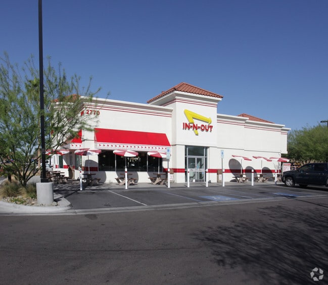
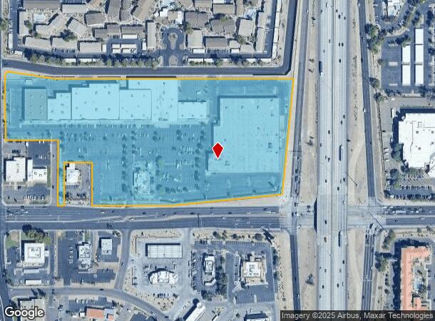
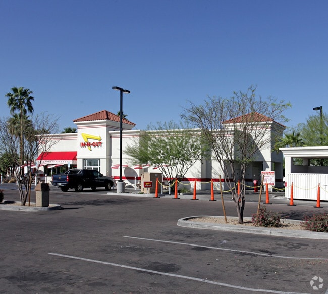
2728 W Peoria Ave
Phoenix-Mesa-Scottsdale, AZ
Metro Square 2
149-20-172
METRO SQUARE 2 MCR 757-01
Regionalshoppingcenterormallwithanchorstore
Maricopa
X
Arizona
04013C1730L
1
2025
14.72 AC
2025
N Phoenix/I-17 Corr
104302
Phoenix
228,072 SF
DEMOGRAPHICS near 2728 W Peoria Ave
1 Mile
3 Mile
5 Mile
2024 Total Population
14,671
167,874
446,514
2029 Population
15,938
181,491
481,257
Pop Growth 2024-2029
+ 8.64%
+ 8.11%
+ 7.78%
Average Age
36
37
37
2024 Total Households
6,315
61,765
164,929
HH Growth 2024-2029
+ 8.87%
+ 8.41%
+ 8.07%
Median Household Inc
$43,790
$53,519
$58,556
Avg Household Size
2.20
2.60
2.50
2024 Avg HH Vehicles
1.00
2.00
2.00
Median Home Value
$266,646
$282,902
$309,728
Median Year Built
1977
1976
1977
Nearby Places
- Restaurants
- Banks
- Shops
- Fitness
- Groceries
PUBLIC TRANSPORTATION
TRANSIT/SUBWAY
Metro Pkwy (Valley Metro Rail - Valley Metro (Phoenix Light Rail))
DRIVE
WALK
Distance
Metro Pkwy (Valley Metro Rail - Valley Metro (Phoenix Light Rail))
3 min
14 min
0.7 mi
AIRPORT
Phoenix Sky Harbor International
DRIVE
WALK
Distance
Phoenix Sky Harbor International
26 min
17.2 mi
Freight Ports
Port of San Diego
DRIVE
WALK
Distance
Port of San Diego
405 min
361.5 mi
Nearby Properties
Address
Land Use
TOTAL SIZE
Lot Size
Zoning
Address
Land Use
TOTAL SIZE
Lot Size
Zoning
249,119 SF
15.40 AC
PUD
Address
Land Use
TOTAL SIZE
Lot Size
Zoning
10.70 AC
I-P
Address
Land Use
TOTAL SIZE
Lot Size
Zoning
98,760 SF
6.76 AC
A-1
Address
Land Use
TOTAL SIZE
Lot Size
Zoning
742,601 SF
295.89 AC
R-8
Address
Land Use
TOTAL SIZE
Lot Size
Zoning
3.58 AC
Address
Land Use
TOTAL SIZE
Lot Size
Zoning
19,474 SF
8.43 AC
C-3
Address
Land Use
TOTAL SIZE
Lot Size
Zoning
558,361 SF
14.61 AC
C-2
Address
Land Use
TOTAL SIZE
Lot Size
Zoning
3,241 SF
2.13 AC
C-N
Address
Land Use
TOTAL SIZE
Lot Size
Zoning
74,376 SF
2.12 AC
C-N
Address
Land Use
TOTAL SIZE
Lot Size
Zoning
2.62 AC
IND.PK.
Address
Land Use
TOTAL SIZE
Lot Size
Zoning
215,150 SF
13.24 AC
R-3
Address
Land Use
TOTAL SIZE
Lot Size
Zoning
16,284 SF
3.77 AC
M-H
Address
Land Use
TOTAL SIZE
Lot Size
Zoning
276,102 SF
39.72 AC
AG
Address
Land Use
TOTAL SIZE
Lot Size
Zoning
4.43 AC
Address
Land Use
TOTAL SIZE
Lot Size
Zoning
146,867 SF
12.95 AC
CPGCP
Address
Land Use
TOTAL SIZE
Lot Size
Zoning
290,321 SF
37.97 AC
R-8
Address
Land Use
TOTAL SIZE
Lot Size
Zoning
268,958 SF
38.42 AC
R-6
Address
Land Use
TOTAL SIZE
Lot Size
Zoning
469,322 SF
22.40 AC
M-H
Address
Land Use
TOTAL SIZE
Lot Size
Zoning
212,227 SF
27.71 AC
R-6
Address
Land Use
TOTAL SIZE
Lot Size
Zoning
584,674 SF
27.83 AC
R-3A
Address
Land Use
TOTAL SIZE
Lot Size
Zoning
362,729 SF
21.85 AC
Address
Land Use
TOTAL SIZE
Lot Size
Zoning
99,714 SF
11.72 AC
R-6
Address
Land Use
TOTAL SIZE
Lot Size
Zoning
123,370 SF
0.82 AC
C-C
Address
Land Use
TOTAL SIZE
Lot Size
Zoning
154,128 SF
9.32 AC
I-1
Address
Land Use
TOTAL SIZE
Lot Size
Zoning
302,016 SF
28.06 AC
Address
Land Use
TOTAL SIZE
Lot Size
Zoning
2.99 AC
C-R
Address
Land Use
TOTAL SIZE
Lot Size
Zoning
84,738 SF
8.83 AC
R-6
Address
Land Use
TOTAL SIZE
Lot Size
Zoning
153,980 SF
20.11 AC
R-8
Address
Land Use
TOTAL SIZE
Lot Size
Zoning
122,646 SF
14.69 AC
I-P
The World's #1 Commercial Real Estate Marketplace
Connect with us
© 2025 CoStar Group
The information above has been obtained from sources believed reliable. While we do not doubt its accuracy we have not verified it and make no guarantee, warranty or representation about it. It is your responsibility to independently confirm its accuracy and completeness. Any projections, opinions, assumptions, or estimates used are for example only and do not represent the current or future performance of the property. The value of this transaction to you depends on tax and other factors which should be evaluated by your tax, financial, and legal advisors. You and your advisors should conduct a careful, independent investigation of the property to determine to your satisfaction the suitability of the property for your needs.