Property Record
2785 Lenwood Rd, Barstow, CA 92311
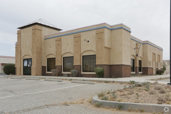


Property Detail
2785 Lenwood Rd
0428-171-58
PARCEL MAP 12850 PARCEL 1
Restaurantdrivein
San Bernardino
AO River or stream flood hazard areas, and areas with a 1% or greater chance of shallow flooding each year. These areas have a 26% chance of flooding over the life of a 30-year mortgage.
California
2025
0.78 AC
2025
Mojave River Valley
011801
Inland Empire (California)
3,488 SF
Riverside-San Bernardino-Ontario, CA
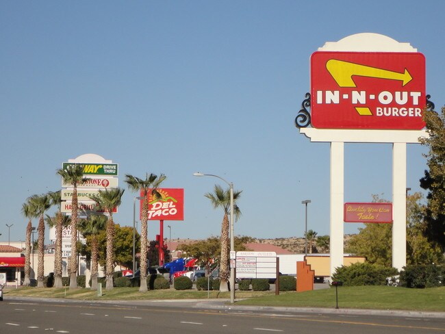
NEARBY LISTINGS FOR SALE OR LEASE
DEMOGRAPHICS near 2785 Lenwood Rd
1 mile
3 mile
5 mile
2025 Total Population
3
5,970
25,147
2030 Population
3
6,142
25,781
Pop Growth 2025-2030
0.00%
+ 2.88%
+ 2.52%
Average Age
0
38
36
2025 Total Households
1
1,992
8,545
HH Growth 2025-2030
0.00%
+ 2.86%
+ 2.54%
Median Household Inc
$0
$84,309
$64,260
Avg Household Size
.00
3.00
2.90
2025 Avg HH Vehicles
.00
2.00
2.00
Median Home Value
$0
$197,259
$256,687
Median Year Built
0
1978
1975
Nearby Places
Map Layers
Map Styles
 Street
 Aerial
Transit
 Traffic
 Biking
Places
Listings with unknown addresses are not visible on the map
- Restaurants
- Banks
- Shops
- Fitness
- Groceries
PUBLIC TRANSPORTATION
COMMUTER RAIL
Drive
Walk
Distance
11 min
7.2 mi
SALE & LEASE HISTORY
LISTING DATE
SALE/LEASE

Sep 23, 2016
For Sale
Jun 21, 2017
For Sale
Apr 25, 2017
For Lease
Nearby Properties
Address
Land Use
TOTAL SIZE
Lot Size
Zoning
Address
Land Use
TOTAL SIZE
Lot Size
Zoning
182,691 SF
36.65 AC
Address
Land Use
TOTAL SIZE
Lot Size
Zoning
65,916 SF
1.97 AC
Address
Land Use
TOTAL SIZE
Lot Size
Zoning
59,700 SF
3.17 AC
Address
Land Use
TOTAL SIZE
Lot Size
Zoning
101,416 SF
3.28 AC
Address
Land Use
TOTAL SIZE
Lot Size
Zoning
60,999 SF
2.60 AC
Address
Land Use
TOTAL SIZE
Lot Size
Zoning
53,692 SF
2.46 AC
Address
Land Use
TOTAL SIZE
Lot Size
Zoning
123,706 SF
13.95 AC
Address
Land Use
TOTAL SIZE
Lot Size
Zoning
16,895 SF
15.95 AC
Address
Land Use
TOTAL SIZE
Lot Size
Zoning
42,969 SF
22.88 AC
Address
Land Use
TOTAL SIZE
Lot Size
Zoning
49,167 SF
1.03 AC
Address
Land Use
TOTAL SIZE
Lot Size
Zoning
33,068 SF
1.41 AC
Address
Land Use
TOTAL SIZE
Lot Size
Zoning
14,015 SF
11.20 AC
Address
Land Use
TOTAL SIZE
Lot Size
Zoning
3,000 SF
1.25 AC
Address
Land Use
TOTAL SIZE
Lot Size
Zoning
34,106 SF
3.37 AC
Address
Land Use
TOTAL SIZE
Lot Size
Zoning
Address
Land Use
TOTAL SIZE
Lot Size
Zoning
351,550 SF
29.38 AC
Address
Land Use
TOTAL SIZE
Lot Size
Zoning
213,202 SF
25.02 AC
Address
Land Use
TOTAL SIZE
Lot Size
Zoning
7,505 SF
1.38 AC
Address
Land Use
TOTAL SIZE
Lot Size
Zoning
14,798 SF
1.93 AC
RS1
Address
Land Use
TOTAL SIZE
Lot Size
Zoning
7,668 SF
3.47 AC
Address
Land Use
TOTAL SIZE
Lot Size
Zoning
22,997 SF
4.37 AC
Address
Land Use
TOTAL SIZE
Lot Size
Zoning
9,100 SF
1.25 AC
CR
Address
Land Use
TOTAL SIZE
Lot Size
Zoning
5,196 SF
1.26 AC
Address
Land Use
TOTAL SIZE
Lot Size
Zoning
4,962 SF
1.97 AC
Address
Land Use
TOTAL SIZE
Lot Size
Zoning
2,621 SF
0.54 AC
Address
Land Use
TOTAL SIZE
Lot Size
Zoning
4,661 SF
1.09 AC
Address
Land Use
TOTAL SIZE
Lot Size
Zoning
Address
Land Use
TOTAL SIZE
Lot Size
Zoning
3,914 SF
1.57 AC
Address
Land Use
TOTAL SIZE
Lot Size
Zoning
28,818 SF
2.47 AC
CR
Address
Land Use
TOTAL SIZE
Lot Size
Zoning
13,105 SF
1.25 AC
The World's #1 Commercial Real Estate Marketplace
Connect with us
© 2026 CoStar Group
The information above has been obtained from sources believed reliable. While we do not doubt its accuracy we have not verified it and make no guarantee, warranty or representation about it. It is your responsibility to independently confirm its accuracy and completeness. Any projections, opinions, assumptions, or estimates used are for example only and do not represent the current or future performance of the property. The value of this transaction to you depends on tax and other factors which should be evaluated by your tax, financial, and legal advisors. You and your advisors should conduct a careful, independent investigation of the property to determine to your satisfaction the suitability of the property for your needs.