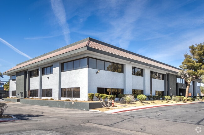
Property Record
2785 E Desert Inn Rd, Las Vegas, NV 89121


Property Detail
2785 E Desert Inn Rd
162-13-102-012
PARCEL MAP FILE 47 PAGE 21 LOT 1 & PT NE4 NW4 SEC 13 21 61
Commercialnec
Clark
CP
Nevada
B and X Area of moderate flood hazard, usually the area between the limits of the 100-year and 500-year floods.
1
2026
6.16 AC
2026
Central East Las Vegas
001707
Las Vegas
121,562 SF
Las Vegas-Henderson-North Las Vegas, NV
NEARBY LISTINGS FOR SALE OR LEASE
DEMOGRAPHICS near 2785 E Desert Inn Rd
1 mile
3 mile
5 mile
2025 Total Population
19,909
223,349
510,940
2030 Population
20,798
233,888
535,316
Pop Growth 2025-2030
+ 4.47%
+ 4.72%
+ 4.77%
Average Age
42
40
39
2025 Total Households
7,682
92,564
195,645
HH Growth 2025-2030
+ 4.48%
+ 4.75%
+ 4.99%
Median Household Inc
$58,674
$49,550
$52,647
Avg Household Size
2.50
2.30
2.50
2025 Avg HH Vehicles
2.00
1.00
1.00
Median Home Value
$352,552
$335,984
$337,642
Median Year Built
1976
1978
1984
Nearby Places
Map Layers
Map Styles
 Street
 Aerial
Layers
 Traffic
 Biking
Places
Listings with unknown addresses are not visible on the map
- Restaurants
- Banks
- Shops
- Fitness
- Groceries
PUBLIC TRANSPORTATION
AIRPORT
Harry Reid International
Drive
Walk
Distance
Harry Reid International
10 min
5.5 mi
Boulder City Municipal
Drive
Walk
Distance
Boulder City Municipal
31 min
22.0 mi
Freight Ports
Port of Long Beach
Drive
Walk
Distance
Port of Long Beach
319 min
282.4 mi
SALE & LEASE HISTORY
LISTING DATE
SALE/LEASE

Mar 04, 2021
For Lease
Jun 27, 2017
For Lease
Dec 07, 2023
For Lease
Nearby Properties
Address
Land Use
TOTAL SIZE
Lot Size
Zoning
Address
Land Use
TOTAL SIZE
Lot Size
Zoning
3,391,505 SF
68.52 AC
Address
Land Use
TOTAL SIZE
Lot Size
Zoning
3,391,505 SF
68.55 AC
Address
Land Use
TOTAL SIZE
Lot Size
Zoning
1,172,527 SF
19.67 AC
H1
Address
Land Use
TOTAL SIZE
Lot Size
Zoning
8,805 SF
45.63 AC
Address
Land Use
TOTAL SIZE
Lot Size
Zoning
74,148 SF
18.51 AC
Address
Land Use
TOTAL SIZE
Lot Size
Zoning
524,471 SF
59.01 AC
Address
Land Use
TOTAL SIZE
Lot Size
Zoning
323,696 SF
24.62 AC
H1
Address
Land Use
TOTAL SIZE
Lot Size
Zoning
162,214 SF
4.32 AC
Address
Land Use
TOTAL SIZE
Lot Size
Zoning
48.58 AC
PF
Address
Land Use
TOTAL SIZE
Lot Size
Zoning
20,924 SF
17.50 AC
H1
Address
Land Use
TOTAL SIZE
Lot Size
Zoning
138.07 AC
PF
Address
Land Use
TOTAL SIZE
Lot Size
Zoning
24,965 SF
25.75 AC
Address
Land Use
TOTAL SIZE
Lot Size
Zoning
281,120 SF
21.38 AC
Address
Land Use
TOTAL SIZE
Lot Size
Zoning
5.96 AC
C2
Address
Land Use
TOTAL SIZE
Lot Size
Zoning
345,133 SF
27.01 AC
H1
Address
Land Use
TOTAL SIZE
Lot Size
Zoning
20.21 AC
H1
Address
Land Use
TOTAL SIZE
Lot Size
Zoning
157,191 SF
5.97 AC
Address
Land Use
TOTAL SIZE
Lot Size
Zoning
5,120 SF
14.60 AC
H1
Address
Land Use
TOTAL SIZE
Lot Size
Zoning
5.39 AC
Address
Land Use
TOTAL SIZE
Lot Size
Zoning
549,077 SF
2.90 AC
H1
Address
Land Use
TOTAL SIZE
Lot Size
Zoning
34,020 SF
7.37 AC
H1
Address
Land Use
TOTAL SIZE
Lot Size
Zoning
72.03 AC
PF
Address
Land Use
TOTAL SIZE
Lot Size
Zoning
709,943 SF
43.10 AC
C2
Address
Land Use
TOTAL SIZE
Lot Size
Zoning
17,454 SF
2.51 AC
L:C-2
Address
Land Use
TOTAL SIZE
Lot Size
Zoning
6,396 SF
15.06 AC
Address
Land Use
TOTAL SIZE
Lot Size
Zoning
95,928 SF
3.71 AC
C:U-V
Address
Land Use
TOTAL SIZE
Lot Size
Zoning
8,611 SF
10 AC
H1
Address
Land Use
TOTAL SIZE
Lot Size
Zoning
239,785 SF
2.20 AC
C:R-5
Address
Land Use
TOTAL SIZE
Lot Size
Zoning
336,359 SF
1.69 AC
H1
The World's #1 Commercial Real Estate Marketplace
Connect with us
© 2026 CoStar Group
The information above has been obtained from sources believed reliable. While we do not doubt its accuracy we have not verified it and make no guarantee, warranty or representation about it. It is your responsibility to independently confirm its accuracy and completeness. Any projections, opinions, assumptions, or estimates used are for example only and do not represent the current or future performance of the property. The value of this transaction to you depends on tax and other factors which should be evaluated by your tax, financial, and legal advisors. You and your advisors should conduct a careful, independent investigation of the property to determine to your satisfaction the suitability of the property for your needs.