Property Record
2787 N 2Nd St, Memphis, TN 38127

NEARBY LISTINGS FOR SALE OR LEASE
Property Detail
2787 N 2Nd St
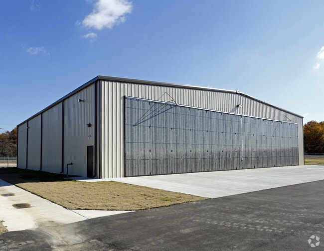
Aircraft
Shelby
AE
Tennessee
05035C0375E
37.81 AC
0
North
2025
Memphis
010121
Memphis, TN-MS-AR
10,000 SF
06-9074-0-0025
DEMOGRAPHICS near 2787 N 2Nd St
1 Mile
3 Mile
5 Mile
2024 Total Population
1,261
29,535
102,514
2029 Population
1,298
30,012
103,121
Pop Growth 2024-2029
+ 2.93%
+ 1.62%
+ 0.59%
Average Age
36
35
37
2024 Total Households
463
12,107
44,664
HH Growth 2024-2029
+ 2.81%
+ 1.30%
+ 0.51%
Median Household Inc
$24,450
$41,562
$40,606
Avg Household Size
2.60
2.40
2.20
2024 Avg HH Vehicles
1.00
1.00
1.00
Median Home Value
$54,411
$95,725
$119,652
Median Year Built
1962
1978
1965
Nearby Places
Map Layers
Map Styles
 Street
 Aerial
- Restaurants
- Banks
- Shops
- Fitness
- Groceries
PUBLIC TRANSPORTATION
COMMUTER RAIL
Central Station (Riverfront Loop - Memphis Area Transit Authority Trolley (MataTrolley))
DRIVE
WALK
Distance
Central Station (Riverfront Loop - Memphis Area Transit Authority Trolley (MataTrolley))
9 min
5.1 mi
AIRPORT
Memphis International
DRIVE
WALK
Distance
Memphis International
22 min
14.0 mi
Freight Ports
Port of Shreveport
DRIVE
WALK
Distance
Port of Shreveport
403 min
371.2 mi
Nearby Properties
Address
Land Use
TOTAL SIZE
Lot Size
Zoning
Address
Land Use
TOTAL SIZE
Lot Size
Zoning
81,088 SF
23.12 AC
RU-3
Address
Land Use
TOTAL SIZE
Lot Size
Zoning
1,913,224 SF
78.98 AC
IH
Address
Land Use
TOTAL SIZE
Lot Size
Zoning
66,370 SF
2.13 AC
HDR
Address
Land Use
TOTAL SIZE
Lot Size
Zoning
141,928 SF
25.08 AC
EMP
Address
Land Use
TOTAL SIZE
Lot Size
Zoning
192,674 SF
1.97 AC
IH
Address
Land Use
TOTAL SIZE
Lot Size
Zoning
2,912 SF
100 AC
CA
Address
Land Use
TOTAL SIZE
Lot Size
Zoning
40,695 SF
1.24 AC
MU
Address
Land Use
TOTAL SIZE
Lot Size
Zoning
95,448 SF
8.04 AC
RU-3
Address
Land Use
TOTAL SIZE
Lot Size
Zoning
35,826 SF
1.21 AC
HDR
Address
Land Use
TOTAL SIZE
Lot Size
Zoning
56,670 SF
9.50 AC
CMU-3
Address
Land Use
TOTAL SIZE
Lot Size
Zoning
104,641 SF
3.55 AC
MDR
Address
Land Use
TOTAL SIZE
Lot Size
Zoning
38,192 SF
1.69 AC
MDR
Address
Land Use
TOTAL SIZE
Lot Size
Zoning
52,220 SF
10.81 AC
CMU-3
Address
Land Use
TOTAL SIZE
Lot Size
Zoning
76,727 SF
13.03 AC
RU-3
Address
Land Use
TOTAL SIZE
Lot Size
Zoning
59,493 SF
9.30 AC
EMP
Address
Land Use
TOTAL SIZE
Lot Size
Zoning
14,104 SF
3.95 AC
MDR
Address
Land Use
TOTAL SIZE
Lot Size
Zoning
92,798 SF
12.66 AC
RU-3
Address
Land Use
TOTAL SIZE
Lot Size
Zoning
76,727 SF
13.03 AC
RU-3
Address
Land Use
TOTAL SIZE
Lot Size
Zoning
20,904 SF
0.66 AC
MU
Address
Land Use
TOTAL SIZE
Lot Size
Zoning
82,859 SF
9.88 AC
MU
Address
Land Use
TOTAL SIZE
Lot Size
Zoning
56,620 SF
25.08 AC
R-6
Address
Land Use
TOTAL SIZE
Lot Size
Zoning
19,013 SF
3.51 AC
RU-3
Address
Land Use
TOTAL SIZE
Lot Size
Zoning
34,313 SF
4.63 AC
CMU-3
Address
Land Use
TOTAL SIZE
Lot Size
Zoning
47,756 SF
9.94 AC
RU-3
Address
Land Use
TOTAL SIZE
Lot Size
Zoning
35,890 SF
10.53 AC
RU-3
Address
Land Use
TOTAL SIZE
Lot Size
Zoning
10.26 AC
R-10
Address
Land Use
TOTAL SIZE
Lot Size
Zoning
39,628 SF
8.81 AC
RU-3
Address
Land Use
TOTAL SIZE
Lot Size
Zoning
39,184 SF
0.96 AC
MU
Address
Land Use
TOTAL SIZE
Lot Size
Zoning
77,046 SF
1.28 AC
MU
Address
Land Use
TOTAL SIZE
Lot Size
Zoning
32,488 SF
0.88 AC
MDR
The World's #1 Commercial Real Estate Marketplace
Connect with us
© 2026 CoStar Group
The information above has been obtained from sources believed reliable. While we do not doubt its accuracy we have not verified it and make no guarantee, warranty or representation about it. It is your responsibility to independently confirm its accuracy and completeness. Any projections, opinions, assumptions, or estimates used are for example only and do not represent the current or future performance of the property. The value of this transaction to you depends on tax and other factors which should be evaluated by your tax, financial, and legal advisors. You and your advisors should conduct a careful, independent investigation of the property to determine to your satisfaction the suitability of the property for your needs.