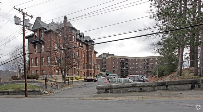
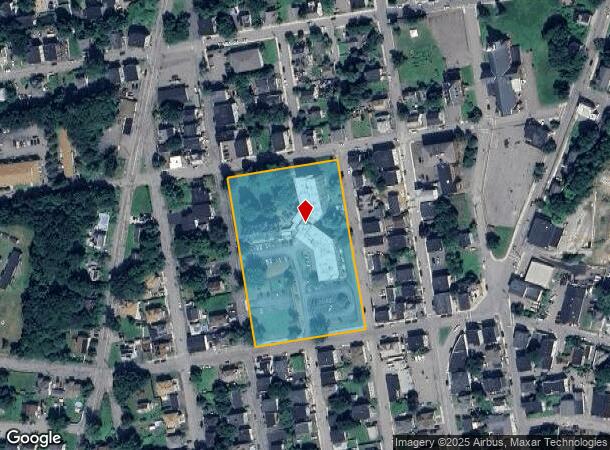
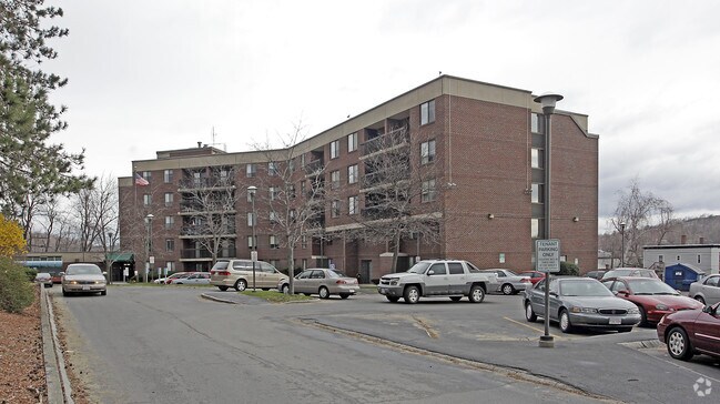
Property Record
279 Daniels St, Fitchburg, MA 01420
NEARBY LISTINGS FOR SALE OR LEASE
-
-
View all Fitchburg listings for sale on LoopNet.com
Property Detail
279 Daniels St
FITC-000076-000071
Worcester
Apartment
Massachusetts
X
3.65 AC
25027C0254F
Cleghorn
2025
Boston
2025
Worcester, MA-CT
710500
DEMOGRAPHICS near 279 Daniels St
1 Mile
3 Mile
5 Mile
2024 Total Population
11,848
45,219
76,123
2029 Population
11,741
45,065
75,854
Pop Growth 2024-2029
(0.90%)
(0.34%)
(0.35%)
Average Age
38
39
40
2024 Total Households
4,609
17,565
30,123
HH Growth 2024-2029
(0.95%)
(0.32%)
(0.37%)
Median Household Inc
$64,472
$64,212
$71,270
Avg Household Size
2.50
2.40
2.40
2024 Avg HH Vehicles
2.00
2.00
2.00
Median Home Value
$249,952
$278,261
$311,841
Median Year Built
1950
1954
1958
Nearby Places
- Restaurants
- Banks
- Shops
- Fitness
- Groceries
PUBLIC TRANSPORTATION
COMMUTER RAIL
Fitchburg (Fitchburg/South Acton Line - Massachusetts Bay Transportation Authority Commuter Rail (Purple Line))
DRIVE
WALK
Distance
Fitchburg (Fitchburg/South Acton Line - Massachusetts Bay Transportation Authority Commuter Rail (Purple Line))
6 min
2.3 mi
DRIVE
WALK
Distance
8 min
3.3 mi
AIRPORT
Worcester Regional
DRIVE
WALK
Distance
Worcester Regional
49 min
29.6 mi
Manchester Boston Regional
DRIVE
WALK
Distance
Manchester Boston Regional
69 min
38.3 mi
Freight Ports
Port of Boston
DRIVE
WALK
Distance
Port of Boston
79 min
50.3 mi
Nearby Properties
Address
Land Use
TOTAL SIZE
Lot Size
Zoning
Address
Land Use
TOTAL SIZE
Lot Size
Zoning
39.19 AC
CR
Address
Land Use
TOTAL SIZE
Lot Size
Zoning
276,822 SF
26.98 AC
I
Address
Land Use
TOTAL SIZE
Lot Size
Zoning
48.02 AC
MSD
Address
Land Use
TOTAL SIZE
Lot Size
Zoning
11.88 AC
FSU
Address
Land Use
TOTAL SIZE
Lot Size
Zoning
144,800 SF
1.58 AC
RC
Address
Land Use
TOTAL SIZE
Lot Size
Zoning
119,783 SF
2.80 AC
FSC
Address
Land Use
TOTAL SIZE
Lot Size
Zoning
12.11 AC
RA
Address
Land Use
TOTAL SIZE
Lot Size
Zoning
91,082 SF
4.09 AC
FSC
Address
Land Use
TOTAL SIZE
Lot Size
Zoning
176,003 SF
12.46 AC
RA
Address
Land Use
TOTAL SIZE
Lot Size
Zoning
43,902 SF
100 AC
RR
Address
Land Use
TOTAL SIZE
Lot Size
Zoning
3.13 AC
DB
Address
Land Use
TOTAL SIZE
Lot Size
Zoning
114,360 SF
6.10 AC
RA
Address
Land Use
TOTAL SIZE
Lot Size
Zoning
281,196 SF
8.70 AC
AI
Address
Land Use
TOTAL SIZE
Lot Size
Zoning
76,396 SF
1.99 AC
DB
Address
Land Use
TOTAL SIZE
Lot Size
Zoning
19.83 AC
RB
Address
Land Use
TOTAL SIZE
Lot Size
Zoning
30,078 SF
19.66 AC
Address
Land Use
TOTAL SIZE
Lot Size
Zoning
16.04 AC
RA
Address
Land Use
TOTAL SIZE
Lot Size
Zoning
73,048 SF
17.38 AC
RA
Address
Land Use
TOTAL SIZE
Lot Size
Zoning
99,800 SF
20 AC
RA
Address
Land Use
TOTAL SIZE
Lot Size
Zoning
48,185 SF
5.14 AC
NB
Address
Land Use
TOTAL SIZE
Lot Size
Zoning
220,142 SF
28 AC
RA
Address
Land Use
TOTAL SIZE
Lot Size
Zoning
127.30 AC
AI
Address
Land Use
TOTAL SIZE
Lot Size
Zoning
33,000 SF
0.33 AC
DB
Address
Land Use
TOTAL SIZE
Lot Size
Zoning
77,500 SF
1.15 AC
RB
Address
Land Use
TOTAL SIZE
Lot Size
Zoning
106,576 SF
16.65 AC
AI
Address
Land Use
TOTAL SIZE
Lot Size
Zoning
32,499 SF
2.11 AC
DB
Address
Land Use
TOTAL SIZE
Lot Size
Zoning
113,250 SF
34.55 AC
CR
Address
Land Use
TOTAL SIZE
Lot Size
Zoning
4.02 AC
Address
Land Use
TOTAL SIZE
Lot Size
Zoning
1.23 AC
NB
Address
Land Use
TOTAL SIZE
Lot Size
Zoning
42,960 SF
0.77 AC
DB
The World's #1 Commercial Real Estate Marketplace
Connect with us
© 2025 CoStar Group
The information above has been obtained from sources believed reliable. While we do not doubt its accuracy we have not verified it and make no guarantee, warranty or representation about it. It is your responsibility to independently confirm its accuracy and completeness. Any projections, opinions, assumptions, or estimates used are for example only and do not represent the current or future performance of the property. The value of this transaction to you depends on tax and other factors which should be evaluated by your tax, financial, and legal advisors. You and your advisors should conduct a careful, independent investigation of the property to determine to your satisfaction the suitability of the property for your needs.