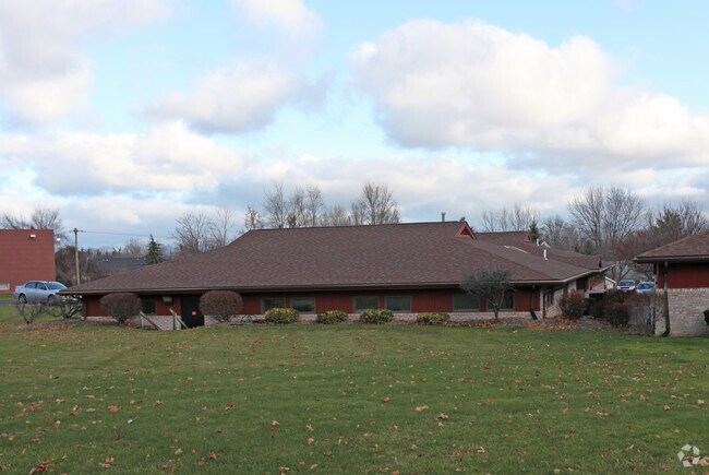
Property Record
279 East Ave, Hilton, NY 14468


NEARBY LISTINGS FOR SALE OR LEASE
Property Detail
279 East Ave
264001-032-060-0003-013-210
L76 NSEC BRAD BAY 32.06-3-13.2
Professionalbldglegalinsurancerealestateetc
Monroe
X
New York
36055C0041G
13.210
2025
0.75 AC
2024
Northwest
014806
Rochester
6,239 SF
Rochester, NY
DEMOGRAPHICS near 279 East Ave
1 Mile
3 Mile
5 Mile
2024 Total Population
5,698
12,860
34,204
2029 Population
5,489
12,521
33,569
Pop Growth 2024-2029
(3.67%)
(2.64%)
(1.86%)
Average Age
41
42
43
2024 Total Households
2,206
4,889
13,208
HH Growth 2024-2029
(3.90%)
(2.82%)
(1.98%)
Median Household Inc
$75,729
$82,785
$90,229
Avg Household Size
2.50
2.60
2.50
2024 Avg HH Vehicles
2.00
2.00
2.00
Median Home Value
$164,053
$186,765
$197,049
Median Year Built
1979
1977
1981
Nearby Places
Map Layers
Map Styles
 Street
 Aerial
- Restaurants
- Banks
- Shops
- Fitness
- Groceries
PUBLIC TRANSPORTATION
AIRPORT
Frederick Douglass/Greater Rochester International
DRIVE
WALK
Distance
Frederick Douglass/Greater Rochester International
31 min
19.0 mi
Nearby Properties
Address
Land Use
TOTAL SIZE
Lot Size
Zoning
Address
Land Use
TOTAL SIZE
Lot Size
Zoning
250,000 SF
59.11 AC
02 - SINGL
Address
Land Use
TOTAL SIZE
Lot Size
Zoning
236,079 SF
63.84 AC
02 - SINGL
Address
Land Use
TOTAL SIZE
Lot Size
Zoning
1.90 AC
05 - COMME
Address
Land Use
TOTAL SIZE
Lot Size
Zoning
89,396 SF
26.60 AC
02 - SINGL
Address
Land Use
TOTAL SIZE
Lot Size
Zoning
11,452 SF
13.10 AC
03 - MULTI
Address
Land Use
TOTAL SIZE
Lot Size
Zoning
78,957 SF
90.80 AC
02 - SINGL
Address
Land Use
TOTAL SIZE
Lot Size
Zoning
93,865 SF
62.80 AC
Address
Land Use
TOTAL SIZE
Lot Size
Zoning
6,462 SF
8.20 AC
03 - MULTI
Address
Land Use
TOTAL SIZE
Lot Size
Zoning
30,194 SF
24 AC
02 - SINGL
Address
Land Use
TOTAL SIZE
Lot Size
Zoning
31,823 SF
2.82 AC
05 - COMME
Address
Land Use
TOTAL SIZE
Lot Size
Zoning
64,153 SF
10.11 AC
05 - COMME
Address
Land Use
TOTAL SIZE
Lot Size
Zoning
4,352 SF
20.50 AC
03 - MULTI
Address
Land Use
TOTAL SIZE
Lot Size
Zoning
53,613 SF
4.20 AC
05 - COMME
Address
Land Use
TOTAL SIZE
Lot Size
Zoning
20,200 SF
38.29 AC
06 - INDUS
Address
Land Use
TOTAL SIZE
Lot Size
Zoning
37.80 AC
Address
Land Use
TOTAL SIZE
Lot Size
Zoning
2,088 SF
1.97 AC
Address
Land Use
TOTAL SIZE
Lot Size
Zoning
16,212 SF
6.48 AC
02 - SINGL
Address
Land Use
TOTAL SIZE
Lot Size
Zoning
6,372 SF
2.44 AC
02 - SINGL
Address
Land Use
TOTAL SIZE
Lot Size
Zoning
37,488 SF
5.50 AC
02 - SINGL
Address
Land Use
TOTAL SIZE
Lot Size
Zoning
9,287 SF
37.57 AC
02 - SINGL
Address
Land Use
TOTAL SIZE
Lot Size
Zoning
9,000 SF
11.96 AC
Address
Land Use
TOTAL SIZE
Lot Size
Zoning
9,288 SF
1.60 AC
03 - MULTI
Address
Land Use
TOTAL SIZE
Lot Size
Zoning
6,400 SF
4.40 AC
Address
Land Use
TOTAL SIZE
Lot Size
Zoning
3,332 SF
2.85 AC
04 - FARM
Address
Land Use
TOTAL SIZE
Lot Size
Zoning
14,220 SF
3.20 AC
05 - COMME
Address
Land Use
TOTAL SIZE
Lot Size
Zoning
11,068 SF
5 AC
02 - SINGL
Address
Land Use
TOTAL SIZE
Lot Size
Zoning
5,906 SF
24.10 AC
Address
Land Use
TOTAL SIZE
Lot Size
Zoning
8,064 SF
0.27 AC
05 - COMME
Address
Land Use
TOTAL SIZE
Lot Size
Zoning
10,504 SF
2.71 AC
05 - COMME
Address
Land Use
TOTAL SIZE
Lot Size
Zoning
2,028 SF
1.41 AC
The World's #1 Commercial Real Estate Marketplace
Connect with us
© 2026 CoStar Group
The information above has been obtained from sources believed reliable. While we do not doubt its accuracy we have not verified it and make no guarantee, warranty or representation about it. It is your responsibility to independently confirm its accuracy and completeness. Any projections, opinions, assumptions, or estimates used are for example only and do not represent the current or future performance of the property. The value of this transaction to you depends on tax and other factors which should be evaluated by your tax, financial, and legal advisors. You and your advisors should conduct a careful, independent investigation of the property to determine to your satisfaction the suitability of the property for your needs.