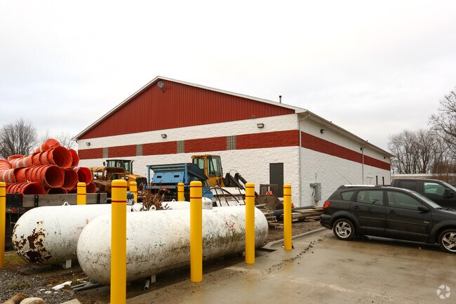
Property Record
27904 Hall Rd, Flat Rock, MI 48134


NEARBY LISTINGS FOR SALE OR LEASE
Property Detail
27904 Hall Rd
Detroit-Warren-Dearborn, MI
Chapman Farms No 3
58-100-01-0037-303
*33D37B, 38B* E 1/2 OF LOT 37 ALSO E 1/2 LOT 38 - - - CHAPMAN FARMS SUB NO. 3 T4S R10E L69 P39 WCR
Industrialgeneral
Wayne
AE
Michigan
26115C0110E
37-38
2025
4.64 AC
2025
Downriver South
599001
Detroit
19,779 SF
DEMOGRAPHICS near 27904 Hall Rd
1 Mile
3 Mile
5 Mile
2024 Total Population
2,582
43,213
84,242
2029 Population
2,477
41,604
81,169
Pop Growth 2024-2029
(4.07%)
(3.72%)
(3.65%)
Average Age
38
41
42
2024 Total Households
960
17,232
34,096
HH Growth 2024-2029
(4.06%)
(3.73%)
(3.65%)
Median Household Inc
$68,688
$80,432
$78,410
Avg Household Size
2.60
2.50
2.40
2024 Avg HH Vehicles
2.00
2.00
2.00
Median Home Value
$208,838
$222,043
$219,707
Median Year Built
1978
1982
1977
Nearby Places
Map Layers
Map Styles
 Street
 Aerial
- Restaurants
- Banks
- Shops
- Fitness
- Groceries
PUBLIC TRANSPORTATION
AIRPORT
Detroit Metro Wayne County
DRIVE
WALK
Distance
Detroit Metro Wayne County
25 min
13.9 mi
Windsor International
DRIVE
WALK
Distance
Windsor International
50 min
32.3 mi
Freight Ports
Port of Toledo
DRIVE
WALK
Distance
Port of Toledo
53 min
40.2 mi
SALE & LEASE HISTORY
LISTING DATE
SALE/LEASE

Dec 14, 2017
For Lease
Nearby Properties
Address
Land Use
TOTAL SIZE
Lot Size
Zoning
Address
Land Use
TOTAL SIZE
Lot Size
Zoning
3,189,689 SF
228.88 AC
Address
Land Use
TOTAL SIZE
Lot Size
Zoning
215,724 SF
Address
Land Use
TOTAL SIZE
Lot Size
Zoning
235,489 SF
23.47 AC
Address
Land Use
TOTAL SIZE
Lot Size
Zoning
177,054 SF
11.88 AC
PUD
Address
Land Use
TOTAL SIZE
Lot Size
Zoning
249,836 SF
22.18 AC
AG
Address
Land Use
TOTAL SIZE
Lot Size
Zoning
1,021,918 SF
163.58 AC
Address
Land Use
TOTAL SIZE
Lot Size
Zoning
35.50 AC
RM-1
Address
Land Use
TOTAL SIZE
Lot Size
Zoning
3,280 SF
99.72 AC
Address
Land Use
TOTAL SIZE
Lot Size
Zoning
209,221 SF
21.80 AC
Address
Land Use
TOTAL SIZE
Lot Size
Zoning
203,114 SF
14.50 AC
R-M MUL
Address
Land Use
TOTAL SIZE
Lot Size
Zoning
178,682 SF
19.23 AC
Address
Land Use
TOTAL SIZE
Lot Size
Zoning
33,600 SF
100.03 AC
Address
Land Use
TOTAL SIZE
Lot Size
Zoning
92,397 SF
12.63 AC
PUD
Address
Land Use
TOTAL SIZE
Lot Size
Zoning
307,181 SF
22.32 AC
Address
Land Use
TOTAL SIZE
Lot Size
Zoning
61,784 SF
6.78 AC
Address
Land Use
TOTAL SIZE
Lot Size
Zoning
141,861 SF
13 AC
RM-1
Address
Land Use
TOTAL SIZE
Lot Size
Zoning
167,004 SF
19.04 AC
RM-1
Address
Land Use
TOTAL SIZE
Lot Size
Zoning
179,235 SF
25.38 AC
Address
Land Use
TOTAL SIZE
Lot Size
Zoning
59,427 SF
5.50 AC
Address
Land Use
TOTAL SIZE
Lot Size
Zoning
68,409 SF
64.56 AC
Address
Land Use
TOTAL SIZE
Lot Size
Zoning
2,368 SF
32.58 AC
Address
Land Use
TOTAL SIZE
Lot Size
Zoning
95,650 SF
73.78 AC
Address
Land Use
TOTAL SIZE
Lot Size
Zoning
52.37 AC
Address
Land Use
TOTAL SIZE
Lot Size
Zoning
48,760 SF
4.86 AC
Address
Land Use
TOTAL SIZE
Lot Size
Zoning
18,678 SF
3.10 AC
R1-ONE
Address
Land Use
TOTAL SIZE
Lot Size
Zoning
3,870 SF
38.38 AC
Address
Land Use
TOTAL SIZE
Lot Size
Zoning
2,816 SF
86.70 AC
RESIDE
Address
Land Use
TOTAL SIZE
Lot Size
Zoning
146,300 SF
25.84 AC
Address
Land Use
TOTAL SIZE
Lot Size
Zoning
101,861 SF
15.33 AC
B-2
Address
Land Use
TOTAL SIZE
Lot Size
Zoning
69,112 SF
10.34 AC
B-2
The World's #1 Commercial Real Estate Marketplace
Connect with us
© 2025 CoStar Group
The information above has been obtained from sources believed reliable. While we do not doubt its accuracy we have not verified it and make no guarantee, warranty or representation about it. It is your responsibility to independently confirm its accuracy and completeness. Any projections, opinions, assumptions, or estimates used are for example only and do not represent the current or future performance of the property. The value of this transaction to you depends on tax and other factors which should be evaluated by your tax, financial, and legal advisors. You and your advisors should conduct a careful, independent investigation of the property to determine to your satisfaction the suitability of the property for your needs.