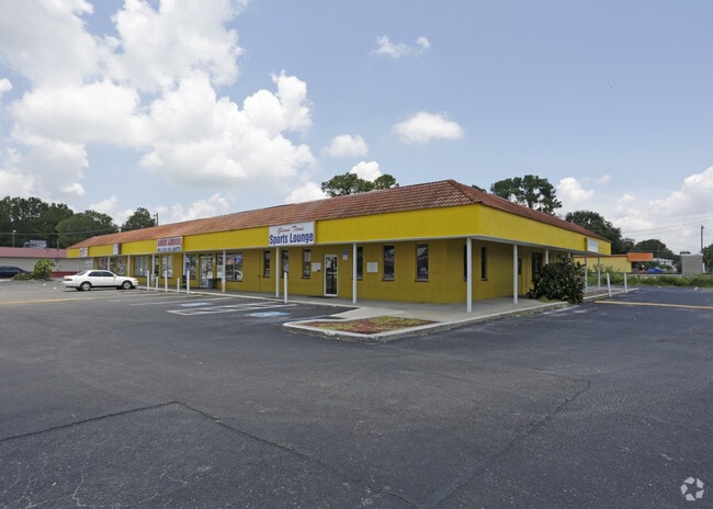
Property Record
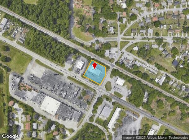
2787 Recker Hwy, Winter Haven, FL 33880
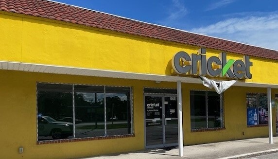
Current Lease Availabilities
NEARBY LISTINGS FOR SALE OR LEASE
Property Detail
2787 Recker Hwy
25-28-25-000000-021060
Bysons Subdivision
Regionalshoppingcenterormallwithanchorstore
BEG INTER ST RD 655 W/COLEMAN RD RUN N 62 DEG 20 MIN W ALONG NLY R/W ST RD 655 210 FT N 27 DEG 40 MIN E 199.44 FT S 62 DEG 20 MIN E ALONG SLY R/W SCLRR 173.8 FT TO E-LINE SEC S 93.5 FT S 31 DEG 03 MIN 35 SEC W ALONG COLEMAN RD 117.08 FT M/L TO POB
A
Polk
12105C0345G
Florida
2024
0.94 AC
2025
Polk County
013802
Tampa/St Petersburg
9,216 SF
Lakeland-Winter Haven, FL
DEMOGRAPHICS near 2787 Recker Hwy
1 Mile
3 Mile
5 Mile
2024 Total Population
12,664
51,659
105,058
2029 Population
15,406
62,036
126,148
Pop Growth 2024-2029
+ 21.65%
+ 20.09%
+ 20.07%
Average Age
37
40
40
2024 Total Households
4,847
20,342
40,073
HH Growth 2024-2029
+ 21.75%
+ 20.02%
+ 19.99%
Median Household Inc
$51,789
$48,619
$52,026
Avg Household Size
2.60
2.50
2.60
2024 Avg HH Vehicles
2.00
2.00
2.00
Median Home Value
$158,979
$171,070
$193,332
Median Year Built
1979
1977
1979
Nearby Places
- Restaurants
- Banks
- Shops
- Fitness
- Groceries
PUBLIC TRANSPORTATION
COMMUTER RAIL
Winter Haven (Silver Meteor - Amtrak, Silver Star - Amtrak)
DRIVE
WALK
Distance
Winter Haven (Silver Meteor - Amtrak, Silver Star - Amtrak)
5 min
2.5 mi
Freight Ports
Port of Tampa Bay
DRIVE
WALK
Distance
Port of Tampa Bay
64 min
48.6 mi
Nearby Properties
Address
Land Use
TOTAL SIZE
Lot Size
Zoning
Address
Land Use
TOTAL SIZE
Lot Size
Zoning
942,646 SF
91.30 AC
R3
Address
Land Use
TOTAL SIZE
Lot Size
Zoning
728,846 SF
28.07 AC
Address
Land Use
TOTAL SIZE
Lot Size
Zoning
250,170 SF
24.21 AC
Address
Land Use
TOTAL SIZE
Lot Size
Zoning
504,548 SF
26.82 AC
BR
Address
Land Use
TOTAL SIZE
Lot Size
Zoning
215,942 SF
43.90 AC
Address
Land Use
TOTAL SIZE
Lot Size
Zoning
303,642 SF
96.19 AC
RC
Address
Land Use
TOTAL SIZE
Lot Size
Zoning
135,118 SF
7.26 AC
Address
Land Use
TOTAL SIZE
Lot Size
Zoning
282,400 SF
19.59 AC
XX
Address
Land Use
TOTAL SIZE
Lot Size
Zoning
267,076 SF
31.67 AC
Address
Land Use
TOTAL SIZE
Lot Size
Zoning
85,378 SF
4.20 AC
BR
Address
Land Use
TOTAL SIZE
Lot Size
Zoning
75,936 SF
0.76 AC
R3
Address
Land Use
TOTAL SIZE
Lot Size
Zoning
155,373 SF
72.76 AC
Address
Land Use
TOTAL SIZE
Lot Size
Zoning
200,200 SF
10.29 AC
Address
Land Use
TOTAL SIZE
Lot Size
Zoning
503,625 SF
20.61 AC
Address
Land Use
TOTAL SIZE
Lot Size
Zoning
225,126 SF
24.54 AC
Address
Land Use
TOTAL SIZE
Lot Size
Zoning
148,390 SF
10.42 AC
R1
Address
Land Use
TOTAL SIZE
Lot Size
Zoning
241,319 SF
5.67 AC
Address
Land Use
TOTAL SIZE
Lot Size
Zoning
322,165 SF
16.88 AC
Address
Land Use
TOTAL SIZE
Lot Size
Zoning
188,403 SF
27.79 AC
BT
Address
Land Use
TOTAL SIZE
Lot Size
Zoning
123,540 SF
5.89 AC
Address
Land Use
TOTAL SIZE
Lot Size
Zoning
135,885 SF
10.12 AC
Address
Land Use
TOTAL SIZE
Lot Size
Zoning
102,307 SF
1.79 AC
RP
Address
Land Use
TOTAL SIZE
Lot Size
Zoning
77,388 SF
5.37 AC
BT
Address
Land Use
TOTAL SIZE
Lot Size
Zoning
185,895 SF
16.16 AC
BR
Address
Land Use
TOTAL SIZE
Lot Size
Zoning
173,328 SF
37.45 AC
C3
Address
Land Use
TOTAL SIZE
Lot Size
Zoning
109,512 SF
5 AC
Address
Land Use
TOTAL SIZE
Lot Size
Zoning
129,567 SF
11.72 AC
C3
Address
Land Use
TOTAL SIZE
Lot Size
Zoning
277,729 SF
423.34 AC
Address
Land Use
TOTAL SIZE
Lot Size
Zoning
70,900 SF
1.62 AC
Address
Land Use
TOTAL SIZE
Lot Size
Zoning
57,387 SF
9.84 AC
RC
The World's #1 Commercial Real Estate Marketplace
Connect with us
© 2025 CoStar Group
The information above has been obtained from sources believed reliable. While we do not doubt its accuracy we have not verified it and make no guarantee, warranty or representation about it. It is your responsibility to independently confirm its accuracy and completeness. Any projections, opinions, assumptions, or estimates used are for example only and do not represent the current or future performance of the property. The value of this transaction to you depends on tax and other factors which should be evaluated by your tax, financial, and legal advisors. You and your advisors should conduct a careful, independent investigation of the property to determine to your satisfaction the suitability of the property for your needs.