Property Record
27910 County Road 215, Bangor, MI 49013


NEARBY LISTINGS FOR SALE OR LEASE
Property Detail
27910 County Road 215
80-03-005-021-06
67-A1A 5-2-15 546-85 717-761 1283-735 1429-745 1529-915 1704-437 *** S 779.84 FT OF E 363.0 FT OF S 1/2 OF SE 1/4 OF SEC.
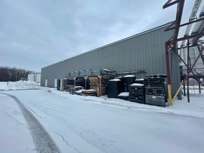
Warehouse
Van Buren
X
Michigan
26159C0179C
6.50 AC
2024
Van Buren County
2025
West Michigan
012002
Kalamazoo-Portage, MI
36,400 SF
DEMOGRAPHICS near 27910 County Road 215
1 Mile
3 Mile
5 Mile
2024 Total Population
243
3,631
6,922
2029 Population
241
3,611
6,972
Pop Growth 2024-2029
(0.82%)
(0.55%)
+ 0.72%
Average Age
41
39
40
2024 Total Households
87
1,329
2,571
HH Growth 2024-2029
(1.15%)
(0.75%)
+ 0.54%
Median Household Inc
$52,666
$50,188
$52,160
Avg Household Size
2.60
2.60
2.60
2024 Avg HH Vehicles
2.00
2.00
2.00
Median Home Value
$172,499
$116,899
$131,407
Median Year Built
1976
1969
1972
Nearby Places
Map Layers
Map Styles
 Street
 Aerial
- Restaurants
- Banks
- Shops
- Fitness
- Groceries
PUBLIC TRANSPORTATION
COMMUTER RAIL
Bangor Amtrak Station (Pere Marquette - Amtrak)
DRIVE
WALK
Distance
Bangor Amtrak Station (Pere Marquette - Amtrak)
4 min
2.8 mi
AIRPORT
Kalamazoo/Battle Creek International
DRIVE
WALK
Distance
Kalamazoo/Battle Creek International
51 min
31.8 mi
Freight Ports
Port Milwaukee
DRIVE
WALK
Distance
Port Milwaukee
262 min
212.4 mi
SALE & LEASE HISTORY
LISTING DATE
SALE/LEASE

Feb 25, 2022
For Lease
Nearby Properties
Address
Land Use
TOTAL SIZE
Lot Size
Zoning
Address
Land Use
TOTAL SIZE
Lot Size
Zoning
952 SF
57.94 AC
AG
Address
Land Use
TOTAL SIZE
Lot Size
Zoning
32,321 SF
9.88 AC
R3
Address
Land Use
TOTAL SIZE
Lot Size
Zoning
12,000 SF
3.96 AC
I-1
Address
Land Use
TOTAL SIZE
Lot Size
Zoning
1,572 SF
80 AC
AG
Address
Land Use
TOTAL SIZE
Lot Size
Zoning
28,560 SF
2.14 AC
I-1
Address
Land Use
TOTAL SIZE
Lot Size
Zoning
3,000 SF
227 AC
AG
Address
Land Use
TOTAL SIZE
Lot Size
Zoning
1,792 SF
63.29 AC
AG
Address
Land Use
TOTAL SIZE
Lot Size
Zoning
2,284 SF
160 AC
AG
Address
Land Use
TOTAL SIZE
Lot Size
Zoning
118 AC
AG
Address
Land Use
TOTAL SIZE
Lot Size
Zoning
9,442 SF
20.01 AC
BREEDVILLE
Address
Land Use
TOTAL SIZE
Lot Size
Zoning
1,120 SF
150 AC
AG
Address
Land Use
TOTAL SIZE
Lot Size
Zoning
24,192 SF
2.83 AC
R3
Address
Land Use
TOTAL SIZE
Lot Size
Zoning
11,250 SF
2.30 AC
C
Address
Land Use
TOTAL SIZE
Lot Size
Zoning
920 SF
20 AC
AG
Address
Land Use
TOTAL SIZE
Lot Size
Zoning
5,312 SF
57.88 AC
AG
Address
Land Use
TOTAL SIZE
Lot Size
Zoning
40,196 SF
5.14 AC
R1
Address
Land Use
TOTAL SIZE
Lot Size
Zoning
29.13 AC
AG
Address
Land Use
TOTAL SIZE
Lot Size
Zoning
23,506 SF
1.81 AC
B2
Address
Land Use
TOTAL SIZE
Lot Size
Zoning
75.75 AC
AG
Address
Land Use
TOTAL SIZE
Lot Size
Zoning
12,096 SF
2.50 AC
R3
Address
Land Use
TOTAL SIZE
Lot Size
Zoning
1,928 SF
80 AC
AG
Address
Land Use
TOTAL SIZE
Lot Size
Zoning
9,800 SF
19.25 AC
C
Address
Land Use
TOTAL SIZE
Lot Size
Zoning
2,464 SF
137 AC
AG
Address
Land Use
TOTAL SIZE
Lot Size
Zoning
9,644 SF
2.09 AC
I-1
Address
Land Use
TOTAL SIZE
Lot Size
Zoning
2,167 SF
89.80 AC
AG
Address
Land Use
TOTAL SIZE
Lot Size
Zoning
1,728 SF
40 AC
AG
Address
Land Use
TOTAL SIZE
Lot Size
Zoning
112 AC
AG
Address
Land Use
TOTAL SIZE
Lot Size
Zoning
20,736 SF
56 AC
C
Address
Land Use
TOTAL SIZE
Lot Size
Zoning
142 AC
AG
The World's #1 Commercial Real Estate Marketplace
Connect with us
© 2025 CoStar Group
The information above has been obtained from sources believed reliable. While we do not doubt its accuracy we have not verified it and make no guarantee, warranty or representation about it. It is your responsibility to independently confirm its accuracy and completeness. Any projections, opinions, assumptions, or estimates used are for example only and do not represent the current or future performance of the property. The value of this transaction to you depends on tax and other factors which should be evaluated by your tax, financial, and legal advisors. You and your advisors should conduct a careful, independent investigation of the property to determine to your satisfaction the suitability of the property for your needs.