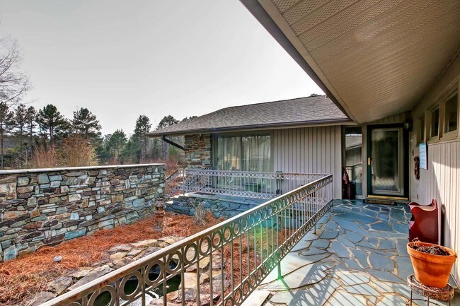
Property Record
2795 Moose Rd, Kannapolis, NC 28083

Property Detail
2795 Moose Rd
145-215
L1 1.65AC
Autorepair
Rowan
OI:OFFICE
North Carolina
AE The base floodplain where base flood elevations are provided. AE Zones are now used on new format FIRMs instead of A1-A30 Zones.
4.25 AC
2025
Rowan County
2025
Charlotte
051400
Charlotte-Concord-Gastonia, NC-SC
5,456 SF
NEARBY LISTINGS FOR SALE OR LEASE
DEMOGRAPHICS near 2795 Moose Rd
1 mile
3 mile
5 mile
2025 Total Population
1,182
20,144
66,732
2030 Population
1,240
21,332
70,983
Pop Growth 2025-2030
+ 4.91%
+ 5.90%
+ 6.37%
Average Age
41
40
40
2025 Total Households
455
7,778
26,284
HH Growth 2025-2030
+ 5.05%
+ 6.04%
+ 6.53%
Median Household Inc
$90,079
$68,913
$61,965
Avg Household Size
2.60
2.60
2.50
2025 Avg HH Vehicles
2.00
2.00
2.00
Median Home Value
$245,935
$237,058
$257,383
Median Year Built
1992
1987
1981
Nearby Places
Map Layers
Map Styles
 Street
 Aerial
Layers
 Traffic
 Biking
Places
Listings with unknown addresses are not visible on the map
- Restaurants
- Banks
- Shops
- Fitness
- Groceries
PUBLIC TRANSPORTATION
COMMUTER RAIL
Kannapolis Station (Piedmont - North Carolina by Train (NC Train))
Drive
Walk
Distance
Kannapolis Station (Piedmont - North Carolina by Train (NC Train))
11 min
4.1 mi
AIRPORT
Concord-Padgett Regional
Drive
Walk
Distance
Concord-Padgett Regional
25 min
15.6 mi
Charlotte/Douglas International
Drive
Walk
Distance
Charlotte/Douglas International
51 min
35.9 mi
Freight Ports
Port of Wilmington
Drive
Walk
Distance
Port of Wilmington
267 min
204.2 mi
SALE & LEASE HISTORY
LISTING DATE
SALE/LEASE

Jan 23, 2018
For Sale
Nearby Properties
Address
Land Use
TOTAL SIZE
Lot Size
Zoning
Address
Land Use
TOTAL SIZE
Lot Size
Zoning
728,000 SF
51.80 AC
Address
Land Use
TOTAL SIZE
Lot Size
Zoning
754,000 SF
56.52 AC
I1-CZ
Address
Land Use
TOTAL SIZE
Lot Size
Zoning
128,064 SF
2.68 AC
CC
Address
Land Use
TOTAL SIZE
Lot Size
Zoning
106,804 SF
1.81 AC
CC
Address
Land Use
TOTAL SIZE
Lot Size
Zoning
176,075 SF
2.35 AC
CC
Address
Land Use
TOTAL SIZE
Lot Size
Zoning
297,600 SF
16.28 AC
Address
Land Use
TOTAL SIZE
Lot Size
Zoning
279,000 SF
23.48 AC
Address
Land Use
TOTAL SIZE
Lot Size
Zoning
85,422 SF
6.30 AC
R8
Address
Land Use
TOTAL SIZE
Lot Size
Zoning
101,014 SF
1.84 AC
CC
Address
Land Use
TOTAL SIZE
Lot Size
Zoning
33,728 SF
14.29 AC
GC
Address
Land Use
TOTAL SIZE
Lot Size
Zoning
128,280 SF
10.82 AC
Address
Land Use
TOTAL SIZE
Lot Size
Zoning
68,257 SF
8.26 AC
R8
Address
Land Use
TOTAL SIZE
Lot Size
Zoning
115,509 SF
4.90 AC
R8
Address
Land Use
TOTAL SIZE
Lot Size
Zoning
193,301 SF
22.50 AC
C-2
Address
Land Use
TOTAL SIZE
Lot Size
Zoning
84,608 SF
23.75 AC
R8
Address
Land Use
TOTAL SIZE
Lot Size
Zoning
12,415 SF
25.46 AC
R8
Address
Land Use
TOTAL SIZE
Lot Size
Zoning
269,700 SF
76.24 AC
Address
Land Use
TOTAL SIZE
Lot Size
Zoning
50,366 SF
1.64 AC
CC
Address
Land Use
TOTAL SIZE
Lot Size
Zoning
175,140 SF
1.12 AC
CC
Address
Land Use
TOTAL SIZE
Lot Size
Zoning
23,246 SF
9.76 AC
C-2
Address
Land Use
TOTAL SIZE
Lot Size
Zoning
15,141 SF
22.29 AC
R4
Address
Land Use
TOTAL SIZE
Lot Size
Zoning
83,701 SF
2.99 AC
R4
Address
Land Use
TOTAL SIZE
Lot Size
Zoning
2,200 SF
10.81 AC
R4
Address
Land Use
TOTAL SIZE
Lot Size
Zoning
504 SF
196.07 AC
OI
Address
Land Use
TOTAL SIZE
Lot Size
Zoning
37,300 SF
20.95 AC
RM2:MULTI
Address
Land Use
TOTAL SIZE
Lot Size
Zoning
39.58 AC
CC
Address
Land Use
TOTAL SIZE
Lot Size
Zoning
72,726 SF
7.14 AC
GC
Address
Land Use
TOTAL SIZE
Lot Size
Zoning
19,718 SF
10.92 AC
R8
Address
Land Use
TOTAL SIZE
Lot Size
Zoning
146,346 SF
16.39 AC
Address
Land Use
TOTAL SIZE
Lot Size
Zoning
34,288 SF
5.61 AC
O-I
The World's #1 Commercial Real Estate Marketplace
Connect with us
© 2026 CoStar Group
The information above has been obtained from sources believed reliable. While we do not doubt its accuracy we have not verified it and make no guarantee, warranty or representation about it. It is your responsibility to independently confirm its accuracy and completeness. Any projections, opinions, assumptions, or estimates used are for example only and do not represent the current or future performance of the property. The value of this transaction to you depends on tax and other factors which should be evaluated by your tax, financial, and legal advisors. You and your advisors should conduct a careful, independent investigation of the property to determine to your satisfaction the suitability of the property for your needs.