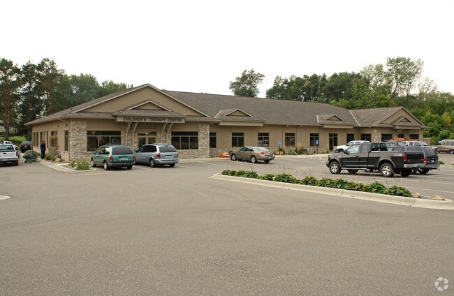
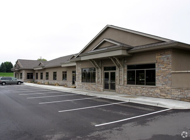
Property Record
2795 Pilot Knob Rd, Saint Paul, MN 55121

Property Detail
2795 Pilot Knob Rd
Minneapolis-St. Paul-Bloomington, MN-WI
CHILDRENS THERAPY ADDITION 1 1
10-17250-01-010
DAKOTA
Commercialnec
Minnesota
B and X Area of moderate flood hazard, usually the area between the limits of the 100-year and 500-year floods.
10
2024
1.55 AC
2024
Burnsville/Eagan/Apple Vy
060726
Minneapolis/St Paul
14,535 SF
NEARBY LISTINGS FOR SALE OR LEASE
DEMOGRAPHICS near 2795 Pilot Knob Rd
1 mile
3 mile
5 mile
2025 Total Population
2,408
34,232
164,496
2030 Population
2,453
35,210
167,404
Pop Growth 2025-2030
+ 1.87%
+ 2.86%
+ 1.77%
Average Age
39
41
41
2025 Total Households
954
15,164
68,576
HH Growth 2025-2030
+ 1.89%
+ 2.96%
+ 1.78%
Median Household Inc
$91,649
$97,240
$93,675
Avg Household Size
2.50
2.20
2.30
2025 Avg HH Vehicles
2.00
2.00
2.00
Median Home Value
$405,963
$426,202
$386,399
Median Year Built
1987
1988
1979
Nearby Places
Map Layers
Map Styles
 Street
 Aerial
Transit
 Traffic
 Biking
Places
Listings with unknown addresses are not visible on the map
- Restaurants
- Banks
- Shops
- Fitness
- Groceries
PUBLIC TRANSPORTATION
COMMUTER RAIL
St. Paul-Minneapolis (Empire Builder - Amtrak)
Drive
Walk
Distance
St. Paul-Minneapolis (Empire Builder - Amtrak)
15 min
9.7 mi
AIRPORT
Minneapolis-St Paul International/Wold-Chamberlain
Drive
Walk
Distance
Minneapolis-St Paul International/Wold-Chamberlain
10 min
4.9 mi
Freight Ports
Port Milwaukee
Drive
Walk
Distance
Port Milwaukee
371 min
336.3 mi
SALE & LEASE HISTORY
LISTING DATE
SALE/LEASE

May 08, 2025
For Lease
Nearby Properties
Address
Land Use
TOTAL SIZE
Lot Size
Zoning
Address
Land Use
TOTAL SIZE
Lot Size
Zoning
4.26 AC
Address
Land Use
TOTAL SIZE
Lot Size
Zoning
3.86 AC
Address
Land Use
TOTAL SIZE
Lot Size
Zoning
479,742 SF
11.35 AC
Address
Land Use
TOTAL SIZE
Lot Size
Zoning
4.29 AC
Address
Land Use
TOTAL SIZE
Lot Size
Zoning
466,503 SF
28.74 AC
Address
Land Use
TOTAL SIZE
Lot Size
Zoning
657,358 SF
17.12 AC
Address
Land Use
TOTAL SIZE
Lot Size
Zoning
264,370 SF
36.39 AC
Address
Land Use
TOTAL SIZE
Lot Size
Zoning
2.49 AC
Address
Land Use
TOTAL SIZE
Lot Size
Zoning
247,470 SF
2.21 AC
Address
Land Use
TOTAL SIZE
Lot Size
Zoning
291,589 SF
6.77 AC
Address
Land Use
TOTAL SIZE
Lot Size
Zoning
246,636 SF
7.20 AC
Address
Land Use
TOTAL SIZE
Lot Size
Zoning
192,843 SF
13.32 AC
Address
Land Use
TOTAL SIZE
Lot Size
Zoning
223,583 SF
5.32 AC
Address
Land Use
TOTAL SIZE
Lot Size
Zoning
381,158 SF
11.86 AC
Address
Land Use
TOTAL SIZE
Lot Size
Zoning
317,235 SF
32.38 AC
Address
Land Use
TOTAL SIZE
Lot Size
Zoning
33,246 SF
5.16 AC
Address
Land Use
TOTAL SIZE
Lot Size
Zoning
378,880 SF
3.42 AC
Address
Land Use
TOTAL SIZE
Lot Size
Zoning
206,818 SF
2.84 AC
Address
Land Use
TOTAL SIZE
Lot Size
Zoning
300,000 SF
18.44 AC
Address
Land Use
TOTAL SIZE
Lot Size
Zoning
314,237 SF
10.63 AC
Address
Land Use
TOTAL SIZE
Lot Size
Zoning
47,397 SF
6.78 AC
Address
Land Use
TOTAL SIZE
Lot Size
Zoning
240,316 SF
9.57 AC
Address
Land Use
TOTAL SIZE
Lot Size
Zoning
Address
Land Use
TOTAL SIZE
Lot Size
Zoning
170,292 SF
2.08 AC
Address
Land Use
TOTAL SIZE
Lot Size
Zoning
Address
Land Use
TOTAL SIZE
Lot Size
Zoning
34,152 SF
6.11 AC
Address
Land Use
TOTAL SIZE
Lot Size
Zoning
26,838 SF
1.30 AC
Address
Land Use
TOTAL SIZE
Lot Size
Zoning
247,451 SF
9.57 AC
Address
Land Use
TOTAL SIZE
Lot Size
Zoning
110,979 SF
9.65 AC
Address
Land Use
TOTAL SIZE
Lot Size
Zoning
278,320 SF
31.12 AC
The World's #1 Commercial Real Estate Marketplace
Connect with us
© 2026 CoStar Group
The information above has been obtained from sources believed reliable. While we do not doubt its accuracy we have not verified it and make no guarantee, warranty or representation about it. It is your responsibility to independently confirm its accuracy and completeness. Any projections, opinions, assumptions, or estimates used are for example only and do not represent the current or future performance of the property. The value of this transaction to you depends on tax and other factors which should be evaluated by your tax, financial, and legal advisors. You and your advisors should conduct a careful, independent investigation of the property to determine to your satisfaction the suitability of the property for your needs.