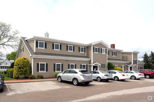
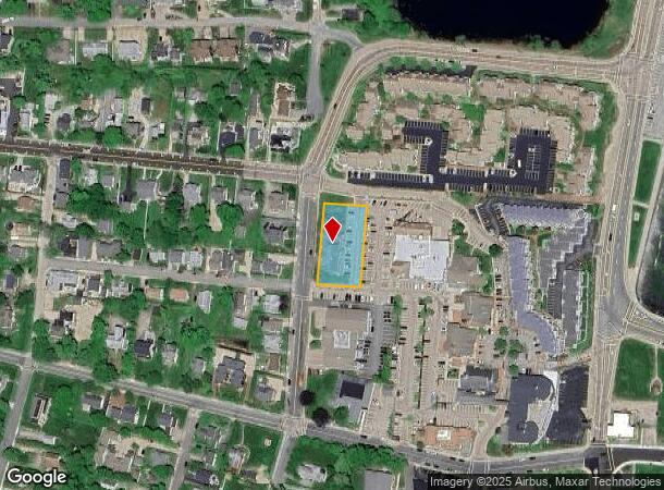
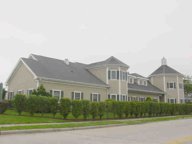
Property Record
28 Caswell St, Narragansett, RI 02882
NEARBY LISTINGS FOR SALE OR LEASE
Property Detail
28 Caswell St
NARR-000181-C000000-000014
Washington
Commercialbuilding
Rhode Island
AE
14
44009C0212J
0.59 AC
2025
Washington County
2025
Providence
051503
Providence-Warwick, RI-MA
10,270 SF
DEMOGRAPHICS near 28 Caswell St
1 Mile
3 Mile
5 Mile
2024 Total Population
3,298
16,277
39,767
2029 Population
3,460
16,570
40,495
Pop Growth 2024-2029
+ 4.91%
+ 1.80%
+ 1.83%
Average Age
48
47
43
2024 Total Households
1,635
7,327
15,752
HH Growth 2024-2029
+ 4.89%
+ 1.69%
+ 1.94%
Median Household Inc
$68,239
$88,692
$91,179
Avg Household Size
1.90
2.10
2.20
2024 Avg HH Vehicles
2.00
2.00
2.00
Median Home Value
$714,669
$482,814
$487,089
Median Year Built
1974
1974
1976
Nearby Places
Map Layers
Map Styles
 Street
 Aerial
- Restaurants
- Banks
- Shops
- Fitness
- Groceries
PUBLIC TRANSPORTATION
COMMUTER RAIL
DRIVE
WALK
Distance
16 min
7.6 mi
AIRPORT
Rhode Island Tf Green International
DRIVE
WALK
Distance
Rhode Island Tf Green International
42 min
26.0 mi
Freight Ports
Port of Davisville, RI
DRIVE
WALK
Distance
Port of Davisville, RI
30 min
16.4 mi
SALE & LEASE HISTORY
LISTING DATE
SALE/LEASE

Sep 25, 2016
For Lease
Oct 25, 2023
For Lease
Nearby Properties
Address
Land Use
TOTAL SIZE
Lot Size
Zoning
Address
Land Use
TOTAL SIZE
Lot Size
Zoning
17.06 AC
GI
Address
Land Use
TOTAL SIZE
Lot Size
Zoning
245,692 SF
11.12 AC
GI
Address
Land Use
TOTAL SIZE
Lot Size
Zoning
35.38 AC
B-B
Address
Land Use
TOTAL SIZE
Lot Size
Zoning
151,375 SF
12.17 AC
SMD
Address
Land Use
TOTAL SIZE
Lot Size
Zoning
7.36 AC
R-40
Address
Land Use
TOTAL SIZE
Lot Size
Zoning
10 AC
SMD
Address
Land Use
TOTAL SIZE
Lot Size
Zoning
88,358 SF
20.25 AC
P
Address
Land Use
TOTAL SIZE
Lot Size
Zoning
90,528 SF
13.32 AC
R-40
Address
Land Use
TOTAL SIZE
Lot Size
Zoning
3.67 AC
P
Address
Land Use
TOTAL SIZE
Lot Size
Zoning
6.50 AC
SMD
Address
Land Use
TOTAL SIZE
Lot Size
Zoning
150.79 AC
GI
Address
Land Use
TOTAL SIZE
Lot Size
Zoning
32.16 AC
B-C
Address
Land Use
TOTAL SIZE
Lot Size
Zoning
24.81 AC
GI
Address
Land Use
TOTAL SIZE
Lot Size
Zoning
15.20 AC
SMD
Address
Land Use
TOTAL SIZE
Lot Size
Zoning
34.60 AC
P
Address
Land Use
TOTAL SIZE
Lot Size
Zoning
1 AC
R-80
Address
Land Use
TOTAL SIZE
Lot Size
Zoning
91,020 SF
6.95 AC
RM
Address
Land Use
TOTAL SIZE
Lot Size
Zoning
85,477 SF
6.23 AC
GI
Address
Land Use
TOTAL SIZE
Lot Size
Zoning
13.34 AC
CH
Address
Land Use
TOTAL SIZE
Lot Size
Zoning
41.50 AC
GI
Address
Land Use
TOTAL SIZE
Lot Size
Zoning
8.35 AC
B-B
Address
Land Use
TOTAL SIZE
Lot Size
Zoning
45 AC
R-80
Address
Land Use
TOTAL SIZE
Lot Size
Zoning
5.03 AC
CH
Address
Land Use
TOTAL SIZE
Lot Size
Zoning
63,563 SF
13.25 AC
R80
Address
Land Use
TOTAL SIZE
Lot Size
Zoning
152.15 AC
P
Address
Land Use
TOTAL SIZE
Lot Size
Zoning
1.28 AC
R-80
Address
Land Use
TOTAL SIZE
Lot Size
Zoning
4.47 AC
B-B
Address
Land Use
TOTAL SIZE
Lot Size
Zoning
1.27 AC
SMD
Address
Land Use
TOTAL SIZE
Lot Size
Zoning
44,985 SF
2.69 AC
R
Address
Land Use
TOTAL SIZE
Lot Size
Zoning
3.43 AC
R-80
The World's #1 Commercial Real Estate Marketplace
Connect with us
© 2025 CoStar Group
The information above has been obtained from sources believed reliable. While we do not doubt its accuracy we have not verified it and make no guarantee, warranty or representation about it. It is your responsibility to independently confirm its accuracy and completeness. Any projections, opinions, assumptions, or estimates used are for example only and do not represent the current or future performance of the property. The value of this transaction to you depends on tax and other factors which should be evaluated by your tax, financial, and legal advisors. You and your advisors should conduct a careful, independent investigation of the property to determine to your satisfaction the suitability of the property for your needs.