Property Record
28 Cedar Bluffs Dr, Hendersonville, NC 28792
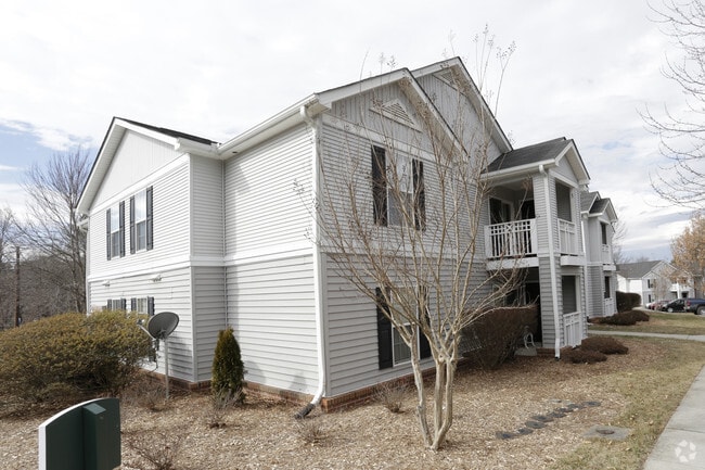


Property Detail
28 Cedar Bluffs Dr
0101096
SR1516 ON FRANCIS RD PL2023-15298
Recreationalentertainmentgeneral
Henderson
101096~PRD
North Carolina
AE The base floodplain where base flood elevations are provided. AE Zones are now used on new format FIRMs instead of A1-A30 Zones.
83
0
9.35 AC
2025
Outlying Henderson County
931000
Asheville
1,287 SF
Asheville, NC
NEARBY LISTINGS FOR SALE OR LEASE
-
-
View all Hendersonville listings for sale on LoopNet.com
DEMOGRAPHICS near 28 Cedar Bluffs Dr
1 mile
3 mile
5 mile
2025 Total Population
4,510
27,302
61,845
2030 Population
4,671
28,196
63,906
Pop Growth 2025-2030
+ 3.57%
+ 3.27%
+ 3.33%
Average Age
47
45
46
2025 Total Households
2,085
12,049
26,709
HH Growth 2025-2030
+ 3.69%
+ 3.45%
+ 3.47%
Median Household Inc
$51,511
$53,409
$57,120
Avg Household Size
2.10
2.20
2.20
2025 Avg HH Vehicles
2.00
2.00
2.00
Median Home Value
$273,958
$316,009
$348,503
Median Year Built
1990
1982
1983
Nearby Places
Map Layers
Map Styles
 Street
 Aerial
Layers
 Traffic
 Biking
Places
Listings with unknown addresses are not visible on the map
- Restaurants
- Banks
- Shops
- Fitness
- Groceries
PUBLIC TRANSPORTATION
AIRPORT
Asheville Regional
Drive
Walk
Distance
Asheville Regional
14 min
10.3 mi
Freight Ports
North Charleston Terminal
Drive
Walk
Distance
North Charleston Terminal
264 min
236.3 mi
Nearby Properties
Address
Land Use
TOTAL SIZE
Lot Size
Zoning
Address
Land Use
TOTAL SIZE
Lot Size
Zoning
8,728 SF
8.84 AC
9970930~PC
Address
Land Use
TOTAL SIZE
Lot Size
Zoning
60,582 SF
9.54 AC
10010646~R
Address
Land Use
TOTAL SIZE
Lot Size
Zoning
60,582 SF
9.53 AC
9948805~R-
Address
Land Use
TOTAL SIZE
Lot Size
Zoning
96,084 SF
13.96 AC
1013416~PI
Address
Land Use
TOTAL SIZE
Lot Size
Zoning
4,800 SF
29.70 AC
1007531~PR
Address
Land Use
TOTAL SIZE
Lot Size
Zoning
97,776 SF
0.92 AC
1009121~MI
Address
Land Use
TOTAL SIZE
Lot Size
Zoning
170,797 SF
55.91 AC
1013176~R1
Address
Land Use
TOTAL SIZE
Lot Size
Zoning
2,888 SF
26.93 AC
10006080~I
Address
Land Use
TOTAL SIZE
Lot Size
Zoning
29,233 SF
83.09 AC
10005104~O
Address
Land Use
TOTAL SIZE
Lot Size
Zoning
172,244 SF
18.87 AC
9968664~R-
Address
Land Use
TOTAL SIZE
Lot Size
Zoning
223,395 SF
29.32 AC
9968634~PC
Address
Land Use
TOTAL SIZE
Lot Size
Zoning
12,309 SF
6.52 AC
10005105~O
Address
Land Use
TOTAL SIZE
Lot Size
Zoning
105,179 SF
5.20 AC
1008855~PC
Address
Land Use
TOTAL SIZE
Lot Size
Zoning
90,000 SF
19.59 AC
1004354~R2
Address
Land Use
TOTAL SIZE
Lot Size
Zoning
3,314 SF
14.75 AC
9969886~PR
Address
Land Use
TOTAL SIZE
Lot Size
Zoning
94,826 SF
8.85 AC
300593~HMU
Address
Land Use
TOTAL SIZE
Lot Size
Zoning
102,649 SF
7.08 AC
9904585~PI
Address
Land Use
TOTAL SIZE
Lot Size
Zoning
106,374 SF
32.85 AC
1013177~R1
Address
Land Use
TOTAL SIZE
Lot Size
Zoning
84,486 SF
36.02 AC
9964983~R2
Address
Land Use
TOTAL SIZE
Lot Size
Zoning
92,512 SF
3.38 AC
9968665~PR
Address
Land Use
TOTAL SIZE
Lot Size
Zoning
135,809 SF
13.87 AC
9967831~PC
Address
Land Use
TOTAL SIZE
Lot Size
Zoning
94,066 SF
15.21 AC
9970994~PC
Address
Land Use
TOTAL SIZE
Lot Size
Zoning
40,975 SF
1.15 AC
9904361~C-
Address
Land Use
TOTAL SIZE
Lot Size
Zoning
72,560 SF
7.23 AC
10000067~P
Address
Land Use
TOTAL SIZE
Lot Size
Zoning
59,072 SF
6.62 AC
10008042~R
Address
Land Use
TOTAL SIZE
Lot Size
Zoning
68,080 SF
2.30 AC
1001184~PC
Address
Land Use
TOTAL SIZE
Lot Size
Zoning
690,212 SF
105.90 AC
1010645~I-
Address
Land Use
TOTAL SIZE
Lot Size
Zoning
33,419 SF
1.56 AC
10005796~R
Address
Land Use
TOTAL SIZE
Lot Size
Zoning
23,960 SF
5.91 AC
1013700~HM
Address
Land Use
TOTAL SIZE
Lot Size
Zoning
9,947 SF
1.67 AC
9948806~C-
The World's #1 Commercial Real Estate Marketplace
Connect with us
© 2026 CoStar Group
The information above has been obtained from sources believed reliable. While we do not doubt its accuracy we have not verified it and make no guarantee, warranty or representation about it. It is your responsibility to independently confirm its accuracy and completeness. Any projections, opinions, assumptions, or estimates used are for example only and do not represent the current or future performance of the property. The value of this transaction to you depends on tax and other factors which should be evaluated by your tax, financial, and legal advisors. You and your advisors should conduct a careful, independent investigation of the property to determine to your satisfaction the suitability of the property for your needs.