Property Record
28 Commercial Ct, Auburn, NH 03032


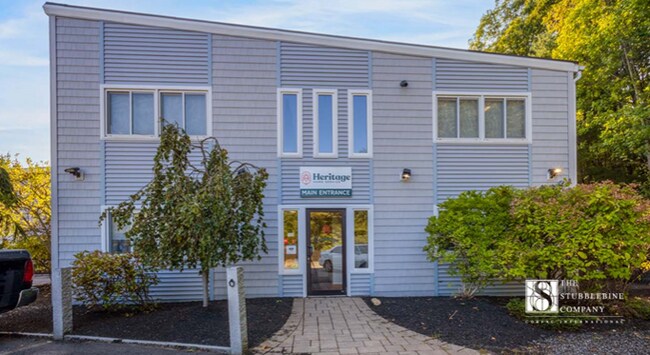
This Property Is For Sale
NEARBY LISTINGS FOR SALE OR LEASE
-
-
View all Auburn listings for sale on LoopNet.com
Property Detail
28 Commercial Ct
AUBR-000001-000016-000024
Rockingham
Commercialbuilding
New Hampshire
X
24
33015C0328E
2.71 AC
2024
Rockingham
2024
Boston
004000
Boston-Cambridge-Newton, MA-NH
24,958 SF
DEMOGRAPHICS near 28 Commercial Ct
1 Mile
3 Mile
5 Mile
2024 Total Population
656
12,309
62,664
2029 Population
661
12,587
63,293
Pop Growth 2024-2029
+ 0.76%
+ 2.26%
+ 1.00%
Average Age
42
41
41
2024 Total Households
224
4,530
25,020
HH Growth 2024-2029
+ 0.89%
+ 2.27%
+ 0.94%
Median Household Inc
$184,210
$127,229
$103,916
Avg Household Size
2.90
2.60
2.40
2024 Avg HH Vehicles
3.00
2.00
2.00
Median Home Value
$701,851
$485,355
$417,305
Median Year Built
1978
1989
1978
Nearby Places
Map Layers
Map Styles
 Street
 Aerial
- Restaurants
- Banks
- Shops
- Fitness
- Groceries
PUBLIC TRANSPORTATION
AIRPORT
Manchester Boston Regional
DRIVE
WALK
Distance
Manchester Boston Regional
24 min
10.1 mi
Portsmouth International at Pease
DRIVE
WALK
Distance
Portsmouth International at Pease
62 min
41.7 mi
Freight Ports
Port of Boston
DRIVE
WALK
Distance
Port of Boston
73 min
48.9 mi
Nearby Properties
Address
Land Use
TOTAL SIZE
Lot Size
Zoning
Address
Land Use
TOTAL SIZE
Lot Size
Zoning
366,008 SF
41.69 AC
IND-I
Address
Land Use
TOTAL SIZE
Lot Size
Zoning
487,970 SF
79.74 AC
IND-I
Address
Land Use
TOTAL SIZE
Lot Size
Zoning
119,139 SF
25.87 AC
IND-I
Address
Land Use
TOTAL SIZE
Lot Size
Zoning
6 AC
RURAL
Address
Land Use
TOTAL SIZE
Lot Size
Zoning
92,492 SF
85 AC
Address
Land Use
TOTAL SIZE
Lot Size
Zoning
125,060 SF
8.76 AC
IND-I
Address
Land Use
TOTAL SIZE
Lot Size
Zoning
156,000 SF
19.19 AC
Address
Land Use
TOTAL SIZE
Lot Size
Zoning
Address
Land Use
TOTAL SIZE
Lot Size
Zoning
722 SF
65 AC
Address
Land Use
TOTAL SIZE
Lot Size
Zoning
56,769 SF
20.09 AC
Address
Land Use
TOTAL SIZE
Lot Size
Zoning
282,303 SF
19.41 AC
Address
Land Use
TOTAL SIZE
Lot Size
Zoning
133,900 SF
Address
Land Use
TOTAL SIZE
Lot Size
Zoning
952 SF
199 AC
AR-I
Address
Land Use
TOTAL SIZE
Lot Size
Zoning
160,452 SF
20.44 AC
Address
Land Use
TOTAL SIZE
Lot Size
Zoning
768 SF
1.90 AC
Address
Land Use
TOTAL SIZE
Lot Size
Zoning
104.90 AC
Address
Land Use
TOTAL SIZE
Lot Size
Zoning
62,164 SF
25.47 AC
IND-I
Address
Land Use
TOTAL SIZE
Lot Size
Zoning
113.28 AC
Address
Land Use
TOTAL SIZE
Lot Size
Zoning
91,360 SF
Address
Land Use
TOTAL SIZE
Lot Size
Zoning
7,414 SF
5.32 AC
Address
Land Use
TOTAL SIZE
Lot Size
Zoning
2,866 SF
3.57 AC
Address
Land Use
TOTAL SIZE
Lot Size
Zoning
56,000 SF
5.93 AC
Address
Land Use
TOTAL SIZE
Lot Size
Zoning
106,008 SF
7.80 AC
Address
Land Use
TOTAL SIZE
Lot Size
Zoning
52,711 SF
4.23 AC
Address
Land Use
TOTAL SIZE
Lot Size
Zoning
70,714 SF
35.18 AC
Address
Land Use
TOTAL SIZE
Lot Size
Zoning
73,640 SF
7.87 AC
Address
Land Use
TOTAL SIZE
Lot Size
Zoning
46,460 SF
6.55 AC
IND-II
Address
Land Use
TOTAL SIZE
Lot Size
Zoning
16,170 SF
10.26 AC
IND-I
Address
Land Use
TOTAL SIZE
Lot Size
Zoning
110 AC
RESIDE
Address
Land Use
TOTAL SIZE
Lot Size
Zoning
24,000 SF
32.17 AC
IND-II
The World's #1 Commercial Real Estate Marketplace
Connect with us
© 2025 CoStar Group
The information above has been obtained from sources believed reliable. While we do not doubt its accuracy we have not verified it and make no guarantee, warranty or representation about it. It is your responsibility to independently confirm its accuracy and completeness. Any projections, opinions, assumptions, or estimates used are for example only and do not represent the current or future performance of the property. The value of this transaction to you depends on tax and other factors which should be evaluated by your tax, financial, and legal advisors. You and your advisors should conduct a careful, independent investigation of the property to determine to your satisfaction the suitability of the property for your needs.