Property Record
28 Daniel Cir, Gulf Breeze, FL 32561

Property Detail
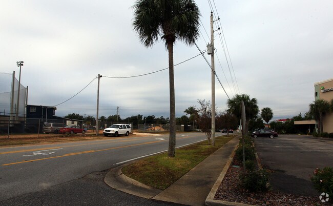
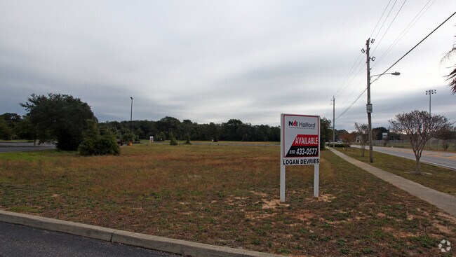
28 Daniel Cir
04-3S-29-0000-00107-0000
*DESCRIPTION UPDATE FOR 2023* COM AT SW CORNER OF GOVT LOT 1 IN SECTION 04 TOWNSHIP 3 SOUTH RANGE 29 WEST THN S88*25'55E 303.82 FT THN N20*41'05W 35.66 FT THN S88*25'55E 344.98 FT TO POB THN CONT 222.89 FT THN N1*34' 05W 194.65 FT THN S61*25'32W 126.
Medicalbuilding
SANTA ROSA
C1
Florida
B and X Area of moderate flood hazard, usually the area between the limits of the 100-year and 500-year floods.
1
2025
0.73 AC
2025
Gulf Breeze
010900
Pensacola
10,944 SF
Pensacola-Ferry Pass-Brent, FL
NEARBY LISTINGS FOR SALE OR LEASE
-
-
View all Gulf Breeze listings for lease on LoopNet.com
DEMOGRAPHICS near 28 Daniel Cir
1 mile
3 mile
5 mile
2025 Total Population
4,095
9,865
29,779
2030 Population
4,428
10,735
31,881
Pop Growth 2025-2030
+ 8.13%
+ 8.82%
+ 7.06%
Average Age
45
47
45
2025 Total Households
1,711
4,223
13,289
HH Growth 2025-2030
+ 7.89%
+ 8.88%
+ 6.91%
Median Household Inc
$118,833
$126,146
$106,439
Avg Household Size
2.40
2.30
2.20
2025 Avg HH Vehicles
2.00
2.00
2.00
Median Home Value
$635,120
$618,731
$479,477
Median Year Built
1974
1978
1980
Nearby Places
Map Layers
Map Styles
 Street
 Aerial
Layers
 Traffic
 Biking
Places
Listings with unknown addresses are not visible on the map
- Restaurants
- Banks
- Shops
- Fitness
- Groceries
PUBLIC TRANSPORTATION
AIRPORT
Pensacola International
Drive
Walk
Distance
Pensacola International
20 min
10.6 mi
Freight Ports
Port of Mobile
Drive
Walk
Distance
Port of Mobile
77 min
64.4 mi
SALE & LEASE HISTORY
LISTING DATE
SALE/LEASE

Sep 26, 2016
For Lease
Nearby Properties
Address
Land Use
TOTAL SIZE
Lot Size
Zoning
Address
Land Use
TOTAL SIZE
Lot Size
Zoning
3,476 SF
540 AC
Address
Land Use
TOTAL SIZE
Lot Size
Zoning
10,134 SF
308 AC
Address
Land Use
TOTAL SIZE
Lot Size
Zoning
83,895 SF
149.82 AC
P
Address
Land Use
TOTAL SIZE
Lot Size
Zoning
341,192 SF
5.33 AC
CH-PB
Address
Land Use
TOTAL SIZE
Lot Size
Zoning
186,964 SF
21.30 AC
M
Address
Land Use
TOTAL SIZE
Lot Size
Zoning
130,923 SF
25.06 AC
CH-PB,GR-P
Address
Land Use
TOTAL SIZE
Lot Size
Zoning
5,410 SF
72 AC
P
Address
Land Use
TOTAL SIZE
Lot Size
Zoning
142,141 SF
3.92 AC
HDR/C-PB
Address
Land Use
TOTAL SIZE
Lot Size
Zoning
120,500 SF
11.11 AC
C1
Address
Land Use
TOTAL SIZE
Lot Size
Zoning
142,717 SF
5.25 AC
R1A
Address
Land Use
TOTAL SIZE
Lot Size
Zoning
132,772 SF
3.65 AC
CH-PB
Address
Land Use
TOTAL SIZE
Lot Size
Zoning
135,461 SF
9.54 AC
C1
Address
Land Use
TOTAL SIZE
Lot Size
Zoning
109,120 SF
4.65 AC
HDR/C-PB
Address
Land Use
TOTAL SIZE
Lot Size
Zoning
77,250 SF
10 AC
G/C-PB
Address
Land Use
TOTAL SIZE
Lot Size
Zoning
116,896 SF
8.12 AC
C1
Address
Land Use
TOTAL SIZE
Lot Size
Zoning
84,933 SF
4.09 AC
C1
Address
Land Use
TOTAL SIZE
Lot Size
Zoning
73,354 SF
0.96 AC
C1
Address
Land Use
TOTAL SIZE
Lot Size
Zoning
106,998 SF
2.82 AC
MDR/C-PB
Address
Land Use
TOTAL SIZE
Lot Size
Zoning
65,959 SF
5.28 AC
C1
Address
Land Use
TOTAL SIZE
Lot Size
Zoning
56,031 SF
2.93 AC
C1
Address
Land Use
TOTAL SIZE
Lot Size
Zoning
73,396 SF
6.31 AC
C1
Address
Land Use
TOTAL SIZE
Lot Size
Zoning
57,926 SF
1.58 AC
C1
Address
Land Use
TOTAL SIZE
Lot Size
Zoning
1,566 SF
16.74 AC
CON/REC-PB
Address
Land Use
TOTAL SIZE
Lot Size
Zoning
38,717 SF
2.95 AC
C1
Address
Land Use
TOTAL SIZE
Lot Size
Zoning
57,128 SF
3.66 AC
CH-PB
Address
Land Use
TOTAL SIZE
Lot Size
Zoning
50,259 SF
3.52 AC
C1
Address
Land Use
TOTAL SIZE
Lot Size
Zoning
62,335 SF
8.76 AC
R1A
Address
Land Use
TOTAL SIZE
Lot Size
Zoning
70,426 SF
1.61 AC
C1
Address
Land Use
TOTAL SIZE
Lot Size
Zoning
43,495 SF
2.89 AC
C1
Address
Land Use
TOTAL SIZE
Lot Size
Zoning
28,913 SF
2.04 AC
C1
The World's #1 Commercial Real Estate Marketplace
Connect with us
© 2026 CoStar Group
The information above has been obtained from sources believed reliable. While we do not doubt its accuracy we have not verified it and make no guarantee, warranty or representation about it. It is your responsibility to independently confirm its accuracy and completeness. Any projections, opinions, assumptions, or estimates used are for example only and do not represent the current or future performance of the property. The value of this transaction to you depends on tax and other factors which should be evaluated by your tax, financial, and legal advisors. You and your advisors should conduct a careful, independent investigation of the property to determine to your satisfaction the suitability of the property for your needs.