Property Record
28 Ironstone Rd, Uxbridge, MA 01569

Save to a Folder
{{folder.Name}}
{{folder.ListingIds.length}} Properties
{{folder.ListingIds.length}} Property
Create a New Folder
Property Detail
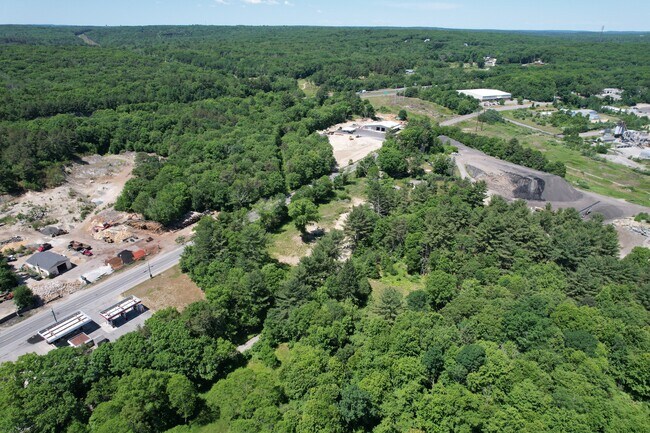
28 Ironstone Rd
UXBR-000450-003128
Worcester
Residentialacreage
Massachusetts
I
9.21 AC
AE The base floodplain where base flood elevations are provided. AE Zones are now used on new format FIRMs instead of A1-A30 Zones.
Outlying Worcester
2025
Boston
2025
Worcester, MA
749100
NEARBY LISTINGS FOR SALE OR LEASE
DEMOGRAPHICS near 28 Ironstone Rd
1 mile
3 mile
5 mile
2025 Total Population
530
13,148
46,223
2030 Population
558
13,664
47,697
Pop Growth 2025-2030
+ 5.28%
+ 3.92%
+ 3.19%
Average Age
43
42
42
2025 Total Households
198
5,003
18,008
HH Growth 2025-2030
+ 5.56%
+ 4.02%
+ 3.22%
Median Household Inc
$150,625
$123,829
$108,758
Avg Household Size
2.70
2.60
2.50
2025 Avg HH Vehicles
2.00
2.00
2.00
Median Home Value
$575,243
$478,867
$457,708
Median Year Built
2000
1982
1972
Nearby Places
Map Layers
Map Styles
 Street
 Aerial
Layers
 Traffic
 Biking
Places
Listings with unknown addresses are not visible on the map
- Restaurants
- Banks
- Shops
- Fitness
- Groceries
PUBLIC TRANSPORTATION
AIRPORT
Worcester Regional
Drive
Walk
Distance
Worcester Regional
36 min
25.3 mi
Rhode Island Tf Green International
Drive
Walk
Distance
Rhode Island Tf Green International
39 min
27.5 mi
Freight Ports
Port of Davisville, RI
Drive
Walk
Distance
Port of Davisville, RI
53 min
39.3 mi
SALE & LEASE HISTORY
LISTING DATE
SALE/LEASE

May 13, 2022
For Sale
Nearby Properties
Address
Land Use
TOTAL SIZE
Lot Size
Zoning
Address
Land Use
TOTAL SIZE
Lot Size
Zoning
450,800 SF
56.41 AC
I
Address
Land Use
TOTAL SIZE
Lot Size
Zoning
602,336 SF
204.50 AC
B
Address
Land Use
TOTAL SIZE
Lot Size
Zoning
31.45 AC
M
Address
Land Use
TOTAL SIZE
Lot Size
Zoning
108.65 AC
RC
Address
Land Use
TOTAL SIZE
Lot Size
Zoning
48,071 SF
44.42 AC
I
Address
Land Use
TOTAL SIZE
Lot Size
Zoning
27,720 SF
4.36 AC
I
Address
Land Use
TOTAL SIZE
Lot Size
Zoning
65,809 SF
17.66 AC
BN
Address
Land Use
TOTAL SIZE
Lot Size
Zoning
28,468 SF
1.24 AC
I
Address
Land Use
TOTAL SIZE
Lot Size
Zoning
42,837 SF
6.34 AC
RS
Address
Land Use
TOTAL SIZE
Lot Size
Zoning
25,100 SF
7.40 AC
I
Address
Land Use
TOTAL SIZE
Lot Size
Zoning
57,698 SF
8.36 AC
RS
Address
Land Use
TOTAL SIZE
Lot Size
Zoning
52,041 SF
47.80 AC
VRD
Address
Land Use
TOTAL SIZE
Lot Size
Zoning
64,110 SF
6 AC
I
Address
Land Use
TOTAL SIZE
Lot Size
Zoning
9,464 SF
53.10 AC
AG
Address
Land Use
TOTAL SIZE
Lot Size
Zoning
33,552 SF
7.87 AC
I
Address
Land Use
TOTAL SIZE
Lot Size
Zoning
53,875 SF
5.42 AC
C
Address
Land Use
TOTAL SIZE
Lot Size
Zoning
7,176 SF
4.55 AC
I
Address
Land Use
TOTAL SIZE
Lot Size
Zoning
56.47 AC
RES
Address
Land Use
TOTAL SIZE
Lot Size
Zoning
22,680 SF
29.31 AC
RC
Address
Land Use
TOTAL SIZE
Lot Size
Zoning
54.63 AC
REA
Address
Land Use
TOTAL SIZE
Lot Size
Zoning
43,654 SF
5.29 AC
I
Address
Land Use
TOTAL SIZE
Lot Size
Zoning
17,924 SF
5.62 AC
I
Address
Land Use
TOTAL SIZE
Lot Size
Zoning
18,424 SF
4.93 AC
RC
Address
Land Use
TOTAL SIZE
Lot Size
Zoning
2,706 SF
43.74 AC
RC
Address
Land Use
TOTAL SIZE
Lot Size
Zoning
12,848 SF
2.62 AC
RS
Address
Land Use
TOTAL SIZE
Lot Size
Zoning
29,650 SF
5 AC
MU2
Address
Land Use
TOTAL SIZE
Lot Size
Zoning
32,428 SF
5.99 AC
B
Address
Land Use
TOTAL SIZE
Lot Size
Zoning
40,271 SF
2.18 AC
M
Address
Land Use
TOTAL SIZE
Lot Size
Zoning
27,673 SF
10.01 AC
B
Address
Land Use
TOTAL SIZE
Lot Size
Zoning
1.71 AC
RS
The World's #1 Commercial Real Estate Marketplace
Connect with us
© 2026 CoStar Group
The information above has been obtained from sources believed reliable. While we do not doubt its accuracy we have not verified it and make no guarantee, warranty or representation about it. It is your responsibility to independently confirm its accuracy and completeness. Any projections, opinions, assumptions, or estimates used are for example only and do not represent the current or future performance of the property. The value of this transaction to you depends on tax and other factors which should be evaluated by your tax, financial, and legal advisors. You and your advisors should conduct a careful, independent investigation of the property to determine to your satisfaction the suitability of the property for your needs.