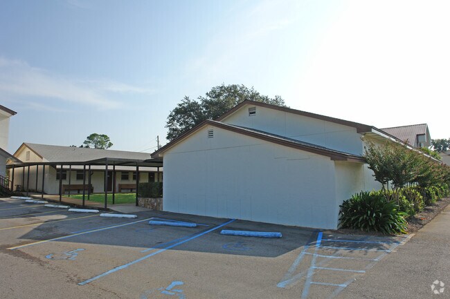
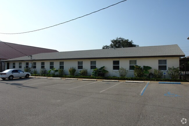
Property Record
28 North St, Mary Esther, FL 32569

NEARBY LISTINGS FOR SALE OR LEASE
Property Detail
28 North St
Other Market Areas
Gulfview S/D
Crestview-Fort Walton Beach-Destin, FL
GULFVIEW S/D LOTS 3 TO 8 AND 18 TO 28 AND S 125FT OF LOTS 16, 17 BLK F
17-2S-24-1100-000F-0030
Okaloosa
Religious
Florida
0
30
2025
3.03 AC
022900
Fort Walton Beach
30,713 SF
DEMOGRAPHICS near 28 North St
1 Mile
3 Mile
5 Mile
2024 Total Population
1,507
22,451
63,945
2029 Population
1,605
23,583
67,233
Pop Growth 2024-2029
+ 6.50%
+ 5.04%
+ 5.14%
Average Age
41
39
39
2024 Total Households
640
9,038
27,187
HH Growth 2024-2029
+ 6.56%
+ 5.07%
+ 5.32%
Median Household Inc
$82,281
$63,072
$57,754
Avg Household Size
2.30
2.40
2.20
2024 Avg HH Vehicles
2.00
2.00
2.00
Median Home Value
$261,009
$257,616
$258,750
Median Year Built
1978
1981
1982
Nearby Places
Map Layers
Map Styles
 Street
 Aerial
- Restaurants
- Banks
- Shops
- Fitness
- Groceries
PUBLIC TRANSPORTATION
AIRPORT
Eglin AFB/Destin-Ft Walton Beach
DRIVE
WALK
Distance
Eglin AFB/Destin-Ft Walton Beach
35 min
15.0 mi
Pensacola International
DRIVE
WALK
Distance
Pensacola International
69 min
41.1 mi
Nearby Properties
Address
Land Use
TOTAL SIZE
Lot Size
Zoning
Address
Land Use
TOTAL SIZE
Lot Size
Zoning
1,954.92 AC
Address
Land Use
TOTAL SIZE
Lot Size
Zoning
173,879 SF
9 AC
Address
Land Use
TOTAL SIZE
Lot Size
Zoning
8,066.36 AC
Address
Land Use
TOTAL SIZE
Lot Size
Zoning
282,804 SF
78.70 AC
Address
Land Use
TOTAL SIZE
Lot Size
Zoning
216,839 SF
9.63 AC
Address
Land Use
TOTAL SIZE
Lot Size
Zoning
55,566 SF
5.40 AC
Address
Land Use
TOTAL SIZE
Lot Size
Zoning
Address
Land Use
TOTAL SIZE
Lot Size
Zoning
182,844 SF
20.62 AC
Address
Land Use
TOTAL SIZE
Lot Size
Zoning
159,550 SF
31.10 AC
Address
Land Use
TOTAL SIZE
Lot Size
Zoning
118,773 SF
26 AC
Address
Land Use
TOTAL SIZE
Lot Size
Zoning
62,097 SF
4.86 AC
Address
Land Use
TOTAL SIZE
Lot Size
Zoning
75,892 SF
1.72 AC
Address
Land Use
TOTAL SIZE
Lot Size
Zoning
3,894 SF
315.07 AC
Address
Land Use
TOTAL SIZE
Lot Size
Zoning
121,164 SF
5.78 AC
Address
Land Use
TOTAL SIZE
Lot Size
Zoning
287,257 SF
13.86 AC
Address
Land Use
TOTAL SIZE
Lot Size
Zoning
229,805 SF
19.31 AC
Address
Land Use
TOTAL SIZE
Lot Size
Zoning
71,050 SF
2.52 AC
Address
Land Use
TOTAL SIZE
Lot Size
Zoning
78,958 SF
7.88 AC
Address
Land Use
TOTAL SIZE
Lot Size
Zoning
51,195 SF
6.10 AC
Address
Land Use
TOTAL SIZE
Lot Size
Zoning
16,204 SF
254.05 AC
Address
Land Use
TOTAL SIZE
Lot Size
Zoning
28,816 SF
1.71 AC
Address
Land Use
TOTAL SIZE
Lot Size
Zoning
47,490 SF
13.69 AC
Address
Land Use
TOTAL SIZE
Lot Size
Zoning
153,870 SF
13.22 AC
Address
Land Use
TOTAL SIZE
Lot Size
Zoning
30,754 SF
1.30 AC
Address
Land Use
TOTAL SIZE
Lot Size
Zoning
15,206 SF
2.64 AC
Address
Land Use
TOTAL SIZE
Lot Size
Zoning
92,621 SF
24.01 AC
Address
Land Use
TOTAL SIZE
Lot Size
Zoning
408,316 SF
24.91 AC
Address
Land Use
TOTAL SIZE
Lot Size
Zoning
133,532 SF
11.34 AC
Address
Land Use
TOTAL SIZE
Lot Size
Zoning
155,374 SF
12.70 AC
Address
Land Use
TOTAL SIZE
Lot Size
Zoning
107,451 SF
3.54 AC
The World's #1 Commercial Real Estate Marketplace
Connect with us
© 2026 CoStar Group
The information above has been obtained from sources believed reliable. While we do not doubt its accuracy we have not verified it and make no guarantee, warranty or representation about it. It is your responsibility to independently confirm its accuracy and completeness. Any projections, opinions, assumptions, or estimates used are for example only and do not represent the current or future performance of the property. The value of this transaction to you depends on tax and other factors which should be evaluated by your tax, financial, and legal advisors. You and your advisors should conduct a careful, independent investigation of the property to determine to your satisfaction the suitability of the property for your needs.