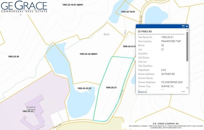
Property Record
28 Pines Rd, Branchville, NJ 07826

NEARBY LISTINGS FOR SALE OR LEASE
-
-
No Photo
-
-
-
View all Branchville listings for sale on LoopNet.com
Property Detail
28 Pines Rd
Newark, NJ-PA
FACILITY NAME: RESIDENCE
05-00025-0000-00021-01
Sussex
Commercialnec
New Jersey
X
21
34037C0163E
2.61 AC
2024
Sussex County
2025
Northern New Jersey
372300
DEMOGRAPHICS near 28 Pines Rd
1 Mile
3 Mile
5 Mile
2024 Total Population
746
4,829
12,461
2029 Population
722
4,846
12,526
Pop Growth 2024-2029
(3.22%)
+ 0.35%
+ 0.52%
Average Age
45
45
46
2024 Total Households
288
1,895
4,999
HH Growth 2024-2029
(3.47%)
+ 0.42%
+ 0.66%
Median Household Inc
$106,818
$103,307
$97,353
Avg Household Size
2.50
2.50
2.50
2024 Avg HH Vehicles
2.00
2.00
2.00
Median Home Value
$347,959
$366,951
$350,425
Median Year Built
1969
1971
1973
Nearby Places
Map Layers
Map Styles
 Street
 Aerial
- Restaurants
- Banks
- Shops
- Fitness
- Groceries
SALE & LEASE HISTORY
LISTING DATE
SALE/LEASE

Sep 02, 2022
For Sale
Jul 25, 2024
For Sale
Nearby Properties
Address
Land Use
TOTAL SIZE
Lot Size
Zoning
Address
Land Use
TOTAL SIZE
Lot Size
Zoning
55.05 AC
O
Address
Land Use
TOTAL SIZE
Lot Size
Zoning
96.14 AC
R-2
Address
Land Use
TOTAL SIZE
Lot Size
Zoning
1,762 SF
21.87 AC
AR
Address
Land Use
TOTAL SIZE
Lot Size
Zoning
14.14 AC
AR
Address
Land Use
TOTAL SIZE
Lot Size
Zoning
4.46 AC
COM
Address
Land Use
TOTAL SIZE
Lot Size
Zoning
864 SF
19.72 AC
R-2
Address
Land Use
TOTAL SIZE
Lot Size
Zoning
592 AC
AR
Address
Land Use
TOTAL SIZE
Lot Size
Zoning
112.54 AC
AR
Address
Land Use
TOTAL SIZE
Lot Size
Zoning
10.87 AC
L-I
Address
Land Use
TOTAL SIZE
Lot Size
Zoning
2.85 AC
L-I
Address
Land Use
TOTAL SIZE
Lot Size
Zoning
4.35 AC
L-I
Address
Land Use
TOTAL SIZE
Lot Size
Zoning
4.44 AC
AR
Address
Land Use
TOTAL SIZE
Lot Size
Zoning
1,396 SF
1.65 AC
R-2
Address
Land Use
TOTAL SIZE
Lot Size
Zoning
1,248 SF
0.70 AC
C-1
Address
Land Use
TOTAL SIZE
Lot Size
Zoning
4.08 AC
AR
Address
Land Use
TOTAL SIZE
Lot Size
Zoning
199.30 AC
AR
Address
Land Use
TOTAL SIZE
Lot Size
Zoning
2,560 SF
5 AC
AR
Address
Land Use
TOTAL SIZE
Lot Size
Zoning
30.93 AC
AR
Address
Land Use
TOTAL SIZE
Lot Size
Zoning
1,800 SF
17.41 AC
B2
Address
Land Use
TOTAL SIZE
Lot Size
Zoning
6.57 AC
R-2
Address
Land Use
TOTAL SIZE
Lot Size
Zoning
187 AC
AR
Address
Land Use
TOTAL SIZE
Lot Size
Zoning
28.28 AC
FCR
Address
Land Use
TOTAL SIZE
Lot Size
Zoning
5.60 AC
CED2
Address
Land Use
TOTAL SIZE
Lot Size
Zoning
1,792 SF
24.32 AC
D 2A
Address
Land Use
TOTAL SIZE
Lot Size
Zoning
3.92 AC
L-I
Address
Land Use
TOTAL SIZE
Lot Size
Zoning
2.94 AC
L-I
Address
Land Use
TOTAL SIZE
Lot Size
Zoning
14,600 SF
8.68 AC
B-2
Address
Land Use
TOTAL SIZE
Lot Size
Zoning
3,400 SF
15.24 AC
R-2
Address
Land Use
TOTAL SIZE
Lot Size
Zoning
2.25 AC
L-I
Address
Land Use
TOTAL SIZE
Lot Size
Zoning
9.41 AC
FCNS
The World's #1 Commercial Real Estate Marketplace
Connect with us
© 2025 CoStar Group
The information above has been obtained from sources believed reliable. While we do not doubt its accuracy we have not verified it and make no guarantee, warranty or representation about it. It is your responsibility to independently confirm its accuracy and completeness. Any projections, opinions, assumptions, or estimates used are for example only and do not represent the current or future performance of the property. The value of this transaction to you depends on tax and other factors which should be evaluated by your tax, financial, and legal advisors. You and your advisors should conduct a careful, independent investigation of the property to determine to your satisfaction the suitability of the property for your needs.