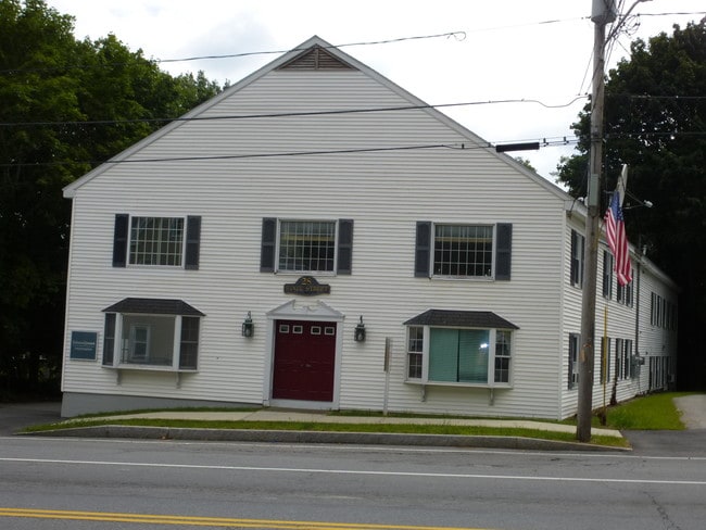
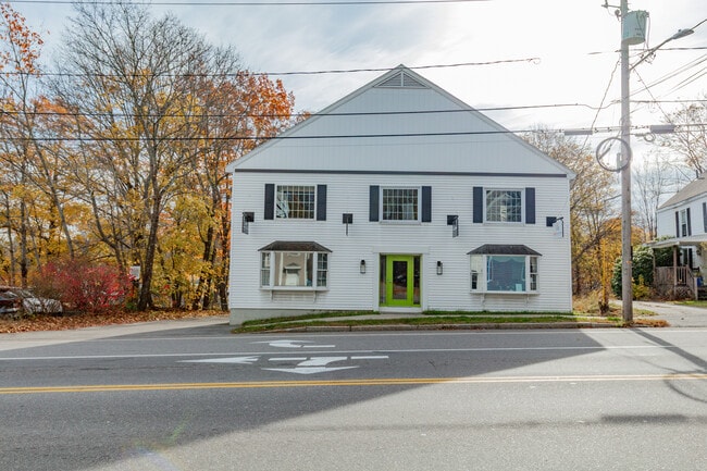
Property Record
28 State St, Gorham, ME 04038
NEARBY LISTINGS FOR SALE OR LEASE
-
-
View all Gorham listings for sale on LoopNet.com
Property Detail
28 State St
GRHM-000102-000029-000005
Village Center Office Condo
Officecondo
Cumberland
X
Maine
23031C0190G
1
2024
0.07 AC
2024
SW Cumberland County
004002
Portland/South Portland
1,920 SF
Portland-South Portland, ME
DEMOGRAPHICS near 28 State St
1 mile
3 mile
5 mile
2024 Total Population
4,492
11,308
36,047
2029 Population
4,649
11,684
37,229
Pop Growth 2024-2029
+ 3.50%
+ 3.33%
+ 3.28%
Average Age
41
40
40
2024 Total Households
1,621
3,932
13,883
HH Growth 2024-2029
+ 3.64%
+ 3.43%
+ 3.34%
Median Household Inc
$85,453
$90,652
$80,960
Avg Household Size
2.40
2.50
2.40
2024 Avg HH Vehicles
2.00
2.00
2.00
Median Home Value
$406,685
$404,120
$343,257
Median Year Built
1980
1983
1979
Nearby Places
Map Layers
Map Styles
 Street
 Aerial
Transit
 Traffic
 Biking
Places
Listings with unknown addresses are not visible on the map
- Restaurants
- Banks
- Shops
- Fitness
- Groceries
PUBLIC TRANSPORTATION
COMMUTER RAIL
Portland (Downeaster - Amtrak)
Drive
Walk
Distance
Portland (Downeaster - Amtrak)
18 min
9.4 mi
AIRPORT
Portland International Jetport
Drive
Walk
Distance
Portland International Jetport
19 min
8.9 mi
Freight Ports
Portland, ME
Drive
Walk
Distance
Portland, ME
21 min
12.0 mi
SALE & LEASE HISTORY
LISTING DATE
SALE/LEASE

Oct 26, 2018
For Sale
Nov 12, 2025
For Sale
Nearby Properties
Address
Land Use
TOTAL SIZE
Lot Size
Zoning
Address
Land Use
TOTAL SIZE
Lot Size
Zoning
19.46 AC
UR
Address
Land Use
TOTAL SIZE
Lot Size
Zoning
93,041 SF
5.53 AC
UR
Address
Land Use
TOTAL SIZE
Lot Size
Zoning
148,964 SF
35.12 AC
UR
Address
Land Use
TOTAL SIZE
Lot Size
Zoning
82,514 SF
59.10 AC
SR
Address
Land Use
TOTAL SIZE
Lot Size
Zoning
7,860 SF
3.07 AC
UC
Address
Land Use
TOTAL SIZE
Lot Size
Zoning
3.44 AC
27
Address
Land Use
TOTAL SIZE
Lot Size
Zoning
25.14 AC
I
Address
Land Use
TOTAL SIZE
Lot Size
Zoning
60,869 SF
17.96 AC
UR
Address
Land Use
TOTAL SIZE
Lot Size
Zoning
79.65 AC
UR
Address
Land Use
TOTAL SIZE
Lot Size
Zoning
74,261 SF
13.03 AC
ND
Address
Land Use
TOTAL SIZE
Lot Size
Zoning
46,764 SF
4.64 AC
UC
Address
Land Use
TOTAL SIZE
Lot Size
Zoning
Address
Land Use
TOTAL SIZE
Lot Size
Zoning
14.78 AC
I
Address
Land Use
TOTAL SIZE
Lot Size
Zoning
107,540 SF
18.50 AC
I
Address
Land Use
TOTAL SIZE
Lot Size
Zoning
Address
Land Use
TOTAL SIZE
Lot Size
Zoning
35,845 SF
5.01 AC
UR
Address
Land Use
TOTAL SIZE
Lot Size
Zoning
33,180 SF
7.95 AC
I
Address
Land Use
TOTAL SIZE
Lot Size
Zoning
43,822 SF
12.19 AC
I
Address
Land Use
TOTAL SIZE
Lot Size
Zoning
61.89 AC
ND
Address
Land Use
TOTAL SIZE
Lot Size
Zoning
30,400 SF
0.94 AC
39
Address
Land Use
TOTAL SIZE
Lot Size
Zoning
40 AC
R
Address
Land Use
TOTAL SIZE
Lot Size
Zoning
17,270 SF
12.87 AC
ND
Address
Land Use
TOTAL SIZE
Lot Size
Zoning
15,970 SF
2.66 AC
UR
Address
Land Use
TOTAL SIZE
Lot Size
Zoning
12,657 SF
19.94 AC
RC
Address
Land Use
TOTAL SIZE
Lot Size
Zoning
34.72 AC
R
Address
Land Use
TOTAL SIZE
Lot Size
Zoning
33.60 AC
R
Address
Land Use
TOTAL SIZE
Lot Size
Zoning
17,805 SF
11.47 AC
UR
Address
Land Use
TOTAL SIZE
Lot Size
Zoning
30,925 SF
Address
Land Use
TOTAL SIZE
Lot Size
Zoning
18,506 SF
5.87 AC
UR
Address
Land Use
TOTAL SIZE
Lot Size
Zoning
57,340 SF
6.50 AC
I
The World's #1 Commercial Real Estate Marketplace
Connect with us
© 2026 CoStar Group
The information above has been obtained from sources believed reliable. While we do not doubt its accuracy we have not verified it and make no guarantee, warranty or representation about it. It is your responsibility to independently confirm its accuracy and completeness. Any projections, opinions, assumptions, or estimates used are for example only and do not represent the current or future performance of the property. The value of this transaction to you depends on tax and other factors which should be evaluated by your tax, financial, and legal advisors. You and your advisors should conduct a careful, independent investigation of the property to determine to your satisfaction the suitability of the property for your needs.