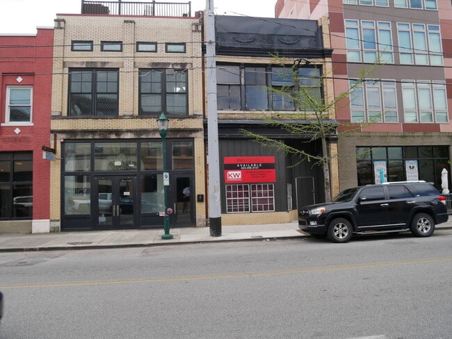
Property Record
28 W Main St, Chattanooga, TN 37408


NEARBY LISTINGS FOR SALE OR LEASE
Property Detail
28 W Main St
Chattanooga, TN-GA
LT 1 SOUTHSIDE EMEMENTARY SCHOOL PB 65 PG 98
145LA-A-001
Hamilton
Publicschool
Tennessee
X
1
47065C0341G
3.49 AC
0
East
2024
Chattanooga
002000
DEMOGRAPHICS near 28 W Main St
1 Mile
3 Mile
5 Mile
2024 Total Population
11,919
59,775
132,751
2029 Population
13,228
65,249
142,183
Pop Growth 2024-2029
+ 10.98%
+ 9.16%
+ 7.11%
Average Age
34
37
38
2024 Total Households
5,826
25,607
56,666
HH Growth 2024-2029
+ 11.96%
+ 9.82%
+ 7.45%
Median Household Inc
$39,259
$43,011
$46,983
Avg Household Size
1.80
2.10
2.20
2024 Avg HH Vehicles
1.00
1.00
2.00
Median Home Value
$371,242
$288,209
$219,071
Median Year Built
1999
1973
1965
Nearby Places
Map Layers
Map Styles
 Street
 Aerial
- Restaurants
- Banks
- Shops
- Fitness
- Groceries
PUBLIC TRANSPORTATION
AIRPORT
Lovell Field
DRIVE
WALK
Distance
Lovell Field
18 min
9.3 mi
Freight Ports
Georgia Ports - Savannah
DRIVE
WALK
Distance
Georgia Ports - Savannah
408 min
364.5 mi
SALE & LEASE HISTORY
LISTING DATE
SALE/LEASE

Nov 11, 2024
For Sale
Nearby Properties
Address
Land Use
TOTAL SIZE
Lot Size
Zoning
Address
Land Use
TOTAL SIZE
Lot Size
Zoning
1,412,692 SF
1.74 AC
C3
Address
Land Use
TOTAL SIZE
Lot Size
Zoning
1,750,017 SF
31.32 AC
Address
Land Use
TOTAL SIZE
Lot Size
Zoning
603,035 SF
21.57 AC
C3
Address
Land Use
TOTAL SIZE
Lot Size
Zoning
6.35 AC
Address
Land Use
TOTAL SIZE
Lot Size
Zoning
409,451 SF
2.53 AC
C3
Address
Land Use
TOTAL SIZE
Lot Size
Zoning
552,237 SF
1.87 AC
Address
Land Use
TOTAL SIZE
Lot Size
Zoning
310,829 SF
1.60 AC
C3
Address
Land Use
TOTAL SIZE
Lot Size
Zoning
293,884 SF
4.40 AC
Address
Land Use
TOTAL SIZE
Lot Size
Zoning
298,706 SF
1.18 AC
Address
Land Use
TOTAL SIZE
Lot Size
Zoning
91,908 SF
2.64 AC
C3
Address
Land Use
TOTAL SIZE
Lot Size
Zoning
22.44 AC
M1
Address
Land Use
TOTAL SIZE
Lot Size
Zoning
296,016 SF
13.36 AC
R3
Address
Land Use
TOTAL SIZE
Lot Size
Zoning
182,932 SF
3.67 AC
M1
Address
Land Use
TOTAL SIZE
Lot Size
Zoning
192,000 SF
3.09 AC
R4
Address
Land Use
TOTAL SIZE
Lot Size
Zoning
105,125 SF
3.38 AC
Address
Land Use
TOTAL SIZE
Lot Size
Zoning
306,411 SF
6.96 AC
Address
Land Use
TOTAL SIZE
Lot Size
Zoning
96,222 SF
0.57 AC
C3
Address
Land Use
TOTAL SIZE
Lot Size
Zoning
291,600 SF
1.32 AC
Address
Land Use
TOTAL SIZE
Lot Size
Zoning
170,000 SF
2.25 AC
C3
Address
Land Use
TOTAL SIZE
Lot Size
Zoning
308,635 SF
2.24 AC
M1
Address
Land Use
TOTAL SIZE
Lot Size
Zoning
279,732 SF
9.39 AC
Address
Land Use
TOTAL SIZE
Lot Size
Zoning
351,776 SF
17.70 AC
R4
Address
Land Use
TOTAL SIZE
Lot Size
Zoning
134,974 SF
3.22 AC
Address
Land Use
TOTAL SIZE
Lot Size
Zoning
8.18 AC
9999
Address
Land Use
TOTAL SIZE
Lot Size
Zoning
75,697 SF
1.33 AC
Address
Land Use
TOTAL SIZE
Lot Size
Zoning
175,260 SF
2.75 AC
C3
Address
Land Use
TOTAL SIZE
Lot Size
Zoning
432,056 SF
2.54 AC
C3
Address
Land Use
TOTAL SIZE
Lot Size
Zoning
171,906 SF
2.10 AC
C2
Address
Land Use
TOTAL SIZE
Lot Size
Zoning
4.70 AC
9999
Address
Land Use
TOTAL SIZE
Lot Size
Zoning
49,694 SF
1.24 AC
C3
The World's #1 Commercial Real Estate Marketplace
Connect with us
© 2025 CoStar Group
The information above has been obtained from sources believed reliable. While we do not doubt its accuracy we have not verified it and make no guarantee, warranty or representation about it. It is your responsibility to independently confirm its accuracy and completeness. Any projections, opinions, assumptions, or estimates used are for example only and do not represent the current or future performance of the property. The value of this transaction to you depends on tax and other factors which should be evaluated by your tax, financial, and legal advisors. You and your advisors should conduct a careful, independent investigation of the property to determine to your satisfaction the suitability of the property for your needs.