Property Record
28 W West River Rd, Hooksett, NH 03106
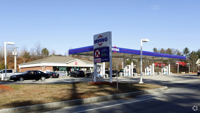

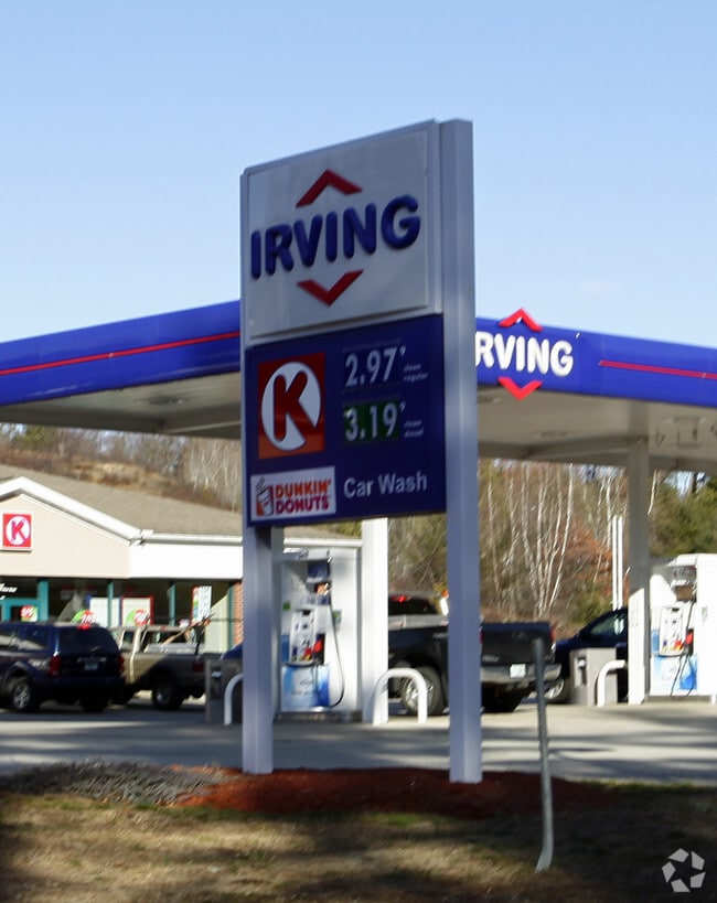
Property Detail
28 W West River Rd
HOOK-000037-000002-000001
Merrimack
Commercialnec
New Hampshire
MUD3
1
B and X Area of moderate flood hazard, usually the area between the limits of the 100-year and 500-year floods.
6.15 AC
2025
Manchester/New Hampshire South Area
2025
Other Market Areas
003001
Concord, NH
3,102 SF
NEARBY LISTINGS FOR SALE OR LEASE
DEMOGRAPHICS near 28 W West River Rd
1 mile
3 mile
5 mile
2025 Total Population
5,122
39,463
121,666
2030 Population
5,234
40,189
122,640
Pop Growth 2025-2030
+ 2.19%
+ 1.84%
+ 0.80%
Average Age
42
41
40
2025 Total Households
2,276
16,851
50,292
HH Growth 2025-2030
+ 2.33%
+ 1.95%
+ 0.86%
Median Household Inc
$95,339
$100,823
$86,211
Avg Household Size
2.00
2.20
2.20
2025 Avg HH Vehicles
2.00
2.00
2.00
Median Home Value
$428,662
$413,739
$380,526
Median Year Built
1985
1980
1970
Nearby Places
Map Layers
Map Styles
 Street
 Aerial
Layers
 Traffic
 Biking
Places
Listings with unknown addresses are not visible on the map
- Restaurants
- Banks
- Shops
- Fitness
- Groceries
PUBLIC TRANSPORTATION
AIRPORT
Manchester Boston Regional
Drive
Walk
Distance
Manchester Boston Regional
22 min
12.0 mi
Freight Ports
Port of Boston
Drive
Walk
Distance
Port of Boston
86 min
59.9 mi
Nearby Properties
Address
Land Use
TOTAL SIZE
Lot Size
Zoning
Address
Land Use
TOTAL SIZE
Lot Size
Zoning
58,227 SF
66.52 AC
Address
Land Use
TOTAL SIZE
Lot Size
Zoning
26,232 SF
39.97 AC
Address
Land Use
TOTAL SIZE
Lot Size
Zoning
12.60 AC
PZ
Address
Land Use
TOTAL SIZE
Lot Size
Zoning
135,686 SF
30.23 AC
Address
Land Use
TOTAL SIZE
Lot Size
Zoning
36,070 SF
141.66 AC
MUD4
Address
Land Use
TOTAL SIZE
Lot Size
Zoning
26,125 SF
150.66 AC
Address
Land Use
TOTAL SIZE
Lot Size
Zoning
143,630 SF
57.86 AC
Address
Land Use
TOTAL SIZE
Lot Size
Zoning
16,464 SF
15.19 AC
Address
Land Use
TOTAL SIZE
Lot Size
Zoning
16,000 SF
58.17 AC
Address
Land Use
TOTAL SIZE
Lot Size
Zoning
51.32 AC
MUD4
Address
Land Use
TOTAL SIZE
Lot Size
Zoning
154,363 SF
17.25 AC
MUD3
Address
Land Use
TOTAL SIZE
Lot Size
Zoning
264,671 SF
4.04 AC
Address
Land Use
TOTAL SIZE
Lot Size
Zoning
4,400 SF
76.15 AC
MUD4
Address
Land Use
TOTAL SIZE
Lot Size
Zoning
206,478 SF
3.91 AC
Address
Land Use
TOTAL SIZE
Lot Size
Zoning
1,998 SF
72.09 AC
MDR
Address
Land Use
TOTAL SIZE
Lot Size
Zoning
44,301 SF
71.24 AC
Address
Land Use
TOTAL SIZE
Lot Size
Zoning
224,859 SF
17.70 AC
Address
Land Use
TOTAL SIZE
Lot Size
Zoning
27,450 SF
9.10 AC
Address
Land Use
TOTAL SIZE
Lot Size
Zoning
72,932 SF
44.26 AC
Address
Land Use
TOTAL SIZE
Lot Size
Zoning
41,252 SF
6.87 AC
Address
Land Use
TOTAL SIZE
Lot Size
Zoning
Address
Land Use
TOTAL SIZE
Lot Size
Zoning
107,144 SF
8.75 AC
Address
Land Use
TOTAL SIZE
Lot Size
Zoning
82,670 SF
27.76 AC
PZ
Address
Land Use
TOTAL SIZE
Lot Size
Zoning
5,150 SF
13.50 AC
Address
Land Use
TOTAL SIZE
Lot Size
Zoning
1,621 SF
8.24 AC
Address
Land Use
TOTAL SIZE
Lot Size
Zoning
69,339 SF
39.63 AC
IND
Address
Land Use
TOTAL SIZE
Lot Size
Zoning
96,192 SF
17.42 AC
IND
Address
Land Use
TOTAL SIZE
Lot Size
Zoning
42,008 SF
4.33 AC
Address
Land Use
TOTAL SIZE
Lot Size
Zoning
42,692 SF
3.98 AC
Address
Land Use
TOTAL SIZE
Lot Size
Zoning
95,626 SF
19.51 AC
MUD3
The World's #1 Commercial Real Estate Marketplace
Connect with us
© 2026 CoStar Group
The information above has been obtained from sources believed reliable. While we do not doubt its accuracy we have not verified it and make no guarantee, warranty or representation about it. It is your responsibility to independently confirm its accuracy and completeness. Any projections, opinions, assumptions, or estimates used are for example only and do not represent the current or future performance of the property. The value of this transaction to you depends on tax and other factors which should be evaluated by your tax, financial, and legal advisors. You and your advisors should conduct a careful, independent investigation of the property to determine to your satisfaction the suitability of the property for your needs.