Property Record
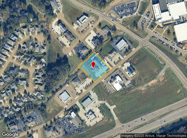
280 Belle Meade Pt, Flowood, MS 39232

NEARBY LISTINGS FOR SALE OR LEASE
Property Detail
280 Belle Meade Pt
G11-000044-00020
APPROX 1.37 AC IN SW4 N OF HWY 25 & SW OF LUCKNEY RD DB 734 PG 630 061595
Officecondo
Rankin
X
Mississippi
28121C0181G
1.37 AC
2024
Brandon/Flowood/Pearl
2024
Jackson
020215
Jackson, MS
3,160 SF
DEMOGRAPHICS near 280 Belle Meade Pt
1 Mile
3 Mile
5 Mile
2024 Total Population
3,333
28,189
65,614
2029 Population
3,444
29,052
66,637
Pop Growth 2024-2029
+ 3.33%
+ 3.06%
+ 1.56%
Average Age
41
40
40
2024 Total Households
1,413
11,612
27,300
HH Growth 2024-2029
+ 3.40%
+ 3.12%
+ 1.51%
Median Household Inc
$100,709
$87,214
$78,171
Avg Household Size
2.30
2.40
2.30
2024 Avg HH Vehicles
2.00
2.00
2.00
Median Home Value
$358,333
$231,918
$229,168
Median Year Built
2003
1997
1991
Nearby Places
Map Layers
Map Styles
 Street
 Aerial
- Restaurants
- Banks
- Shops
- Fitness
- Groceries
PUBLIC TRANSPORTATION
AIRPORT
Jackson-Medgar Wiley Evers International
DRIVE
WALK
Distance
Jackson-Medgar Wiley Evers International
16 min
8.0 mi
Freight Ports
Port of Gulf Port
DRIVE
WALK
Distance
Port of Gulf Port
204 min
165.7 mi
SALE & LEASE HISTORY
LISTING DATE
SALE/LEASE

Sep 24, 2016
For Sale
Nearby Properties
Address
Land Use
TOTAL SIZE
Lot Size
Zoning
Address
Land Use
TOTAL SIZE
Lot Size
Zoning
19,639 SF
4.07 AC
Address
Land Use
TOTAL SIZE
Lot Size
Zoning
136,355 SF
26.65 AC
Address
Land Use
TOTAL SIZE
Lot Size
Zoning
121,590 SF
Address
Land Use
TOTAL SIZE
Lot Size
Zoning
6,639 SF
35.63 AC
Address
Land Use
TOTAL SIZE
Lot Size
Zoning
125,008 SF
18 AC
Address
Land Use
TOTAL SIZE
Lot Size
Zoning
8,030 SF
222.20 AC
Address
Land Use
TOTAL SIZE
Lot Size
Zoning
8,896 SF
12.73 AC
Address
Land Use
TOTAL SIZE
Lot Size
Zoning
74,153 SF
4.52 AC
Address
Land Use
TOTAL SIZE
Lot Size
Zoning
66,102 SF
6.21 AC
Address
Land Use
TOTAL SIZE
Lot Size
Zoning
15,115 SF
2.48 AC
Address
Land Use
TOTAL SIZE
Lot Size
Zoning
192,761 SF
9.81 AC
Address
Land Use
TOTAL SIZE
Lot Size
Zoning
1,490 SF
15.24 AC
Address
Land Use
TOTAL SIZE
Lot Size
Zoning
57,577 SF
13.40 AC
Address
Land Use
TOTAL SIZE
Lot Size
Zoning
191,219 SF
22.21 AC
Address
Land Use
TOTAL SIZE
Lot Size
Zoning
125,227 SF
8.91 AC
Address
Land Use
TOTAL SIZE
Lot Size
Zoning
19,971 SF
9.56 AC
Address
Land Use
TOTAL SIZE
Lot Size
Zoning
12,416 SF
9.22 AC
Address
Land Use
TOTAL SIZE
Lot Size
Zoning
12,464 SF
9.79 AC
Address
Land Use
TOTAL SIZE
Lot Size
Zoning
17,565 SF
9.70 AC
Address
Land Use
TOTAL SIZE
Lot Size
Zoning
Address
Land Use
TOTAL SIZE
Lot Size
Zoning
109,573 SF
7.09 AC
Address
Land Use
TOTAL SIZE
Lot Size
Zoning
11,243 SF
1.45 AC
Address
Land Use
TOTAL SIZE
Lot Size
Zoning
3,358 SF
6.12 AC
Address
Land Use
TOTAL SIZE
Lot Size
Zoning
93,595 SF
7.86 AC
Address
Land Use
TOTAL SIZE
Lot Size
Zoning
11,284 SF
7.60 AC
Address
Land Use
TOTAL SIZE
Lot Size
Zoning
137,395 SF
12.61 AC
Address
Land Use
TOTAL SIZE
Lot Size
Zoning
72,361 SF
7.19 AC
Address
Land Use
TOTAL SIZE
Lot Size
Zoning
62,042 SF
2.64 AC
Address
Land Use
TOTAL SIZE
Lot Size
Zoning
68,858 SF
7.19 AC
The World's #1 Commercial Real Estate Marketplace
Connect with us
© 2025 CoStar Group
The information above has been obtained from sources believed reliable. While we do not doubt its accuracy we have not verified it and make no guarantee, warranty or representation about it. It is your responsibility to independently confirm its accuracy and completeness. Any projections, opinions, assumptions, or estimates used are for example only and do not represent the current or future performance of the property. The value of this transaction to you depends on tax and other factors which should be evaluated by your tax, financial, and legal advisors. You and your advisors should conduct a careful, independent investigation of the property to determine to your satisfaction the suitability of the property for your needs.