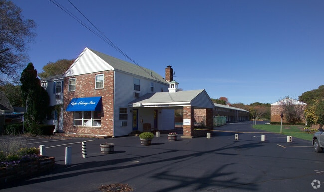
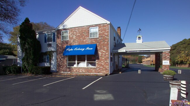
Property Record
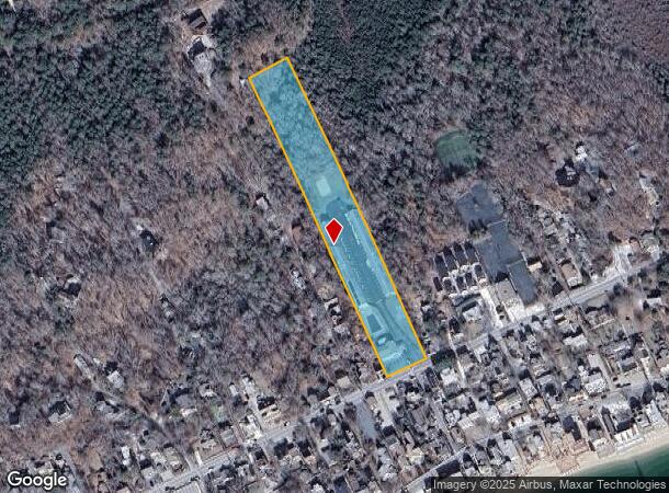
280 Bradford St, Provincetown, MA 02657
NEARBY LISTINGS FOR SALE OR LEASE
-
-
View all Provincetown listings for sale on LoopNet.com
Property Detail
280 Bradford St
Commercialnec
Barnstable
AE
Massachusetts
25001C0116J
2.34 AC
2021
Cape Cod
2025
Other Market Areas
010100
Barnstable Town, MA
3,400 SF
PROV-000015-000003-000096
DEMOGRAPHICS near 280 Bradford St
1 Mile
3 Mile
5 Mile
2024 Total Population
2,277
4,672
5,257
2029 Population
2,411
4,975
5,533
Pop Growth 2024-2029
+ 5.88%
+ 6.49%
+ 5.25%
Average Age
57
56
56
2024 Total Households
1,366
2,775
3,061
HH Growth 2024-2029
+ 5.71%
+ 6.27%
+ 5.23%
Median Household Inc
$67,780
$72,719
$76,976
Avg Household Size
1.60
1.70
1.70
2024 Avg HH Vehicles
1.00
1.00
1.00
Median Home Value
$786,633
$794,892
$818,617
Median Year Built
1956
1955
1962
Nearby Places
- Restaurants
- Banks
- Shops
- Fitness
- Groceries
Nearby Properties
Address
Land Use
TOTAL SIZE
Lot Size
Zoning
Address
Land Use
TOTAL SIZE
Lot Size
Zoning
57,350 SF
11.66 AC
RES3
Address
Land Use
TOTAL SIZE
Lot Size
Zoning
1,246 SF
0.45 AC
TCC
Address
Land Use
TOTAL SIZE
Lot Size
Zoning
50,336 SF
4.51 AC
RES1
Address
Land Use
TOTAL SIZE
Lot Size
Zoning
63,049 SF
6.03 AC
RES1
Address
Land Use
TOTAL SIZE
Lot Size
Zoning
18,225 SF
7.45 AC
RES3
Address
Land Use
TOTAL SIZE
Lot Size
Zoning
35,832 SF
1.93 AC
RES1
Address
Land Use
TOTAL SIZE
Lot Size
Zoning
21,798 SF
0.86 AC
TCC
Address
Land Use
TOTAL SIZE
Lot Size
Zoning
27,312 SF
1.08 AC
TCC
Address
Land Use
TOTAL SIZE
Lot Size
Zoning
6,491 SF
0.82 AC
RES1
Address
Land Use
TOTAL SIZE
Lot Size
Zoning
20,426 SF
0.44 AC
TCC
Address
Land Use
TOTAL SIZE
Lot Size
Zoning
21,327 SF
1.62 AC
RESB
Address
Land Use
TOTAL SIZE
Lot Size
Zoning
68.35 AC
RES1
Address
Land Use
TOTAL SIZE
Lot Size
Zoning
2,634 SF
1.75 AC
RES3
Address
Land Use
TOTAL SIZE
Lot Size
Zoning
3,716 SF
0.42 AC
RES1
Address
Land Use
TOTAL SIZE
Lot Size
Zoning
69,468 SF
2.66 AC
RES3
Address
Land Use
TOTAL SIZE
Lot Size
Zoning
11,170 SF
1.27 AC
TCC
Address
Land Use
TOTAL SIZE
Lot Size
Zoning
43,479 SF
3.61 AC
GC
Address
Land Use
TOTAL SIZE
Lot Size
Zoning
10,156 SF
0.44 AC
TCC
Address
Land Use
TOTAL SIZE
Lot Size
Zoning
4,190 SF
0.96 AC
RES1
Address
Land Use
TOTAL SIZE
Lot Size
Zoning
1,288 SF
0.14 AC
TCC
Address
Land Use
TOTAL SIZE
Lot Size
Zoning
15,642 SF
0.34 AC
TCC
Address
Land Use
TOTAL SIZE
Lot Size
Zoning
13,448 SF
1.22 AC
RES3
Address
Land Use
TOTAL SIZE
Lot Size
Zoning
22,362 SF
1.42 AC
RES1
Address
Land Use
TOTAL SIZE
Lot Size
Zoning
26,590 SF
0.46 AC
TCC
Address
Land Use
TOTAL SIZE
Lot Size
Zoning
9,655 SF
0.20 AC
TCC
Address
Land Use
TOTAL SIZE
Lot Size
Zoning
2,757 SF
1.08 AC
RES1
Address
Land Use
TOTAL SIZE
Lot Size
Zoning
18,205 SF
0.35 AC
RES3
Address
Land Use
TOTAL SIZE
Lot Size
Zoning
3,890 SF
0.90 AC
RES1
Address
Land Use
TOTAL SIZE
Lot Size
Zoning
19,112 SF
0.59 AC
RES3
Address
Land Use
TOTAL SIZE
Lot Size
Zoning
3,712 SF
3.25 AC
RES1
The World's #1 Commercial Real Estate Marketplace
Connect with us
© 2025 CoStar Group
The information above has been obtained from sources believed reliable. While we do not doubt its accuracy we have not verified it and make no guarantee, warranty or representation about it. It is your responsibility to independently confirm its accuracy and completeness. Any projections, opinions, assumptions, or estimates used are for example only and do not represent the current or future performance of the property. The value of this transaction to you depends on tax and other factors which should be evaluated by your tax, financial, and legal advisors. You and your advisors should conduct a careful, independent investigation of the property to determine to your satisfaction the suitability of the property for your needs.