Property Record
280 Linde Rd, Kittanning, PA 16201

Property Detail
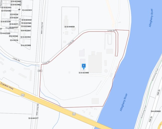
280 Linde Rd
32-0-023406
38.723A
Industrialgeneral
Armstrong
AE The base floodplain where base flood elevations are provided. AE Zones are now used on new format FIRMs instead of A1-A30 Zones.
Pennsylvania
2025
38.72 AC
2025
Armstrong County
951200
Pittsburgh
10,788 SF
Pittsburgh, PA
NEARBY LISTINGS FOR SALE OR LEASE
DEMOGRAPHICS near 280 Linde Rd
1 mile
3 mile
5 mile
2025 Total Population
2,298
15,120
20,229
2030 Population
2,213
14,692
19,696
Pop Growth 2025-2030
(3.70%)
(2.83%)
(2.63%)
Average Age
47
44
45
2025 Total Households
1,102
6,816
8,956
HH Growth 2025-2030
(3.54%)
(2.83%)
(2.67%)
Median Household Inc
$49,218
$63,544
$65,723
Avg Household Size
2.00
2.20
2.20
2025 Avg HH Vehicles
1.00
2.00
2.00
Median Home Value
$162,033
$141,941
$153,225
Median Year Built
1956
1952
1955
Nearby Places
Map Layers
Map Styles
 Street
 Aerial
Layers
 Traffic
 Biking
Places
Listings with unknown addresses are not visible on the map
- Restaurants
- Banks
- Shops
- Fitness
- Groceries
Nearby Properties
Address
Land Use
TOTAL SIZE
Lot Size
Zoning
Address
Land Use
TOTAL SIZE
Lot Size
Zoning
233,203 SF
9.93 AC
Address
Land Use
TOTAL SIZE
Lot Size
Zoning
260,664 SF
68 AC
Address
Land Use
TOTAL SIZE
Lot Size
Zoning
145,792 SF
13.04 AC
COMMERCIAL
Address
Land Use
TOTAL SIZE
Lot Size
Zoning
112,395 SF
13 AC
Address
Land Use
TOTAL SIZE
Lot Size
Zoning
75,000 SF
121.87 AC
Address
Land Use
TOTAL SIZE
Lot Size
Zoning
37,066 SF
60.59 AC
Address
Land Use
TOTAL SIZE
Lot Size
Zoning
90,000 SF
49.36 AC
Address
Land Use
TOTAL SIZE
Lot Size
Zoning
31,984 SF
0.79 AC
BUSINESS
Address
Land Use
TOTAL SIZE
Lot Size
Zoning
27,200 SF
5.99 AC
INDUSTRIAL
Address
Land Use
TOTAL SIZE
Lot Size
Zoning
96,646 SF
7.90 AC
COMMERCIAL
Address
Land Use
TOTAL SIZE
Lot Size
Zoning
42,795 SF
7.89 AC
INDUSTRIAL
Address
Land Use
TOTAL SIZE
Lot Size
Zoning
113,651 SF
4.49 AC
Address
Land Use
TOTAL SIZE
Lot Size
Zoning
42,238 SF
1.50 AC
PUBLIC
Address
Land Use
TOTAL SIZE
Lot Size
Zoning
57,435 SF
7.11 AC
Address
Land Use
TOTAL SIZE
Lot Size
Zoning
31,290 SF
2.93 AC
COMMERCIAL
Address
Land Use
TOTAL SIZE
Lot Size
Zoning
89,326 SF
1.01 AC
PUBLIC
Address
Land Use
TOTAL SIZE
Lot Size
Zoning
72,840 SF
1.08 AC
RESIDENTIA
Address
Land Use
TOTAL SIZE
Lot Size
Zoning
36,441 SF
22.55 AC
COMMERCIAL
Address
Land Use
TOTAL SIZE
Lot Size
Zoning
83,216 SF
1.15 AC
PUBLIC
Address
Land Use
TOTAL SIZE
Lot Size
Zoning
28,431 SF
1.26 AC
Address
Land Use
TOTAL SIZE
Lot Size
Zoning
65,038 SF
0.91 AC
PUBLIC
Address
Land Use
TOTAL SIZE
Lot Size
Zoning
31,104 SF
7.22 AC
Address
Land Use
TOTAL SIZE
Lot Size
Zoning
35,940 SF
24.59 AC
COMMERCIAL
Address
Land Use
TOTAL SIZE
Lot Size
Zoning
45,222 SF
3.06 AC
Address
Land Use
TOTAL SIZE
Lot Size
Zoning
22,792 SF
0.48 AC
COMMERCIAL
Address
Land Use
TOTAL SIZE
Lot Size
Zoning
29,456 SF
3.70 AC
Address
Land Use
TOTAL SIZE
Lot Size
Zoning
20,040 SF
0.72 AC
MEDIUM DEN
Address
Land Use
TOTAL SIZE
Lot Size
Zoning
14,604 SF
0.78 AC
Address
Land Use
TOTAL SIZE
Lot Size
Zoning
54,048 SF
4 AC
COMMERCIAL
Address
Land Use
TOTAL SIZE
Lot Size
Zoning
12,146 SF
6.87 AC
The World's #1 Commercial Real Estate Marketplace
Connect with us
© 2026 CoStar Group
The information above has been obtained from sources believed reliable. While we do not doubt its accuracy we have not verified it and make no guarantee, warranty or representation about it. It is your responsibility to independently confirm its accuracy and completeness. Any projections, opinions, assumptions, or estimates used are for example only and do not represent the current or future performance of the property. The value of this transaction to you depends on tax and other factors which should be evaluated by your tax, financial, and legal advisors. You and your advisors should conduct a careful, independent investigation of the property to determine to your satisfaction the suitability of the property for your needs.