Property Record
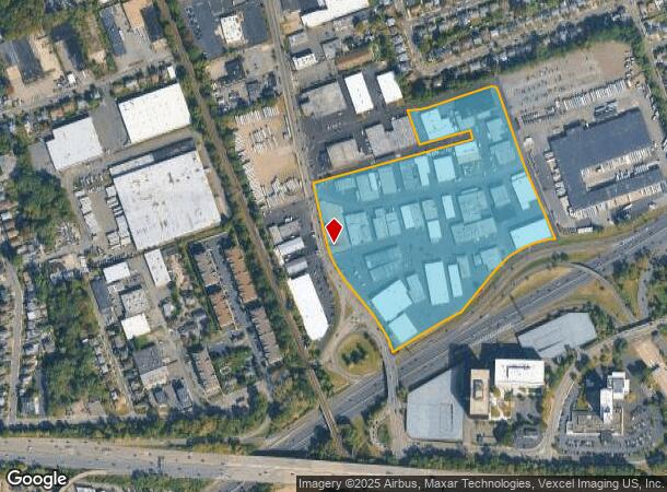
280 N Midland Ave, Saddle Brook, NJ 07663

NEARBY LISTINGS FOR SALE OR LEASE
Property Detail
280 N Midland Ave
New York-Jersey City-White Plains, NY-NJ
19.999 AC.
57-01202-0000-00030
Bergen
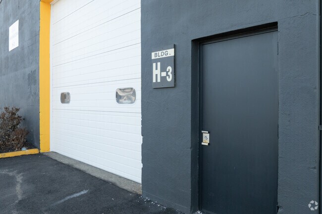
Industrialgeneral
New Jersey
X
30
34003C0186H
20 AC
2024
Route 46 Corridor
2025
Northern New Jersey
052100
DEMOGRAPHICS near 280 N Midland Ave
1 Mile
3 Mile
5 Mile
2024 Total Population
17,279
251,944
656,653
2029 Population
16,849
243,681
639,731
Pop Growth 2024-2029
(2.49%)
(3.28%)
(2.58%)
Average Age
42
39
39
2024 Total Households
6,163
86,874
226,117
HH Growth 2024-2029
(2.58%)
(3.32%)
(2.59%)
Median Household Inc
$99,437
$73,870
$76,467
Avg Household Size
2.70
2.80
2.80
2024 Avg HH Vehicles
2.00
2.00
2.00
Median Home Value
$445,179
$422,404
$449,583
Median Year Built
1956
1953
1954
Nearby Places
Map Layers
Map Styles
 Street
 Aerial
- Restaurants
- Banks
- Shops
- Fitness
- Groceries
PUBLIC TRANSPORTATION
COMMUTER RAIL
Broadway (Bergen County/Port Jervis Line - NJ Transit Commuter Rail (NJ Transit))
DRIVE
WALK
Distance
Broadway (Bergen County/Port Jervis Line - NJ Transit Commuter Rail (NJ Transit))
4 min
1.3 mi
Plauderville (Bergen County/Port Jervis Line - NJ Transit Commuter Rail (NJ Transit))
DRIVE
WALK
Distance
Plauderville (Bergen County/Port Jervis Line - NJ Transit Commuter Rail (NJ Transit))
4 min
1.5 mi
AIRPORT
Newark Liberty International
DRIVE
WALK
Distance
Newark Liberty International
26 min
19.8 mi
LaGuardia
DRIVE
WALK
Distance
LaGuardia
34 min
21.3 mi
Westchester County
DRIVE
WALK
Distance
Westchester County
55 min
37.1 mi
Freight Ports
Maher Terminal
DRIVE
WALK
Distance
Maher Terminal
32 min
20.8 mi
SALE & LEASE HISTORY
LISTING DATE
SALE/LEASE

Oct 17, 2023
For Lease
Nearby Properties
Address
Land Use
TOTAL SIZE
Lot Size
Zoning
Address
Land Use
TOTAL SIZE
Lot Size
Zoning
Address
Land Use
TOTAL SIZE
Lot Size
Zoning
136.31 AC
Address
Land Use
TOTAL SIZE
Lot Size
Zoning
988,414 SF
34.89 AC
BG
Address
Land Use
TOTAL SIZE
Lot Size
Zoning
378,400 SF
39.30 AC
BML
Address
Land Use
TOTAL SIZE
Lot Size
Zoning
7.10 AC
R-3
Address
Land Use
TOTAL SIZE
Lot Size
Zoning
102,070 SF
29.70 AC
BL
Address
Land Use
TOTAL SIZE
Lot Size
Zoning
160,036 SF
21.93 AC
R75
Address
Land Use
TOTAL SIZE
Lot Size
Zoning
7,060 SF
115.84 AC
HP
Address
Land Use
TOTAL SIZE
Lot Size
Zoning
8.66 AC
CH1
Address
Land Use
TOTAL SIZE
Lot Size
Zoning
232,368 SF
5.10 AC
Address
Land Use
TOTAL SIZE
Lot Size
Zoning
197,742 SF
6.20 AC
R3
Address
Land Use
TOTAL SIZE
Lot Size
Zoning
250,833 SF
13.49 AC
BG
Address
Land Use
TOTAL SIZE
Lot Size
Zoning
341,076 SF
40.02 AC
R100
Address
Land Use
TOTAL SIZE
Lot Size
Zoning
259,273 SF
19.77 AC
BIL
Address
Land Use
TOTAL SIZE
Lot Size
Zoning
394,046 SF
1.88 AC
R3
Address
Land Use
TOTAL SIZE
Lot Size
Zoning
12,268 SF
98 AC
CR
Address
Land Use
TOTAL SIZE
Lot Size
Zoning
431,600 SF
2.70 AC
R3
Address
Land Use
TOTAL SIZE
Lot Size
Zoning
25.50 AC
B2
Address
Land Use
TOTAL SIZE
Lot Size
Zoning
26,816 SF
25.50 AC
POP
Address
Land Use
TOTAL SIZE
Lot Size
Zoning
242,048 SF
25.40 AC
BLL
Address
Land Use
TOTAL SIZE
Lot Size
Zoning
9.96 AC
MU
Address
Land Use
TOTAL SIZE
Lot Size
Zoning
286,500 SF
26.90 AC
LL
Address
Land Use
TOTAL SIZE
Lot Size
Zoning
16.94 AC
R2
Address
Land Use
TOTAL SIZE
Lot Size
Zoning
57,680 SF
20.01 AC
CR
Address
Land Use
TOTAL SIZE
Lot Size
Zoning
7.83 AC
Address
Land Use
TOTAL SIZE
Lot Size
Zoning
78,424 SF
1.72 AC
Address
Land Use
TOTAL SIZE
Lot Size
Zoning
5.40 AC
RB
Address
Land Use
TOTAL SIZE
Lot Size
Zoning
Address
Land Use
TOTAL SIZE
Lot Size
Zoning
116,670 SF
13.79 AC
BIL
The World's #1 Commercial Real Estate Marketplace
Connect with us
© 2026 CoStar Group
The information above has been obtained from sources believed reliable. While we do not doubt its accuracy we have not verified it and make no guarantee, warranty or representation about it. It is your responsibility to independently confirm its accuracy and completeness. Any projections, opinions, assumptions, or estimates used are for example only and do not represent the current or future performance of the property. The value of this transaction to you depends on tax and other factors which should be evaluated by your tax, financial, and legal advisors. You and your advisors should conduct a careful, independent investigation of the property to determine to your satisfaction the suitability of the property for your needs.