Property Record
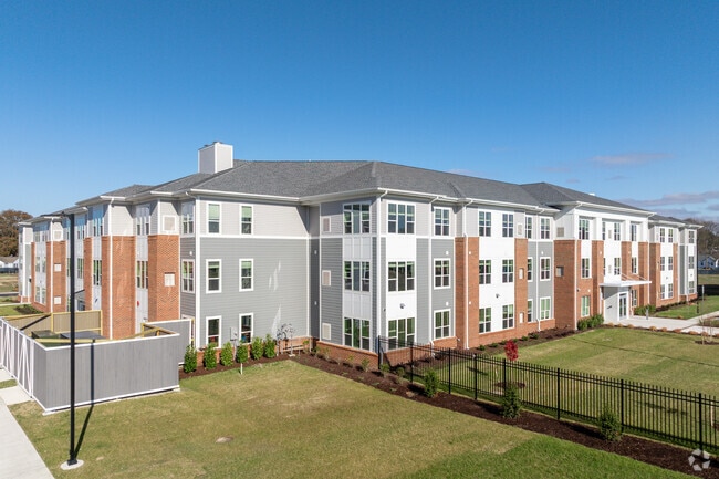
280 Paul Revere Dr, Portsmouth, VA 23704

NEARBY LISTINGS FOR SALE OR LEASE
Property Detail
280 Paul Revere Dr
0145-0012
Commercial District 3
Apartment
PARCEL 1A LEXINGTON SUBDIV
X
Portsmouth
5155290079D
Virginia
0
0.91 AC
2025
Portsmouth County
211800
Hampton Roads
32,664 SF
Virginia Beach-Norfolk-Newport News, VA-NC
DEMOGRAPHICS near 280 Paul Revere Dr
1 Mile
3 Mile
5 Mile
2024 Total Population
15,840
84,361
227,365
2029 Population
15,972
84,507
228,944
Pop Growth 2024-2029
+ 0.83%
+ 0.17%
+ 0.69%
Average Age
36
37
37
2024 Total Households
5,945
34,908
89,813
HH Growth 2024-2029
+ 0.81%
0.00%
+ 0.51%
Median Household Inc
$38,446
$52,053
$56,908
Avg Household Size
2.60
2.30
2.40
2024 Avg HH Vehicles
1.00
2.00
2.00
Median Home Value
$151,307
$183,578
$226,287
Median Year Built
1956
1962
1970
Nearby Places
Map Layers
Map Styles
 Street
 Aerial
- Restaurants
- Banks
- Shops
- Fitness
- Groceries
PUBLIC TRANSPORTATION
COMMUTER RAIL
Norfolk (Northeast Regional - Amtrak)
DRIVE
WALK
Distance
Norfolk (Northeast Regional - Amtrak)
9 min
4.6 mi
AIRPORT
Norfolk International
DRIVE
WALK
Distance
Norfolk International
21 min
11.0 mi
Newport News/Williamsburg International
DRIVE
WALK
Distance
Newport News/Williamsburg International
48 min
33.5 mi
Freight Ports
Virginia Port Authority - Portsmouth
DRIVE
WALK
Distance
Virginia Port Authority - Portsmouth
11 min
3.7 mi
Nearby Properties
Address
Land Use
TOTAL SIZE
Lot Size
Zoning
Address
Land Use
TOTAL SIZE
Lot Size
Zoning
5,704 SF
4.67 AC
D2
Address
Land Use
TOTAL SIZE
Lot Size
Zoning
250,000 SF
38 AC
MUH
Address
Land Use
TOTAL SIZE
Lot Size
Zoning
300,829 SF
38.40 AC
IL
Address
Land Use
TOTAL SIZE
Lot Size
Zoning
482.38 AC
MULTI: MUL
Address
Land Use
TOTAL SIZE
Lot Size
Zoning
85,756 SF
3.59 AC
D5
Address
Land Use
TOTAL SIZE
Lot Size
Zoning
250,766 SF
31.14 AC
NMU
Address
Land Use
TOTAL SIZE
Lot Size
Zoning
390,960 SF
4.43 AC
Address
Land Use
TOTAL SIZE
Lot Size
Zoning
421,856 SF
2.64 AC
D1
Address
Land Use
TOTAL SIZE
Lot Size
Zoning
971,654 SF
6.01 AC
D2
Address
Land Use
TOTAL SIZE
Lot Size
Zoning
473,072 SF
9.72 AC
SD
Address
Land Use
TOTAL SIZE
Lot Size
Zoning
258,000 SF
1.38 AC
M2: GENERA
Address
Land Use
TOTAL SIZE
Lot Size
Zoning
192,270 SF
1.99 AC
D2
Address
Land Use
TOTAL SIZE
Lot Size
Zoning
363,974 SF
1.49 AC
Address
Land Use
TOTAL SIZE
Lot Size
Zoning
66,718 SF
4.09 AC
D5
Address
Land Use
TOTAL SIZE
Lot Size
Zoning
356,598 SF
1.84 AC
D2
Address
Land Use
TOTAL SIZE
Lot Size
Zoning
50,384 SF
0.74 AC
Address
Land Use
TOTAL SIZE
Lot Size
Zoning
406,344 SF
8.45 AC
GMU
Address
Land Use
TOTAL SIZE
Lot Size
Zoning
35,091 SF
0.71 AC
Address
Land Use
TOTAL SIZE
Lot Size
Zoning
197,074 SF
6.69 AC
Address
Land Use
TOTAL SIZE
Lot Size
Zoning
130,750 SF
68.79 AC
IN
Address
Land Use
TOTAL SIZE
Lot Size
Zoning
608,074 SF
0.60 AC
Address
Land Use
TOTAL SIZE
Lot Size
Zoning
254,194 SF
1.93 AC
D3
Address
Land Use
TOTAL SIZE
Lot Size
Zoning
56,217 SF
1.31 AC
Address
Land Use
TOTAL SIZE
Lot Size
Zoning
251,984 SF
0.40 AC
D2
Address
Land Use
TOTAL SIZE
Lot Size
Zoning
199,530 SF
2.56 AC
IN2
Address
Land Use
TOTAL SIZE
Lot Size
Zoning
5 AC
D1
Address
Land Use
TOTAL SIZE
Lot Size
Zoning
210,897 SF
2.12 AC
IN2
Address
Land Use
TOTAL SIZE
Lot Size
Zoning
563,325 SF
0.72 AC
D2
Address
Land Use
TOTAL SIZE
Lot Size
Zoning
186,138 SF
0.26 AC
Address
Land Use
TOTAL SIZE
Lot Size
Zoning
237,629 SF
2.65 AC
T6
The World's #1 Commercial Real Estate Marketplace
Connect with us
© 2025 CoStar Group
The information above has been obtained from sources believed reliable. While we do not doubt its accuracy we have not verified it and make no guarantee, warranty or representation about it. It is your responsibility to independently confirm its accuracy and completeness. Any projections, opinions, assumptions, or estimates used are for example only and do not represent the current or future performance of the property. The value of this transaction to you depends on tax and other factors which should be evaluated by your tax, financial, and legal advisors. You and your advisors should conduct a careful, independent investigation of the property to determine to your satisfaction the suitability of the property for your needs.