Property Record
280 Redstone Hill Rd, Bristol, CT 06010


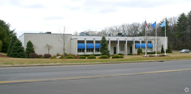
Property Detail
280 Redstone Hill Rd
BRIS-000004-000000-000001-000001A
Naugatuck Vly
Manufacturinglight
Connecticut
IP-1
1-1a
B and X Area of moderate flood hazard, usually the area between the limits of the 100-year and 500-year floods.
1.38 AC
2025
Bristol
2025
Hartford
405402
Hartford-West Hartford-East Hartford, CT
15,640 SF
NEARBY LISTINGS FOR SALE OR LEASE
DEMOGRAPHICS near 280 Redstone Hill Rd
1 mile
3 mile
5 mile
2025 Total Population
6,911
62,191
125,442
2030 Population
7,120
63,920
128,592
Pop Growth 2025-2030
+ 3.02%
+ 2.78%
+ 2.51%
Average Age
42
42
43
2025 Total Households
3,197
27,005
52,569
HH Growth 2025-2030
+ 3.00%
+ 2.77%
+ 2.52%
Median Household Inc
$77,147
$76,452
$89,266
Avg Household Size
2.10
2.20
2.30
2025 Avg HH Vehicles
2.00
2.00
2.00
Median Home Value
$234,468
$260,153
$300,454
Median Year Built
1979
1965
1969
Nearby Places
Map Layers
Map Styles
 Street
 Aerial
Layers
 Traffic
 Biking
Places
Listings with unknown addresses are not visible on the map
- Restaurants
- Banks
- Shops
- Fitness
- Groceries
PUBLIC TRANSPORTATION
COMMUTER RAIL
Drive
Walk
Distance
17 min
9.9 mi
Drive
Walk
Distance
17 min
9.9 mi
AIRPORT
Tweed/New Haven
Drive
Walk
Distance
Tweed/New Haven
48 min
29.7 mi
Bradley International
Drive
Walk
Distance
Bradley International
49 min
32.2 mi
Freight Ports
Port of New Haven
Drive
Walk
Distance
Port of New Haven
43 min
27.1 mi
Nearby Properties
Address
Land Use
TOTAL SIZE
Lot Size
Zoning
Address
Land Use
TOTAL SIZE
Lot Size
Zoning
77,001 SF
54.59 AC
IP-1
Address
Land Use
TOTAL SIZE
Lot Size
Zoning
349,054 SF
12.03 AC
R-15
Address
Land Use
TOTAL SIZE
Lot Size
Zoning
100,304 SF
28.80 AC
IP-1
Address
Land Use
TOTAL SIZE
Lot Size
Zoning
58,473 SF
18.20 AC
IP-1
Address
Land Use
TOTAL SIZE
Lot Size
Zoning
145,719 SF
17.90 AC
R-15
Address
Land Use
TOTAL SIZE
Lot Size
Zoning
114,375 SF
12.72 AC
IP-1
Address
Land Use
TOTAL SIZE
Lot Size
Zoning
330,400 SF
36.90 AC
IP-1
Address
Land Use
TOTAL SIZE
Lot Size
Zoning
28.47 AC
R-10
Address
Land Use
TOTAL SIZE
Lot Size
Zoning
12,892 SF
20.91 AC
A
Address
Land Use
TOTAL SIZE
Lot Size
Zoning
56,184 SF
19.42 AC
BG
Address
Land Use
TOTAL SIZE
Lot Size
Zoning
171,826 SF
36.60 AC
R-15
Address
Land Use
TOTAL SIZE
Lot Size
Zoning
199,744 SF
44.70 AC
R-15
Address
Land Use
TOTAL SIZE
Lot Size
Zoning
62,232 SF
0.90 AC
BD-1
Address
Land Use
TOTAL SIZE
Lot Size
Zoning
54,904 SF
7.01 AC
A
Address
Land Use
TOTAL SIZE
Lot Size
Zoning
502,440 SF
27.87 AC
I-2
Address
Land Use
TOTAL SIZE
Lot Size
Zoning
4,000 SF
13.78 AC
BG
Address
Land Use
TOTAL SIZE
Lot Size
Zoning
17.62 AC
B
Address
Land Use
TOTAL SIZE
Lot Size
Zoning
1,700 SF
38.81 AC
A
Address
Land Use
TOTAL SIZE
Lot Size
Zoning
120,801 SF
8.35 AC
R-40
Address
Land Use
TOTAL SIZE
Lot Size
Zoning
29.05 AC
R-20
Address
Land Use
TOTAL SIZE
Lot Size
Zoning
149,912 SF
13.66 AC
B
Address
Land Use
TOTAL SIZE
Lot Size
Zoning
143,315 SF
4.50 AC
A
Address
Land Use
TOTAL SIZE
Lot Size
Zoning
3,084 SF
14.90 AC
BG
Address
Land Use
TOTAL SIZE
Lot Size
Zoning
133,720 SF
7.34 AC
IP-1
Address
Land Use
TOTAL SIZE
Lot Size
Zoning
19 AC
GI
Address
Land Use
TOTAL SIZE
Lot Size
Zoning
42,516 SF
10.40 AC
BG
Address
Land Use
TOTAL SIZE
Lot Size
Zoning
41,011 SF
8.50 AC
BG
Address
Land Use
TOTAL SIZE
Lot Size
Zoning
16.04 AC
B
Address
Land Use
TOTAL SIZE
Lot Size
Zoning
118,573 SF
9.75 AC
BG
Address
Land Use
TOTAL SIZE
Lot Size
Zoning
51,851 SF
1.32 AC
BD-1
The World's #1 Commercial Real Estate Marketplace
Connect with us
© 2026 CoStar Group
The information above has been obtained from sources believed reliable. While we do not doubt its accuracy we have not verified it and make no guarantee, warranty or representation about it. It is your responsibility to independently confirm its accuracy and completeness. Any projections, opinions, assumptions, or estimates used are for example only and do not represent the current or future performance of the property. The value of this transaction to you depends on tax and other factors which should be evaluated by your tax, financial, and legal advisors. You and your advisors should conduct a careful, independent investigation of the property to determine to your satisfaction the suitability of the property for your needs.