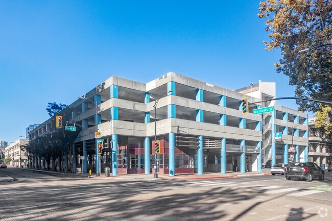
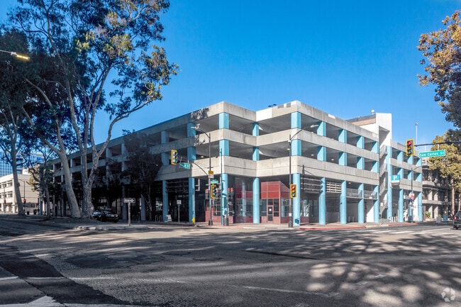
Property Record
280 S 2Nd St, San Jose, CA 95113


Property Detail
280 S 2Nd St
467-46-097
SANTA CLARA
Residentialacreage
California
CG
5,6,8
D Areas with possible but undetermined flood hazards.
0.85 AC
0
Downtown San Jose
2025
South Bay/San Jose
500901
San Jose-Sunnyvale-Santa Clara, CA
NEARBY LISTINGS FOR SALE OR LEASE
DEMOGRAPHICS near 280 S 2Nd St
1 mile
3 mile
5 mile
2025 Total Population
46,356
268,429
670,988
2030 Population
48,228
274,688
683,769
Pop Growth 2025-2030
+ 4.04%
+ 2.33%
+ 1.90%
Average Age
36
38
39
2025 Total Households
17,540
90,848
218,567
HH Growth 2025-2030
+ 4.70%
+ 2.59%
+ 2.12%
Median Household Inc
$95,450
$108,731
$122,556
Avg Household Size
2.30
2.70
2.90
2025 Avg HH Vehicles
2.00
2.00
2.00
Median Home Value
$1,021,259
$1,036,347
$1,056,135
Median Year Built
1976
1974
1973
Nearby Places
Map Layers
Map Styles
 Street
 Aerial
Layers
 Traffic
 Biking
Places
Listings with unknown addresses are not visible on the map
- Restaurants
- Banks
- Shops
- Fitness
- Groceries
SALE & LEASE HISTORY
LISTING DATE
SALE/LEASE

Nov 07, 2024
For Lease
Nov 07, 2024
For Lease
Nearby Properties
Address
Land Use
TOTAL SIZE
Lot Size
Zoning
Address
Land Use
TOTAL SIZE
Lot Size
Zoning
2.50 AC
DC
Address
Land Use
TOTAL SIZE
Lot Size
Zoning
194,790 SF
5.30 AC
APDCI
Address
Land Use
TOTAL SIZE
Lot Size
Zoning
1.73 AC
DC
Address
Land Use
TOTAL SIZE
Lot Size
Zoning
837,391 SF
1.42 AC
DC
Address
Land Use
TOTAL SIZE
Lot Size
Zoning
33.32 AC
R140
Address
Land Use
TOTAL SIZE
Lot Size
Zoning
194,530 SF
12.26 AC
APD
Address
Land Use
TOTAL SIZE
Lot Size
Zoning
590,000 SF
2.33 AC
C3
Address
Land Use
TOTAL SIZE
Lot Size
Zoning
557,448 SF
1.46 AC
DC
Address
Land Use
TOTAL SIZE
Lot Size
Zoning
333,472 SF
1.24 AC
APD
Address
Land Use
TOTAL SIZE
Lot Size
Zoning
289,503 SF
0.97 AC
DC
Address
Land Use
TOTAL SIZE
Lot Size
Zoning
330,927 SF
2.35 AC
M1
Address
Land Use
TOTAL SIZE
Lot Size
Zoning
445,687 SF
6.44 AC
A(PD)
Address
Land Use
TOTAL SIZE
Lot Size
Zoning
340,000 SF
0.65 AC
CG(PD
Address
Land Use
TOTAL SIZE
Lot Size
Zoning
194,549 SF
2.76 AC
APDCI
Address
Land Use
TOTAL SIZE
Lot Size
Zoning
381,000 SF
1.40 AC
DC
Address
Land Use
TOTAL SIZE
Lot Size
Zoning
11.96 AC
M4
Address
Land Use
TOTAL SIZE
Lot Size
Zoning
491,622 SF
4.18 AC
A(PD)
Address
Land Use
TOTAL SIZE
Lot Size
Zoning
286,350 SF
0.80 AC
C
Address
Land Use
TOTAL SIZE
Lot Size
Zoning
1.16 AC
R1BD
Address
Land Use
TOTAL SIZE
Lot Size
Zoning
3.74 AC
APD
Address
Land Use
TOTAL SIZE
Lot Size
Zoning
279,230 SF
1.69 AC
C3H
Address
Land Use
TOTAL SIZE
Lot Size
Zoning
226,000 SF
0.82 AC
DC
Address
Land Use
TOTAL SIZE
Lot Size
Zoning
348,754 SF
1.58 AC
DC
Address
Land Use
TOTAL SIZE
Lot Size
Zoning
300,000 SF
1.66 AC
DC
Address
Land Use
TOTAL SIZE
Lot Size
Zoning
315,000 SF
0.71 AC
CG
Address
Land Use
TOTAL SIZE
Lot Size
Zoning
469,773 SF
7.02 AC
APD
Address
Land Use
TOTAL SIZE
Lot Size
Zoning
320,986 SF
0.78 AC
CG-PD
Address
Land Use
TOTAL SIZE
Lot Size
Zoning
350,000 SF
2.09 AC
CG
Address
Land Use
TOTAL SIZE
Lot Size
Zoning
166,696 SF
2.68 AC
APDCI
Address
Land Use
TOTAL SIZE
Lot Size
Zoning
302,148 SF
4.43 AC
APD
The World's #1 Commercial Real Estate Marketplace
Connect with us
© 2026 CoStar Group
The information above has been obtained from sources believed reliable. While we do not doubt its accuracy we have not verified it and make no guarantee, warranty or representation about it. It is your responsibility to independently confirm its accuracy and completeness. Any projections, opinions, assumptions, or estimates used are for example only and do not represent the current or future performance of the property. The value of this transaction to you depends on tax and other factors which should be evaluated by your tax, financial, and legal advisors. You and your advisors should conduct a careful, independent investigation of the property to determine to your satisfaction the suitability of the property for your needs.