Property Record
280 Wolf Run, Mukwonago, WI 53149
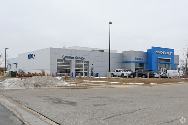

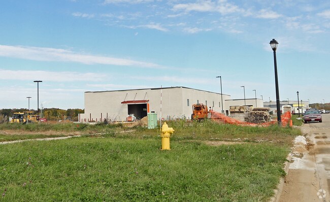

Property Detail
280 Wolf Run
Milwaukee-Waukesha, WI
LOT 2 CERT SURV 11223 VOL 110/236 REC AS DOC# 4100968 REDIVISION LOT 2 CERT SURV 9844 PT SW1/4 SE1/4 OF SE1/4 SEC 25 & PT NE1/4 NW1/4 OF NE1/4 SEC 36 T5N R18E :: DOC# 4102986
MUKV-2013-994-004
WAUKESHA
Commercialnec
Wisconsin
AE The base floodplain where base flood elevations are provided. AE Zones are now used on new format FIRMs instead of A1-A30 Zones.
2
2024
11.41 AC
2024
SW/Mukwonago
203902
Milwaukee/Madison
NEARBY LISTINGS FOR SALE OR LEASE
-
-
View all Mukwonago listings for sale on LoopNet.com
DEMOGRAPHICS near 280 Wolf Run
1 mile
3 mile
5 mile
2025 Total Population
1,406
12,469
20,889
2030 Population
1,458
12,907
21,391
Pop Growth 2025-2030
+ 3.70%
+ 3.51%
+ 2.40%
Average Age
40
42
43
2025 Total Households
522
4,960
8,071
HH Growth 2025-2030
+ 3.45%
+ 3.49%
+ 2.43%
Median Household Inc
$100,812
$93,491
$100,015
Avg Household Size
2.50
2.50
2.60
2025 Avg HH Vehicles
2.00
2.00
2.00
Median Home Value
$393,213
$354,505
$382,146
Median Year Built
1995
1986
1984
Nearby Places
Map Layers
Map Styles
 Street
 Aerial
Transit
 Traffic
 Biking
Places
Listings with unknown addresses are not visible on the map
- Restaurants
- Banks
- Shops
- Fitness
- Groceries
PUBLIC TRANSPORTATION
AIRPORT
General Mitchell International
Drive
Walk
Distance
General Mitchell International
38 min
26.0 mi
Freight Ports
Port Milwaukee
Drive
Walk
Distance
Port Milwaukee
37 min
27.9 mi
Nearby Properties
Address
Land Use
TOTAL SIZE
Lot Size
Zoning
Address
Land Use
TOTAL SIZE
Lot Size
Zoning
15.47 AC
Address
Land Use
TOTAL SIZE
Lot Size
Zoning
15.59 AC
Address
Land Use
TOTAL SIZE
Lot Size
Zoning
21.46 AC
Address
Land Use
TOTAL SIZE
Lot Size
Zoning
4.37 AC
Address
Land Use
TOTAL SIZE
Lot Size
Zoning
15.80 AC
Address
Land Use
TOTAL SIZE
Lot Size
Zoning
14.61 AC
Address
Land Use
TOTAL SIZE
Lot Size
Zoning
17.43 AC
Address
Land Use
TOTAL SIZE
Lot Size
Zoning
41.22 AC
Address
Land Use
TOTAL SIZE
Lot Size
Zoning
10.35 AC
Address
Land Use
TOTAL SIZE
Lot Size
Zoning
12.89 AC
Address
Land Use
TOTAL SIZE
Lot Size
Zoning
12.25 AC
Address
Land Use
TOTAL SIZE
Lot Size
Zoning
10.92 AC
Address
Land Use
TOTAL SIZE
Lot Size
Zoning
Address
Land Use
TOTAL SIZE
Lot Size
Zoning
Address
Land Use
TOTAL SIZE
Lot Size
Zoning
10.97 AC
Address
Land Use
TOTAL SIZE
Lot Size
Zoning
2.32 AC
Address
Land Use
TOTAL SIZE
Lot Size
Zoning
Address
Land Use
TOTAL SIZE
Lot Size
Zoning
4.43 AC
Address
Land Use
TOTAL SIZE
Lot Size
Zoning
7.50 AC
Address
Land Use
TOTAL SIZE
Lot Size
Zoning
9.62 AC
Address
Land Use
TOTAL SIZE
Lot Size
Zoning
3.70 AC
Address
Land Use
TOTAL SIZE
Lot Size
Zoning
3.82 AC
Address
Land Use
TOTAL SIZE
Lot Size
Zoning
Address
Land Use
TOTAL SIZE
Lot Size
Zoning
2.99 AC
Address
Land Use
TOTAL SIZE
Lot Size
Zoning
Address
Land Use
TOTAL SIZE
Lot Size
Zoning
Address
Land Use
TOTAL SIZE
Lot Size
Zoning
The World's #1 Commercial Real Estate Marketplace
Connect with us
© 2026 CoStar Group
The information above has been obtained from sources believed reliable. While we do not doubt its accuracy we have not verified it and make no guarantee, warranty or representation about it. It is your responsibility to independently confirm its accuracy and completeness. Any projections, opinions, assumptions, or estimates used are for example only and do not represent the current or future performance of the property. The value of this transaction to you depends on tax and other factors which should be evaluated by your tax, financial, and legal advisors. You and your advisors should conduct a careful, independent investigation of the property to determine to your satisfaction the suitability of the property for your needs.