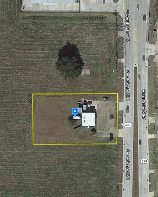
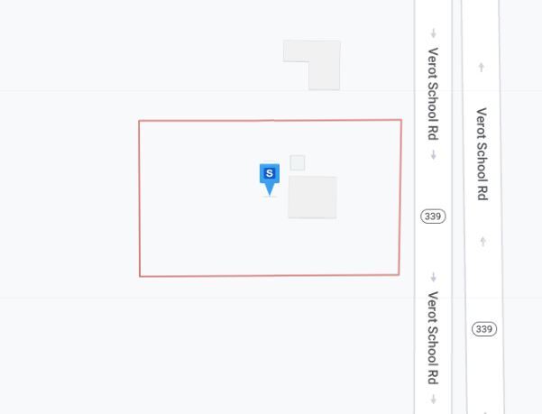
Property Record
2800 Blk Verot School Rd, , LA

Property Detail
2800 Blk Verot School Rd
Lafayette, LA
SEC 26 T10S R4E (1.158 AC)(2022-35115 PLAT) SEC 26 T10S R4E (8.882 AC)(UNPLATTED)(12-29815 - PLAT) P LOT 2 SEC 26 T10S R4E
6162884
LAFAYETTE
Commercialacreage
Louisiana
B and X Area of moderate flood hazard, usually the area between the limits of the 100-year and 500-year floods.
2
2025
12.39 AC
2025
Greater Lafayette
0014032035
Lafayette
NEARBY LISTINGS FOR SALE OR LEASE
DEMOGRAPHICS near 2800 Blk Verot School Rd
1 mile
3 mile
5 mile
2025 Total Population
5,758
59,938
126,849
2030 Population
5,982
62,465
132,404
Pop Growth 2025-2030
+ 3.89%
+ 4.22%
+ 4.38%
Average Age
40
39
39
2025 Total Households
2,255
24,838
52,521
HH Growth 2025-2030
+ 3.90%
+ 4.37%
+ 4.49%
Median Household Inc
$101,993
$85,873
$80,198
Avg Household Size
2.50
2.30
2.30
2025 Avg HH Vehicles
2.00
2.00
2.00
Median Home Value
$368,378
$305,642
$290,007
Median Year Built
1999
1997
1992
Nearby Places
Map Layers
Map Styles
 Street
 Aerial
Layers
 Traffic
 Biking
Places
Listings with unknown addresses are not visible on the map
- Restaurants
- Banks
- Shops
- Fitness
- Groceries
PUBLIC TRANSPORTATION
COMMUTER RAIL
Lafayette Amtrak Station (Sunset Limited - Amtrak)
Drive
Walk
Distance
Lafayette Amtrak Station (Sunset Limited - Amtrak)
14 min
8.2 mi
AIRPORT
Lafayette Regional/Paul Fournet Field
Drive
Walk
Distance
Lafayette Regional/Paul Fournet Field
13 min
7.2 mi
Freight Ports
Port of Iberia
Drive
Walk
Distance
Port of Iberia
30 min
20.7 mi
Nearby Properties
Address
Land Use
TOTAL SIZE
Lot Size
Zoning
Address
Land Use
TOTAL SIZE
Lot Size
Zoning
432,844 SF
44.64 AC
Address
Land Use
TOTAL SIZE
Lot Size
Zoning
18.28 AC
Address
Land Use
TOTAL SIZE
Lot Size
Zoning
24.98 AC
Address
Land Use
TOTAL SIZE
Lot Size
Zoning
200,000 SF
Address
Land Use
TOTAL SIZE
Lot Size
Zoning
20,775 SF
11.04 AC
Address
Land Use
TOTAL SIZE
Lot Size
Zoning
120,024 SF
Address
Land Use
TOTAL SIZE
Lot Size
Zoning
23,377 SF
14.53 AC
Address
Land Use
TOTAL SIZE
Lot Size
Zoning
4,632 SF
14.48 AC
Address
Land Use
TOTAL SIZE
Lot Size
Zoning
4,906 SF
12.65 AC
Address
Land Use
TOTAL SIZE
Lot Size
Zoning
7,354 SF
11.09 AC
Address
Land Use
TOTAL SIZE
Lot Size
Zoning
145,412 SF
0.01 AC
Address
Land Use
TOTAL SIZE
Lot Size
Zoning
45,651 SF
7.44 AC
Address
Land Use
TOTAL SIZE
Lot Size
Zoning
Address
Land Use
TOTAL SIZE
Lot Size
Zoning
16.16 AC
Address
Land Use
TOTAL SIZE
Lot Size
Zoning
27,294 SF
12.91 AC
Address
Land Use
TOTAL SIZE
Lot Size
Zoning
191,300 SF
29.94 AC
Address
Land Use
TOTAL SIZE
Lot Size
Zoning
11,778 SF
15.25 AC
Address
Land Use
TOTAL SIZE
Lot Size
Zoning
12,372 SF
10 AC
Address
Land Use
TOTAL SIZE
Lot Size
Zoning
98,973 SF
9.91 AC
Address
Land Use
TOTAL SIZE
Lot Size
Zoning
10.02 AC
Address
Land Use
TOTAL SIZE
Lot Size
Zoning
900 SF
12.41 AC
Address
Land Use
TOTAL SIZE
Lot Size
Zoning
30,773 SF
5.12 AC
Address
Land Use
TOTAL SIZE
Lot Size
Zoning
210,169 SF
20.75 AC
Address
Land Use
TOTAL SIZE
Lot Size
Zoning
47,960 SF
3.97 AC
Address
Land Use
TOTAL SIZE
Lot Size
Zoning
98,234 SF
28.71 AC
Address
Land Use
TOTAL SIZE
Lot Size
Zoning
81,704 SF
73.80 AC
Address
Land Use
TOTAL SIZE
Lot Size
Zoning
114,843 SF
12.64 AC
Address
Land Use
TOTAL SIZE
Lot Size
Zoning
74,343 SF
8.88 AC
Address
Land Use
TOTAL SIZE
Lot Size
Zoning
173,563 SF
19.13 AC
Address
Land Use
TOTAL SIZE
Lot Size
Zoning
11,768 SF
11.29 AC
The World's #1 Commercial Real Estate Marketplace
Connect with us
© 2026 CoStar Group
The information above has been obtained from sources believed reliable. While we do not doubt its accuracy we have not verified it and make no guarantee, warranty or representation about it. It is your responsibility to independently confirm its accuracy and completeness. Any projections, opinions, assumptions, or estimates used are for example only and do not represent the current or future performance of the property. The value of this transaction to you depends on tax and other factors which should be evaluated by your tax, financial, and legal advisors. You and your advisors should conduct a careful, independent investigation of the property to determine to your satisfaction the suitability of the property for your needs.